Waymart, Pennsylvania
Looking for the best photography in Waymart? We've got you covered with the top trails, trips, hiking, backpacking, camping and more around Waymart. The detailed guides, photos, and reviews are all submitted by the Outbound community.
Top Photography Spots in and near Waymart
-
Sandyston, New Jersey
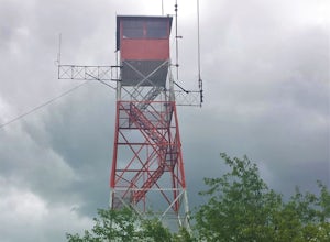
Hike the AT to Culvers Lookout Tower
3.2 miStart your journey in Stokes State Forest at the Culver Gap Parking Lot, located at 41.180239, -74.787954. From the parking lot, jump on over to the Appalachian Trail and hike Northbound. You know you're headed the right way if you are going away from the small town and cross over Sunrise Mountai...Read more -
Columbia, New Jersey
Hike the Mount Mohican-Raccoon Ridge Traverse
7.5 mi / 1500 ft gainThis point to point hike can be done in either direction. There is parking at the entrance to Worthington Campground. Cross Old Mine Road and start up the Garvey Spring Trail (orange markers). The trail passes Laurel Falls on the right then ascends steeply until you reach an old forest road. The...Read more -
Frankford, New Jersey
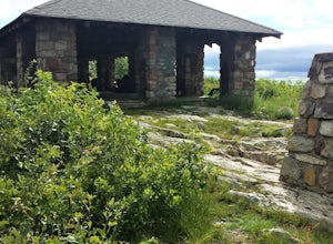
Picnic at the Sunrise Mountain Pavilion
This pavilion is one of the key features along the New Jersey section of the Appalachian Trail. There is a parking lot a very short hike part way down the mountain, but I recommend backpacking in from a different area to take in more of the beauty of the trail, mountains, and views in this area. ...Read more -
Bangor, Pennsylvania
Hike Mount Minsi
3.6This is a great 5.5 mile hike at the Delaware Water Gap. You follow the Appalachian Trail the entire time (white marked trail) as it climbs to the top on Mt Minsi. There are multiple viewpoints on your way up that provide a great view of the water gap as well as some very picturesque trail points...Read more -
Columbia, New Jersey
Hike to Sunfish Pond
4.57.9 mi / 1150 ft gainAt the end of the parking lot, cross over the bridge and follow the Appalachian Trail (AT, white blazes) to a V-intersection. Turn right onto Dunnfield Creek Trail (green blazes), which will take you past a few cascades and up to Sunfish Pond. Relax and eat lunch at the pond. When you're ready, t...Read more -
Columbia, New Jersey
Hike Mt. Tammany via Red Dot Trail
4.62.3 mi / 1115 ft gainThis is a short but strenuous hike to a bluff overlooking the Delaware River and surrounding mountains and hills. The summit makes a good spot for a picnic or just for relaxing and watching the sunset. The entire hike also has plenty of beautiful photo ops, especially in the Fall. Find the trailh...Read more -
Columbia, New Jersey
Hike Mount Tammany's Red Dot and Blue Dot Loop
4.53.3 mi / 1197 ft gainMount Tammany located in the Delaware Water Gap is a very exciting hike. Short in length but with steep, rocky uphill portions this becomes more of a challenging trek. This hike allows for amazing views of the Delaware River, Route 80, and Mount Minsi on the other side. The summit makes for an aw...Read more -
Vestal, New York
Hike the Wetlands Loop, BU Nature Preserve
4.01.4 mi / 0 ft gainPark across from the Nature Preserve Kiosk where you can pay to park ($1 for 30 mins) ask an attendant for directions at the entrance of the university for ease of navigation through campus. The lot is clearly marked however and is titled 'Lot M0'Follow trail markers to hike around the Marsh and ...Read more -
Penn Forest Township, Pennsylvania
Tank Hollow Vista
4.03.33 mi / 272 ft gainThis is a simple, short hike to a fantastic vista looking out over the Lehigh River Gorge. The trailhead for the hike to Tank Hollow Vista is along Behrens Road just outside of Jim Thorpe, PA. Most of the hike is on state game lands. If the gate is open from the first lot, you can shorten this h...Read more -
Lehighton, Pennsylvania
Hike the Falls Trail at Beltzville State Park
4.05.5 miAt the Christman Trailhead, hike a quick, flat 2.5 miles following the yellow trail markers through farm meadows and birch forests to the Falls Trail loop/intersection. Here hike the Falls trail which is a 0.5 mile loop that links back to the 2.5 mile section back to the parking area. Bridges and...Read more -
Benton, Pennsylvania
Falls Trail Loop in Ricketts Glen State Park
4.96.29 mi / 938 ft gainRicketts Glen State Park in Pennsylvania sprawls over 13,050 acres in the Luzerne, Sullivan and Columbia counties. The park boasts a lake, 21 named waterfalls, diverse wildlife and old growth timber. There are two Falls Trails alternatives – a long and short loop. The long loop is 7.2 miles long...Read more -
Endwell, New York
Hike the IBM Glen Preserve
4.81.7 mi / 400 ft gainFrom the parking lot follow the only trail heading downhill, the yellow trail. At the first and second forks in the trail, stay left remaining on the yellow trail. When you reach the creek, I prefer to trek through the creek on a summer day.However the yellow trial crosses the creek and continues...Read more

