Sunbury, Pennsylvania
Top Spots in and near Sunbury
-
Marysville, Pennsylvania
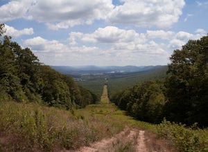
Hike to the Susquehanna Overlook
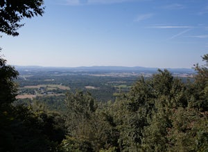
3.57 miOnce you reach the power lines, about a mile after cresting the top of the mountain you can look one way and you’ll see the Susquehanna River. Look the other way, and you’ll see beautiful woods and farm fields in Perry County. Return by the same route for a total of about 7 miles.Parking is at th...Read more -
Benton, Pennsylvania
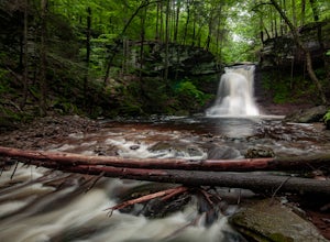
Sullivan Falls
0.1 miSullivan Falls is a beautiful roughly 30 foot waterfall near Ricketts Glen State Park, but in State Game Lands Number 13. There is a large parking area with a huge stone labeled 'Sullivan Falls' and from the lot it is more of a short walk vs a hike back a trail to the top of the falls. However, t...Read more -
Benton, Pennsylvania
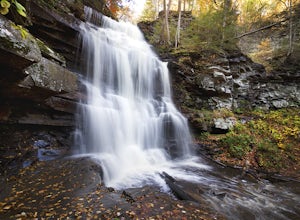
Falls Trail Loop in Ricketts Glen State Park
4.96.29 mi / 938 ft gainRicketts Glen State Park in Pennsylvania sprawls over 13,050 acres in the Luzerne, Sullivan and Columbia counties. The park boasts a lake, 21 named waterfalls, diverse wildlife and old growth timber. There are two Falls Trails alternatives – a long and short loop. The long loop is 7.2 miles long...Read more -
Hillsgrove, Pennsylvania
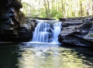
Hike to Mill Creek Falls in the Loyalsock State Forest
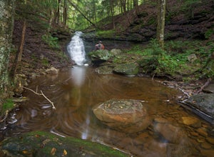
4.00.5 miThe Loyalsock State Forest is full of beautiful waterfalls and Mill Creek Falls is one of them. The 12 foot high falls is one of the smaller falls in the forest, but is still worth a visit as it sits in a beautiful grotto and contains a scenic plunge pool. I've also never seen another person in m...Read more -
Sweet Valley, Pennsylvania
Camp at Ricketts Glen
Some would argue that the trails hidden inside this state park are some of the most scenic in all of Pennsylvania, while I haven't explored a ton of the state I sure see where the fans of this park are coming from. The campground is very large and reservations would be highly recommended if you a...Read more -
Muncy Valley, Pennsylvania
Mineral Springs Falls
0.25 miMineral Springs is a roadside waterfall near Worlds End State Park. It is worth the stop to photograph and fairly easy to move around on either side of the run to get different angles. This is a run not far from Canyon Vista which is another popular spot. The waterfall sits just off Mineral Sp...Read more -
Muncy Valley, Pennsylvania
Photograph The Loyalsock Canyon Vista
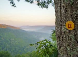
4.0Take a drive to World's End State Park through the Loyalsock Valley and enjoy a great view. Once you enter the state park via 154, drive past the main parking area and take a right onto Mineral Spring Road and follow it until you take a left onto Cold Run Road. The road up is about two miles - wh...Read more -
Forksville, Pennsylvania
Double Run Nature Trail
4.01.3 mi / 335 ft gainDouble Run Nature Trail is a loop trail that takes you by a waterfall located near Forksville, Pennsylvania.Read more -
Forksville, Pennsylvania
High Bridge Falls/Hoagland Branch
This beautiful photogenic spot in Loyalsock State Forest is viewable as you drive by, but be sure to stop and take some photos. The Hoagland Branch Road (gravel forest road) drives right by this scenic waterfall and waterway, you will see it while crossing on a small bridge. There is a pull off ...Read more -
Forksville, Pennsylvania
Camp at World's End Park Campground
5.0World's End Campground is tucked into a valley in the Loyalsock State Forest. Recreational opportunities abound here. Lay low and explore the valley, hike to the ridges and take in the views, or play in the Loyalsock creek which runs by the campground. The lush Pennsylvania wilderness makes for a...Read more -
Wilmington, Delaware
Worlds End Link Trail
1.38 mi / 285 ft gainWorlds End Link Trail is an out-and-back trail that takes you by a river located near Forksville, Pennsylvania.Read more -
Forksville, Pennsylvania
High Rock Trail
4.01.31 mi / 427 ft gainWorld's End offers a ton of trails, some for the family, and some for the more adventurous. The High Rock Trail is one of the more difficult trails in the State Park and one of the shortest. Start by parking at the main parking lot just near the Visitor Center. Take a quick walk over the bridge t...Read more -
Carlisle, Pennsylvania
Hike to the Cumberland Valley Overlook
4.06 miThis hike is steep at points but the climb up the mountain has lots of switchbacks so it isn't just straight up. The hike is beautiful and during the summer there are lots of blackberry and raspberry bushes along the trail that we stopped to snack on. The Overlook is just before you crest the top...Read more -
Dushore, Pennsylvania
Hike the Haystacks Rapids and Dutchman Falls
5.03.9 mi / 425 ft gainThe Haystacks is a great end of the overall Loyalsock Trail. It is easily accessible, and fairly a gentile trail, however, the beginning is still a relatively rocky and will require some initial effort. When the trail intersects the rail road grade, you can turn left and take the path with the ye...Read more -
Dushore, Pennsylvania
Loyalsock Trail
5.056.75 mi / 9882 ft gainLoyalsock Trail is a point-to-point trail that takes you by a waterfall located near Laporte, Pennsylvania.Read more -
Dushore, Pennsylvania
Loyalsock Link Trail and Haystacks and Dutchman Falls
24.87 mi / 3944 ft gainLoyalsock Link trail and Haystacks and Dutchman Falls is a loop trail that takes you by a lake located near Laporte, Pennsylvania.Read more

