Rhododendron, Oregon
Looking for the best running in Rhododendron? We've got you covered with the top trails, trips, hiking, backpacking, camping and more around Rhododendron. The detailed guides, photos, and reviews are all submitted by the Outbound community.
Top Running Spots in and near Rhododendron
-
Portland, Oregon
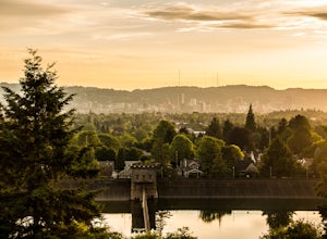
Mount Tabor Park
4.3Sitting 400 feet above the city with views of Mt. Hood and Portland doesn't sound to bad right?? Mount Tabor is located in Southeast Portland and is a once active volcano. There are 196 acres of park for you to explore. In order to photograph the best pictures of Mt. Hood I highly suggest gettin...Read more -
Portland, Oregon
Run Springwater Corridor Trail
4.07 mi / 50 ft gainSpringwater Corridor is a 40-mile paved trail that stretches from downtown Portland all the way to Boring. This trail is wide, virtually flat, and yes, paved - but there is a clear manmade path on the dirt shoulders that's friendlier to knees. Any given day, you'll see dozens of cyclists and pede...Read more -
Portland, Oregon
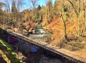
Tryon Creek Triple Bridge Loop
3.35 mi / 479 ft gainTryon Creek Triple Bridge Loop is a scenic approximately 3.5-mile loop with bridge crossings near downtown Portland. This trail is a great way to get outside, stretch your legs, and feel like you're away from the hustle and bustle of the city. This trail is dog-friendly on-leash. If you're look...Read more -
Portland, Oregon
Tryon Creek Outer Loop
4.55.12 mi / 554 ft gainTryon Creek State Park has a fantastic, well-maintained trail system that’s a great alternative to Portland’s downtown Washington Park and Forest Park. It’s a super family-friendly area with a Nature Center that hosts kid’s events year-round. This entire area is relatively small and therefore eas...Read more -
Portland, Oregon
Waterfront Park
4.52.68 mi / 79 ft gainLooking for a quick run along the water in the heart of Portland? Look no further. This relatively flat 2.6 mile loop runs right along the Willamette and features great views of the city’s bridges, river, the downtown skyline, and all of the fun people enjoying this urban park. From the Salmon S...Read more -
Portland, Oregon
Wildwood Trail in Washington Park
5.07.63 mi / 1503 ft gainTake the train to Washington Park and hike through Hoyt Arboretum. This will bypass a few miles of Wildwood Trail, but you won't miss much. In the arboretum, the trail twists and turns through the trees, will smaller trails jutting off to the sides, through other groups of trees (each trail is a...Read more -
Portland, Oregon
Hoyt Arboretum
1.4 mi / 148 ft gainFounded in 1928 to conserve endangered species and educate visitors, Hoyt Arboretum is a 190-acre park in the forest above Portland's NW area. It's only 15 minutes from downtown! There are 12+ miles of trails to explore, my favorite is the Redwood Trail that takes you through towering redwoods a...Read more -
Portland, Oregon
Leif Erikson Drive to Saltzman Road
4.711.47 mi / 1608 ft gainLeif Erikson Drive is a wide dirt road running through the heart of Forest Park that is closed to motorized vehicles…making it a magnet for those looking to add some relatively easy and scenic distance to their workouts. The road itself is nicely graded and well maintained. It has relatively goo...Read more -
11020 Southwest Denney Road, Oregon
Run the Fanno Creek trail
4 miThe parking lot marked is at the North end of the Fanno Creek trail, you can get on the paved path here and put on just about as many miles as you want! With the help of google maps on your phone you can follow trail hop all the way down to Tualatin! But if you're looking for a shorter workout yo...Read more -
Portland, Oregon
Run the Saltzman Road Trail
4.56 mi / 700 ft gainThis trail is an easy out and back from either the west or east side of Forest Park. The east trailhead is off NW Skyline Blvd, on Saltzman Road, which is a dirt/gravel road like the trail. You'll park near the gates where there aren't No Parking signs up (the land around the trail at this point ...Read more -
Portland, Oregon
Run the Maple Trail Loop
5.06.2 miThe Maple Trail loop lies in the heart of Portland’s Forest Park, at 5,100 wooded acres, it’s the largest forested natural area within city limits in the United States. It’s packed with tons of natural variety as it winds through the park’s most heavily forested canyons. You’ll be amazed at how s...Read more -
Amboy, Washington
Siouxon Trail to 14 Mile Falls
5.013.03 mi / 2310 ft gainWhen you park at the top of the trail, all you see is layers and layers of emerald trees and ground clear of any underbrush. Once on the trail, you start on a rapid decline that brings you to the first of the many streams along this hike. Cross the bridge made out of logs and head towards the ma...Read more -
7444-7498 Southwest 160th Avenue, Oregon
Bike the Westside Regional Trail
8 miTechnically this trail stretches from the Tualatin Hills Nature Park, down through the west Beaverton/ Sexton Mountain area and can comfortably get you to Barrow’s park near Big Al’s. The trail from end to end comes in at just over 8 miles, so a down and back by bike can make for a good workout a...Read more -
Idanha, Oregon
Pamelia Lake Trail
4.04.37 mi / 906 ft gainPamelia Lake Trail is an out-and-back trail that takes you by a lake located near Idanha, Oregon.Read more -
Beaverton, Oregon
Hike through Tualatin Hills Nature Park
2 miThis is an awesome place to escape to for a workout, or just a walk through the forest! You can make it a short walk, or turn it in to 6+ miles of loops! The one main trail is paved, but it’s not hard to find some single dirt track trails branching off and wandering through the trees, it can make...Read more -
Silverton, Oregon
South Silver Falls
5.02.14 mi / 361 ft gainSouth Silver Falls is a loop trail that takes you by a river located near Silverton, Oregon.Read more

