Mount Hood, Oregon
Looking for the best hiking in Mount Hood? We've got you covered with the top trails, trips, hiking, backpacking, camping and more around Mount Hood. The detailed guides, photos, and reviews are all submitted by the Outbound community.
Top Hiking Spots in and near Mount Hood
-
Carson, Washington
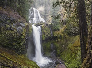
Falls Creek Falls
4.85.82 mi / 1512 ft gainThe trail to Falls Creek Falls is well maintained with a few short moderately steep areas. The trail hugs the creek for the first mile, and takes you through old growth trees for the second mile. Once the falls are in sight, make sure to stop and look up to see the top tier through the trees. It'...Read more -
Portland, Oregon
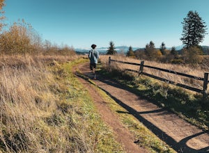
Powell Butte Nature Park Loop
6.22 mi / 1004 ft gainBefore officially becoming a nature park in 1987, Powell Butte was primarily known for being home to four 50-million gallon underground reservoirs. Today, the wide expanse of land is packed with miles of trails-- the perfect place for hikers, mountain bikers, and even horseback riders to get thei...Read more -
Skamania County, Washington
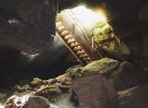
Camp Forlorn Lakes & Explore Guler Ice Cave
Camp at scenic and easily-accessible Forlorn Lakes, where the 25 campsites ($10/night) are both isolated and roomy. Sites have a picnic table and fire ring and provide access to the series of lakes, as well as the East Crater Trailhead which leads into the Indian Heaven Wilderness.Nearby, explore...Read more -
Marion County, Oregon
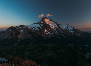
Explore Mt. Jefferson
5.0I went for a quick overnighter. The end of August is great for weather, very little bugs, and perfect time to meet and chat with PCT through hikers.The weather was absolutely perfect for night photography and lounging around camp. It's also one of the best views in Oregon if you ask me.If you're ...Read more -
Marion County, Oregon
Hike Mt. Jefferson's Park Ridge
5.07.4 mi / 1500 ft gainFrom the Breightenbush Lake PCT trailhead (5,600ft Elevation) you hike through a thick forest until you reach an old burn area. This area was burned from a forest fire and has rebirthed lush green plants and bushes to help feed all the animals in the area. After a mile of climbing through the bur...Read more -
Marion County, Oregon
Gold Butte Fire Lookout
4.32.44 mi / 741 ft gainGold Butte Fire Lookout is a real gem in the Willamette National Forest. At 4618 feet elevation, the nearby Cascade Mountain views are nothing short of spectacular! At the summit, sits a L-4 Ground Structure Type Fire Lookout that was built in1934 to be used as a Fire Lookout. Additionally, durin...Read more -
Detroit, Oregon
Battle Ax Mountain
5.05.09 mi / 1594 ft gainWith no officially marked trailhead, this hike begins slightly west of Elk Lake in Marion County. Take Highway 22 to Detroit, OR. East of the bridge over Breitenbush River, turn onto (FR) Forest Road 46, with signs pointing to Breitenbush River. After 4.5 miles turn left at a sign for Elk Lake, a...Read more -
Gladstone, Oregon
Run the Clackamette Park Loop
1.2 mi / 10 ft gainClackamette Park is known for its prime destination right off of the freeway and across from Oregon City's most popular shopping area, but it's frequented for its public boat dock, RV facilities, and handicap-accessible picnic benches. While the rest of Portland's parks freeze over or flood, Clac...Read more -
Skamania County, Washington
Indian Heaven to Blue Lake
4.56.71 mi / 997 ft gainCrowds and mosquitoes were nonexistent as we went a bit early in the season. The trails were all covered in snow, but we were able to do some way finding with a GPS and topo map. 3.5 miles in we found a dry spot next to Blue Lake and set up shop. After dropping off our gear we climbed up Gifford...Read more -
Portland, Oregon
Mount Tabor Loop
4.51.88 mi / 325 ft gainMount Tabor City Park is located in the heart of southeast Portland and is situated atop an extinct volcano. It’s comprised of more than 190 acres of beautiful Douglas Fir forest and features several relatively easy routes to the top: the easiest being the road you can drive (but what’s the fun i...Read more -
Gates, Oregon
Opal Creek Pools Loop
4.66.6 mi / 663 ft gainNote: this trail is closed due to fire damage. For more updates, please visit the Forest Service website. The Opal Creek pools are a wonderful place to visit year-round, but they’re a true oasis on a hot summer day. With a variety of rock outcroppings and ledges to jump off of, and plenty of ro...Read more -
Molalla, Oregon
Huckleberry, Mark's and Looney's Gate Loop
4.03.72 mi / 702 ft gainHuckleberry, Mark's and Looney's Gate Loop is a loop trail that takes you through a nice forest located near Molalla, Oregon.Read more -
Oregon City, Oregon
Walk the Canemah Bluff Loop
4.51.6 mi / 200 ft gainYou'll never stumble upon Canemah Park unless you're really looking for it. Tucked away in the hills of Oregon City above the Locks, this residential park has a miniature-sized set of everything you'd expect in a children's park: Playground, picnic benches, bathrooms, and wide, forested trails. D...Read more -
Lyons, Oregon
Cedar Flat and Kopetski Trail Loop
9.62 mi / 958 ft gainOn Saturday, I slid into the backseat alongside weekend belongings crammed in the car trunk. Backpacks with patches and streaks of dust. Bags of food that could be cooked over the flames of a fire. We drove south on the 5, leaving Portland and crossing through Salem, as Lake Street Dive albums p...Read more -
Detroit, Oregon
Boca Cave & Triangulation Peak
4.04.75 mi / 1053 ft gainTriangulation Peak, Spire Rock and Boca Cave TH #3372 The trail starts on level ground where you travel east along the top of the ridge. There are multiple trees that have fallen across the trail making the hike quite adventurous. Some trees you'll go over and some you will need to go under. Dep...Read more -
Amboy, Washington
Siouxon Trail to 14 Mile Falls
5.013.03 mi / 2310 ft gainWhen you park at the top of the trail, all you see is layers and layers of emerald trees and ground clear of any underbrush. Once on the trail, you start on a rapid decline that brings you to the first of the many streams along this hike. Cross the bridge made out of logs and head towards the ma...Read more

