Albany, Oregon
Top Spots in and near Albany
-
Eugene, Oregon
Wild Iris Ridge Loop from Summit Sky Boulevard
5.01.58 mi / 220 ft gainWild Iris Ridge Loop from Summit Sky Boulevard is a loop trail where you may see beautiful wildflowers located near Eugene, Oregon.Read more -
Detroit, Oregon
Dome Rock via the Upper Trailhead
2.36 mi / 479 ft gainFrom Highway 22 at the Breitenbush River Bridge, in Detroit, turn north on to French Creek Rd. Drive up French Creek about 7.7 miles to the Upper TH #3379/3381 to Dome Rock and Tumble Lake. The trail can be found on the left side of the road and is easily seen after you pass it. It's best to pass...Read more -
Otis, Oregon
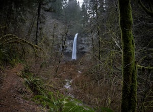
Hike to Drift Creek Falls
4.93.5 mi / 490 ft gainThis hike down to Drift Creek Falls is more of an easy stroll. But before you reach the trail head, if coming from the north, make sure to stop at Oregon's oldest covered bridge off Bear Creek Rd.The trail head to Drift Creek Falls will be farther south on Bear Creek Rd where you will branch off ...Read more -
Lyons, Oregon
Cedar Flat and Kopetski Trail Loop
9.62 mi / 958 ft gainOn Saturday, I slid into the backseat alongside weekend belongings crammed in the car trunk. Backpacks with patches and streaks of dust. Bags of food that could be cooked over the flames of a fire. We drove south on the 5, leaving Portland and crossing through Salem, as Lake Street Dive albums p...Read more -
Gates, Oregon
Opal Creek Pools Loop
4.66.6 mi / 663 ft gainNote: this trail is closed due to fire damage. For more updates, please visit the Forest Service website. The Opal Creek pools are a wonderful place to visit year-round, but they’re a true oasis on a hot summer day. With a variety of rock outcroppings and ledges to jump off of, and plenty of ro...Read more -
McMinnville, Oregon
Hike the Red Trail in Miller Woods
4.04 mi / 400 ft gainLocated three miles west of McMinnville and available for public hiking and activities, Miller Woods is owned and operated by Yamhill SWCD. You may choose different trails to take.From the parking lot the trails are marked by colors to go on the 4.0 mile loop go to the meadow and follow the red m...Read more -
McMinnville, Oregon
Miller Woods
5.03.63 mi / 735 ft gainMiller Woods Trail is a loop trail where you may see beautiful wildflowers located near McMinnville, Oregon.Read more -
Eugene, Oregon
Spencer Butte Loop
4.51.6 mi / 564 ft gainGetting There Searching Spencer Butte Trailhead Parking Lot on Google Maps will direct you to exactly where you need to go. From downtown Eugene/ UO you'll drive south on Willamette St. until you see an official park sign for Spencer Butte Park. Take a left on the gated road (will be locked duri...Read more -
Saint Paul, Oregon
Hike the Champoeg SP Loop
5.03.4 mi / 120 ft gainChampoeg was the first town to be settled in the Willamette Valley and the site of the formation of the first government in the northwest. The park offers historical sites as well as plentiful camping and some short day hikes. I decided to do the Townsite loop with my family on black friday #opto...Read more -
Newport, Oregon
Surf Agate Beach
4.0Agate beach is a beach break in Newport Oregon. Bring your booties and gloves because the water temperature up there is very cold. The wave is a fun rippable wave with both lefts and rights. There is a rip that you can use to get out into the lineup right next to the headland. Note: During winte...Read more -
Newport, Oregon
Surf Moolack Beach
5.0This beach break in Newport Oregon, is very fickle and doesn’t break cleanly very often. It's a wide open beach break, so it is usually exposed to too much swell. However, when the waves do line up, it's a fun beach break with several different peaks to choose from. It offers both lefts and right...Read more -
Foster, Oregon
Iron Mountain
4.71.79 mi / 610 ft gainGetting There There are a couple of different routes to the summit of Iron Mountain. This adventure article focuses on the shorter but more strenuous hike to the summit of Iron Mountain. To get there, drive to the upper trailhead (Trail # 3389) via Highway 20. Take Forest Service Road (FSR) 035 ...Read more -
Otter Rock, Oregon
Surf Otter Rock
5.0Otter rock is the most popular surf spot for beginners in the state of Oregon. Located by Devils Punch Bowl, Otter rock offers playful waves that are great for beginners to learn how to surf. It's often called the Waikiki of Oregon. Even though it is a predominately beginner surf spot, the waves ...Read more -
Beaver, Oregon
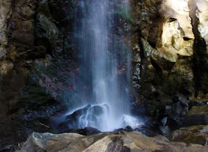
Hike to Pheasant Creek Falls
4.04 mi / 800 ft gainHike: The hike to Pheasant Creek Falls is just short continuation of nearby Niagara Falls. After reaching Niagara Falls, continue on the trail for about another 300 feet and you'll reach the more impressive, Pheasant Creek Falls.For more detailed information including a trail map and directions ...Read more -
Otter Rock, Oregon
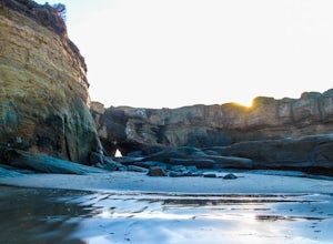
Explore the Devils Punchbowl Arch
4.6Devils Punchbowl State Park is located just off of Highway 101. Finding the access path to the beach can be tricky since you need to be on the North side of the Punchbowl, but look for a path heading through the trees on C Avenue just north of 3rd. Once you get down to the beach head left.You may...Read more -
Newport, Oregon
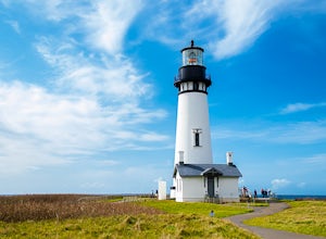
Explore the Yaquina Head Lighthouse
4.6The Yaquina Head Natural Area is home to the historic 93 ft tall Yaquina Head lighthouse, built in 1872. The construction of the lighthouse from approximately 370,000 bricks took nearly a year, and the lighthouse has been active ever since.The park is open daily, from 7am until sunset; however, i...Read more

