Mars Hill, North Carolina
Top Spots in and near Mars Hill
-
Gatlinburg, Tennessee
4.9
7.83 mi
/ 2190 ft gain
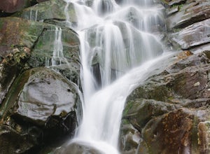
This multi-tiered waterfall is known as the tallest in the park – a worthwhile reward for the steep and sometimes tricky terrain you'll face on the way up.
The popular route to the falls also passes through an impressive old-growth forest, which apparently boasts some of the tallest trees in the...
Read more
-
Bluff City, Tennessee
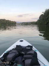
There is a mud parking area on Lakeview Drive underneath the 11E bridges with a cleared mud parking area with access to the the South Fork of the Holston River. There is a gradual drop to the water where kayaks, canoes, or SUPs can be placed in the water. To the east, the river is more narrow at ...
Read more
-
Church Hill, Tennessee
5.0
3.96 mi
/ 712 ft gain
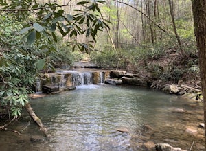
Laurel Run Trail is an out-and-back trail that takes you by a waterfall located near Church Hill, Tennessee.
Read more
-
Bluff City, Tennessee
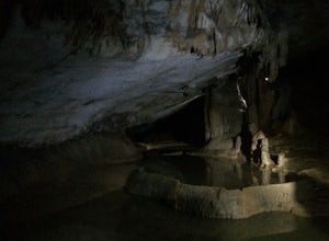
Worley’s Cave, also known as Morrill Cave, lies just outside of Boone across the Tennessee border. It is the second longest cave in the state of Tennessee at a whopping 4.4 miles in total length. It is a non-lit cavern that’s path is lit only by those who venture in its depths (i.e. headlamps, la...
Read more
-
Kingsport, Tennessee
5.0
6.01 mi
/ 728 ft gain
Bays Mountain Trail Loop is a loop trail that takes you by a lake located near Kingsport, Tennessee.
Read more
-
-
Kingsport, Tennessee
4.8
3.67 mi
/ 768 ft gain
Bay's Mountain Firetower overlooks the city of Kingsport, the South Fork Holston River, and the surrounding Tennessee mountains. Part of Bay's Mountain State Park, this is the most popular hike of the 25 miles of trails. The hike to the fire tower passes the Kingsport Reservoir which is essential...
Read more
-
Kingsport, Tennessee
5.0
4.79 mi
/ 879 ft gain
Bays Mountain Fire Tower Loop is a loop trail that takes you by a lake located near Kingsport, Tennessee.
Read more
-
Banner Elk, North Carolina
5.0
6.31 mi
/ 1991 ft gain
At 5,946 feet, Calloway Peak provides hikers with perhaps the best view of North Carolina's Blue Ridge Mountains. You'll have to earn this view - it is a tough climb up, although not terribly long.
Begin at the trailhead for Tanawha Trail in the Boone Fork Parking Area on the Blue Ridge Parkway....
Read more
-
Banner Elk, North Carolina
Boone Fork Bridge and creek is situated at the base of Grandfather Mountain, on the Blue Ridge Parkway, milepost 299.9. Elevation 3905'.The trailhead is at the left side of Boone Fork Creek parking area and the trail is a gentle meander through Rhododendrons and a hardwood forest.As you head tow...
Read more
-
Cherokee, North Carolina
The pinpoint for this particular entrance starts just outside of Cherokee, North Carolina, following the Parkway North.
They say the Blue Ridge Parkway is more than just a road, it's a beautiful journey. Start this journey and you will quickly find this to be true. This 469 mile gateway connects...
Read more
-
Cleveland, South Carolina
Getting there
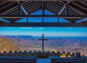
Fred W. Symmes (aka Pretty Place) Chapel is perched near the
top of Standing Stone Mountain at 3000 feet above sea level. That being said,
expect a long and winding drive up the mountain. It takes about 30 minutes
starting from the bottom of the mountain to arrive to the chapel.
Th...
Read more
-
Gatlinburg, Tennessee
Take Porters Creek Trail, a gravel road alongside Porters Creek. You will pass by an old farmstead and cemetery, as well as lots of wildflowers if you're out during the spring.
In a mile, keep left, then in another half mile or so you should cross over a small (and somewhat harrowing) footbridge...
Read more
-
Cullowhee, North Carolina
Judaculla was an ancient Cherokee spirit being and giant. He ruled in western North Carolina in the traditional Cherokee homeland. Once while chasing some hunters, when he jumped to the ground, his hand hit a rock. You can still see the print on Judaculla Rock. It is the most elaborate piece of r...
Read more
-
Bryson City, North Carolina
5.0
3.92 mi
/ 850 ft gain
Kephart Prong is a pretty easy hike in close proximity to the Visitor Center on the North Carolina Side of GSMNP. 2 miles up the trail, you'll arrive at Kephart Shelter, where you can rest and enjoy vies of the Kephart Prong. Once you've had your fill, head back down the way you came.
During th...
Read more
-
Bryson City, North Carolina
Charlies Bunion via Kephart Loop is a loop trail located near Cherokee, North Carolina. This is a longer version of the Charlies Bunion hike starting from the Newfound Gap parking lot. The added benefit of this longer loop is the opportunity to see more of the Great Smokey Mountains! You'll pass ...
Read more

