Maggie Valley, North Carolina
Top Spots in and near Maggie Valley
-
Bryson City, North Carolina
Leaving the Nantahala Outdoor Center, drive upriver for 6.5 miles until you see a pull off on the right. Walk past the picnic tables, cross the railroad tracks, then follow the trail to arrive at the creek. Once you're there, it's up to you on what to do next.One of the most popular activities he...
Read more
-
Franklin, North Carolina
5.0
3.66 mi
/ 1060 ft gain
The Appalachian Trail does not need a lot of hype beyond its existing legendary status. However, there are certain parts of it that do stand out as being a little extra special. Siler Bald is one of those spots. A large clearing starting from Snowbird Gap and going all the way up to Siler Bald...
Read more
-
Cedar Mountain, North Carolina
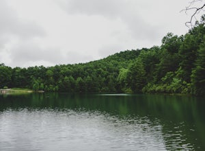
Fawn Lake sits on the backside of DuPont State Forest, about a 15 minute drive from the High Falls Parking/ Visitor Center as well as Hooker Falls parking lots. With easy access and easy terrain, this is a must see to add to the list.
While sometimes the main parking lots and trails of DuPont can...
Read more
-
Franklin, North Carolina
4.0
27.11 mi
/ 5420 ft gain
Winding Stair Gap on Highway 64 is the starting point for this spectacular backpacking trip through the Nantahala National Forest. It's right outside the hiker friendly town of Franklin, NC, so the town is your last chance for a hot meal and any last minute supplies. There is a parking lot at the...
Read more
-
Mountain Rest, South Carolina
Spoonauger falls housed in Sumter National Forest, received its name after the Spoonauger family which historically lived above the falls.
From Walhalla SC, drive north on Highway 28 until it meets SC 107 (right under 10 miles). Take a slight right onto SC 107 and drive another 10 miles until yo...
Read more
-
Mountain Rest, South Carolina
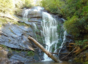
The trail to Kings Creek begins behind the bulletin board in the Burrells Ford primitive campground parking lot. It is an easy .5 mile trail to the falls. The falls are only 70ft high but they are beautiful, there is an area to the side of the falls with some nice sitting rocks and the area under...
Read more
-
Mountain Rest, South Carolina
Very nice dog-friendly and family-friendly adventure! The hike is not long at all and the end result is a beautiful 70 ft waterfall with a pooled area at the bottom! Old logs are around for sitting on and relaxing while enjoying your lunch or snacks...
Read more
-
Cleveland, South Carolina
For Caesar's Head State Park access, head North from Pickens on HWY 178 until it intersects with HWY 11. Turn right onto HWY 11 North and continue for 10 miles until the 276 intersection where you veer off to the left. Follow 276 to the top of the mountain. 1 miles past the Caesars Head Visitors ...
Read more
-
Mountain Rest, South Carolina
The hike to Big Bend Falls begins on the Chattooga River Trail at the Burrell's Ford Campground. To get here you take Burrell's Ford Road off of SC 107. There will be a good sized gravel parking area off to the left about 3 miles down Burrell's Ford Road. When you park the car you can walk down t...
Read more
-
Cleveland, South Carolina
4.5
7.76 mi
/ 2185 ft gain
Location: From the intersection of US276 & SC11, head Northwest on US276. Drive to the top of the mountain, 1 mile past the visitor's center, and The Raven Cliff Falls Parking Area and trail head will be on your right.
After parking in the Raven Cliff Falls Parking Area, the trailhead is l...
Read more
-
Townsend, Tennessee
Start your hike at Anthony Creek Trailhead (elevation 1,800 ft), in the Cade’s Cove area. The trailhead is located at the far end of the day-use picnic area near Cade’s Cove campground. There are a few parking spots right at the trailhead, but note that the picnic area closes at dusk (a gate clos...
Read more
-
35.604955,-83.770373
5.0
12.8 mi
/ 3500 ft gain
Rocky Top is known to be the spot that inspired the famous fight song of the University of Tennessee, which is also an official song for the state of Tennessee.
The trailhead for this hike begins in the Cade’s Cove picnic area parking lot towards the back side. There are a few parking spots ri...
Read more
-
Sunset, South Carolina
Once you get to the destination there should be a small parking area. At the end of this parking area you will see the start of the Twin Falls trail that will be mostly a flat walk. Follow this trail approximately 0.5 miles to the falls. You will know you are in the right place if the creek is r...
Read more
-
Cleveland, South Carolina
Getting there
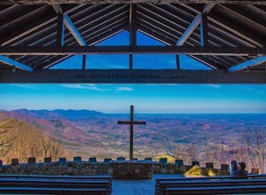
Fred W. Symmes (aka Pretty Place) Chapel is perched near the
top of Standing Stone Mountain at 3000 feet above sea level. That being said,
expect a long and winding drive up the mountain. It takes about 30 minutes
starting from the bottom of the mountain to arrive to the chapel.
Th...
Read more
-
Cleveland, South Carolina
5.0
0.27 mi
/ 144 ft gain
The Drive: Head North on SC Highway 11 "Cherokee Foothills Scenic Highway" towards Table Rock State Park. Follow SC 11 past Table Rock approximately 8 miles where it will merge with SC 8 at Pumpkin Town. Follow SC 8 for another 3-4 miles until you see the intersection for SC Highway 276 on the le...
Read more
-
Franklin, North Carolina
Begins at the parking lot for the Standing Indian Campground. (No permits are needed to park here) For the first 3.7 miles, take Kimsey Creek Trail, which runs along the water, until you meet up with the AT at Deep Gap. Rolling hills and lots of foliage throughout, leading up to Standing Indian M...
Read more

