Maggie Valley, North Carolina
Looking for the best hiking in Maggie Valley? We've got you covered with the top trails, trips, hiking, backpacking, camping and more around Maggie Valley. The detailed guides, photos, and reviews are all submitted by the Outbound community.
Top Hiking Spots in and near Maggie Valley
-
Mountain Rest, South Carolina
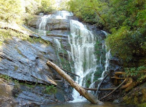
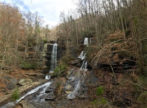
Hike to King Creek Falls
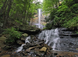
0.6 miVery nice dog-friendly and family-friendly adventure! The hike is not long at all and the end result is a beautiful 70 ft waterfall with a pooled area at the bottom! Old logs are around for sitting on and relaxing while enjoying your lunch or snacks...Read more -
Cleveland, South Carolina
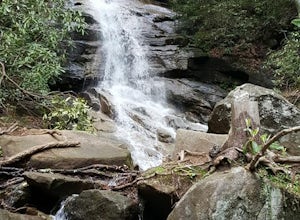
Hike to Jones Gap Falls
8.2 mi / 1200 ft gainFor Caesar's Head State Park access, head North from Pickens on HWY 178 until it intersects with HWY 11. Turn right onto HWY 11 North and continue for 10 miles until the 276 intersection where you veer off to the left. Follow 276 to the top of the mountain. 1 miles past the Caesars Head Visitors ...Read more -
Mountain Rest, South Carolina
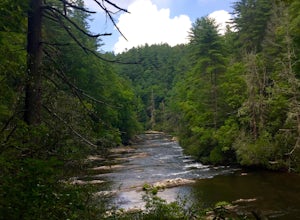
Hike to Big Bend Falls
5.06.5 miThe hike to Big Bend Falls begins on the Chattooga River Trail at the Burrell's Ford Campground. To get here you take Burrell's Ford Road off of SC 107. There will be a good sized gravel parking area off to the left about 3 miles down Burrell's Ford Road. When you park the car you can walk down t...Read more -
Cleveland, South Carolina
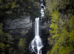
Raven Cliff Falls
4.57.76 mi / 2185 ft gainLocation: From the intersection of US276 & SC11, head Northwest on US276. Drive to the top of the mountain, 1 mile past the visitor's center, and The Raven Cliff Falls Parking Area and trail head will be on your right. After parking in the Raven Cliff Falls Parking Area, the trailhead is l...Read more -
Townsend, Tennessee
Backpack to Spence Field
13.8 mi / 3100 ft gainStart your hike at Anthony Creek Trailhead (elevation 1,800 ft), in the Cade’s Cove area. The trailhead is located at the far end of the day-use picnic area near Cade’s Cove campground. There are a few parking spots right at the trailhead, but note that the picnic area closes at dusk (a gate clos...Read more -
35.604955,-83.770373
Hike to Rocky Top
5.012.8 mi / 3500 ft gainRocky Top is known to be the spot that inspired the famous fight song of the University of Tennessee, which is also an official song for the state of Tennessee. The trailhead for this hike begins in the Cade’s Cove picnic area parking lot towards the back side. There are a few parking spots ri...Read more -
Sunset, South Carolina
Hike to Twin Falls, SC
5.01 mi / 0 ft gainOnce you get to the destination there should be a small parking area. At the end of this parking area you will see the start of the Twin Falls trail that will be mostly a flat walk. Follow this trail approximately 0.5 miles to the falls. You will know you are in the right place if the creek is r...Read more -
Cleveland, South Carolina
Caesars Head Overlook
5.00.27 mi / 144 ft gainThe Drive: Head North on SC Highway 11 "Cherokee Foothills Scenic Highway" towards Table Rock State Park. Follow SC 11 past Table Rock approximately 8 miles where it will merge with SC 8 at Pumpkin Town. Follow SC 8 for another 3-4 miles until you see the intersection for SC Highway 276 on the le...Read more -
Franklin, North Carolina
Backpack the Standing Indian Loop on the Appalachian Trail
24 miBegins at the parking lot for the Standing Indian Campground. (No permits are needed to park here) For the first 3.7 miles, take Kimsey Creek Trail, which runs along the water, until you meet up with the AT at Deep Gap. Rolling hills and lots of foliage throughout, leading up to Standing Indian M...Read more -
Otto, North Carolina
Hike to and Climb Pickens Nose
4.81.5 mi / 200 ft gainFrom the parking area (fits about 6 cars) follow the trail on the same side of the road up the ridge through dense rhododendron. Several spur trails branch off of the main trail and lead to rock outcroppings with excellent views. Getting to the parking area is slow. The narrow gravel road winds...Read more -
Dillard, Georgia
Hike to Rabun Bald
5.03 mi / 4696 ft gainStarting at the trailhead you begin by following the yellow blazes. The trail isn't well marked so keep an eye out for the blazes you see. The trailhead starts at the dead end of Kelsey Mountain Trail. The path immediately starts to incline and doesn't stop. A few minutes in you will come to a fo...Read more -
Salem, South Carolina
Camp on Lake Jocassee
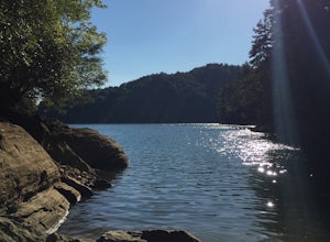
4.7To avoid the regret of cutting your trip too short, go ahead and book a campsite. Come as a walk-in or reserve your site. Either way, you will have to check in at the Park Office. Upon check-in, you will receive your map and general information. Check-in time for camping is 2PM. The only publi...Read more -
Fontana Dam, North Carolina
Shuckstack Fire Tower
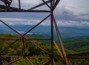
5.08.84 mi / 2605 ft gainYour Shuckstack adventure starts at the Fontana Dam outside of Bryson City, NC. As the highest dam East of the Rocky Mountains, it's a sight on its own. This will be your last chance to fill up water bottles and use the restroom so take advantage. You can leave on foot from the dam and continue ...Read more -
Greenville County, South Carolina
Hike to Rainbow Falls and Pretty Place
5.05.96 mi / 1844 ft gainJones Gap State Park in the Upstate of South Carolina is one of the most beautiful parks in the state offering a good range of moderate and challenging hiking and backpacking trails through the Mountain Bridge Wilderness Area. Jones Gap also provides superb primitive camping sites along the rocky...Read more -
Greenville County, South Carolina
Hike the Jones Gap Loop
5.05.5 mi / 2000 ft gainStart on the Jones Gap Trail (blue), which will lead you alongside the Saluda River. After 2.5 miles, take the Old Springs Branch Trail (orange) to loop back to the lot.For a challenging, more strenuous hike, with great views of the Gap, check out Rim of the Gap Trail. It is not advised to take c...Read more -
Greenville County, South Carolina
Hike the Pinnacle Pass/Rim of the Gap Loop
11.5 mi / 2345 ft gainThe Trailhead: Located at Jones Gap State Park in Marietta, SC of northern Greenville County. Follow the trail across an iron bridge that crosses the Middle Saluda River, and be sure to register at the Ranger’s Station/Gift Shop on the far side of the gap. The trail head(s) are located directly o...Read more

