Highlands, North Carolina
Looking for the best chillin in Highlands? We've got you covered with the top trails, trips, hiking, backpacking, camping and more around Highlands. The detailed guides, photos, and reviews are all submitted by the Outbound community.
Top Chillin Spots in and near Highlands
-
Clayton, Georgia
Hike to Martin Creek Falls
5.00.6 miThere are two different ways to get to this waterfall.The easiest way is through a trail in the Warwoman Wildlife Management Area. To get to this trail head, drive east on Warwoman Road from Clayton, GA. At approximately 3.5 miles, take a left onto Finney Creek Road (FS 152). You will see a sign ...Read more -
Tuckasegee, North Carolina
Hike to Cedar Cliff Rock
2.4 mi / 830 ft gainCedar Cliff Rock is one of those local places that exemplifies the Blue Ridge mountains oh-so-well. From the top you can see the Tuckaseegee River along with both Cedar Cliff and Bear Creek Reservoirs. While there are a few homes in between, much of the view is untouched, allowing a big mountain ...Read more -
Sunset, South Carolina
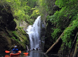
Kayak to Laurel Fork Falls
4.0This stunning waterfall tumbles down 80 feet before spilling into Lake Jocassee between a slot of shear rock cliffs. However, the catch is not many people see this beautiful location unless you have a boat or are willing to hike a streneous 8-mile hike one-way along the Foothills Trail.But I am s...Read more -
Walhalla, South Carolina
Hike to Issaqueena Falls and Stumphouse Tunnel
4.01.5 mi / 250 ft gainFrom Walhalla South Carolina, follow SC 28 westward 7 miles until you see Stumphouse Tunnel Park on the right-hand side of the road. Take this road halfway down, and park in the parking area on the right. From here, you can travel a short walk to the falls overlook, or, for the more adventurous ...Read more -
Walhalla, South Carolina
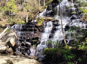
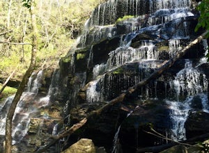
Hike to Yellow Branch Falls
5.03 miOnce you have turned into the picnic area off of Highway SC 28, you will see the open and easy parking area. The trail begins at 2 points on the southern end of the parking area. These 2 points form a small loop about 0.2 miles long, with a spur in the middle of the loop onto the main yellow bran...Read more -
Cullowhee, North Carolina
Exploring two legendary Cherokee sites: Judaculla Rock and Devil's Courthouse, North Carolina
5.00.9 mi / 258 ft gainJudaculla was an ancient Cherokee spirit being and giant. He ruled in western North Carolina in the traditional Cherokee homeland. Once while chasing some hunters, when he jumped to the ground, his hand hit a rock. You can still see the print on Judaculla Rock. It is the most elaborate piece of r...Read more -
Sunset, South Carolina
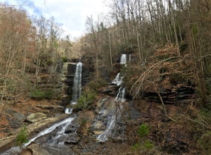
Virginia Hawkins Falls (Double Falls)
4.02.6 mi / 456 ft gainA moderate to advanced 2.6 mile hike has many stairs and a lot of ascents and descents along the way. The hike may not be the easiest but the payoff is worth it. The trail is easily marked so no need to worry about getting lost.Read more -
Sunset, South Carolina
Hike to Twin Falls, SC
5.01 mi / 0 ft gainOnce you get to the destination there should be a small parking area. At the end of this parking area you will see the start of the Twin Falls trail that will be mostly a flat walk. Follow this trail approximately 0.5 miles to the falls. You will know you are in the right place if the creek is r...Read more -
Clayton, Georgia
Camp at Tallulah River Campground
Tallulah River Campground is located in the Chattahoochee-Oconee national forest. It is just outside of Clayton, Georgia. The campground has about 15 spots that are big enough for a small to medium sized RV. Each camping spot also has a nice tent pad for a big tent. Most spots are also on the riv...Read more -
Tuckasegee, North Carolina
Hike to Dill Falls
0.4 mi / 400 ft gainThe drive to this waterfall can be a little muddy when there is a lot of rain and can need an AWD or 4WD in the rain. The road has some new gravel laid in parts so it could be improved in a few months. In the summer there is also a chance of seeing large dump trucks and logging trucks, but the ro...Read more -
Bryson City, North Carolina
Hike to Alarka Falls
5.01 mi / 100 ft gainTo visit the falls, take US-74 west from Bryson City to exit 64 . Take a left at the exit and drive on Alarka Road for about 10 miles. Follow the road all the way to the end where you will find a turnaround. Don't make the mistake of following the forest service road (it is gated), as it is not ...Read more -
Franklin, North Carolina
Photograph Wayah Bald Lookout Tower
0.1 mi / 0 ft gainThe Wayah Bald Lookout Tower is located in Nantahala National Forest in one of the oldest part of the protected land. It was first built in the 1920s then it was rebuilt throughout the years until it was finally made out of stone and concrete. The current tower that stands offers great views of t...Read more -
Tiger, Georgia
Hike to Glassy Mountain
5.01 mi / 3415 ft gainIn order to find this hidden gem, you'll have to drive quite a ways up the mountain first, otherwise it is a very steep incline. There will be limited parking at the gate that stops you from driving the whole way up. You will turn onto a road called "Glassy Mountain Rd" and that will be the road ...Read more -
Tallulah Falls, Georgia
Camp at Tallulah Gorge State Park
4.7Tallulah Gorge is a must-see feature of Georgia. Campers can lay low and experience the gorge from its floor, engaging in river activities such as kayaking or swimming. Those seeking a thrill can hike the rim trails of the gorge, and even cross an 80' high suspension bridge. (Hikers who may be fe...Read more -
Canton, North Carolina
Hike to Bubling Spring Falls
0.1 mi / 50 ft gainThe road to get to this waterfall is right off of NC 215 which comes right off of the Blue Ridge Parkway and is only about 3 miles away from parkway. The parking area is very small and does not offer many parking spots but since it is not that popular of an area parking is usually not a problem. ...Read more -
Canton, North Carolina
Photograph Sunburst Falls
This waterfall is right off the side of the road on NC 215. NC 215 is straight off of the blue ridge parkway and is just north of Brevard. The waterfall has to main parts one that is above the road and one that is below. The part below the road is the most scenic and the easiest to walk too. The ...Read more


