Haywood County, North Carolina
Top Spots in and near Haywood County
-
Franklin, North Carolina
5.0
3.66 mi
/ 1060 ft gain
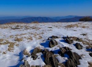
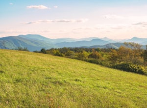
The Appalachian Trail does not need a lot of hype beyond its existing legendary status. However, there are certain parts of it that do stand out as being a little extra special. Siler Bald is one of those spots. A large clearing starting from Snowbird Gap and going all the way up to Siler Bald...
Read more
-
Burnsville, North Carolina
Snaggy Mountain is privately owned land that offers a beautiful camping spot located just outside of the Pigsah National Forest. It's completely secluded by an Apple Orchard and is a great home base for several hiking adventures in the area. The location on the map will get you to the parking spo...
Read more
-
Franklin, North Carolina
4.0
27.11 mi
/ 5420 ft gain
Winding Stair Gap on Highway 64 is the starting point for this spectacular backpacking trip through the Nantahala National Forest. It's right outside the hiker friendly town of Franklin, NC, so the town is your last chance for a hot meal and any last minute supplies. There is a parking lot at the...
Read more
-
Walland, Tennessee
The foothills parkway runs parallel to the Great Smoky Mountains. It is 38.6 miles in total with the longest section at 33.0 miles. There are a few different places to get on to the parkway. There is one entrance near Fontana, Walland, Wears Valley, and Cosby. However Cosby is a smaller section a...
Read more
-
Fontana Dam, North Carolina
5.0
8.84 mi
/ 2605 ft gain
Your Shuckstack adventure starts at the Fontana Dam outside of Bryson City, NC. As the highest dam East of the Rocky Mountains, it's a sight on its own. This will be your last chance to fill up water bottles and use the restroom so take advantage.
You can leave on foot from the dam and continue ...
Read more
-
Saluda, North Carolina
This is a really nice hike along Cove Creek that leads to a beautiful, 100 foot waterfall. While most of the trail is a relaxing stroll, the end of the hike provides a little adventure for those who feel up for it.
Starting from the parking lot, follow the main trail into the woods. Early in the ...
Read more
-
Townsend, Tennessee
Cade's Cove is a valley located smack in the middle of the Great Smoky Mountains National Park. Feel free to drive the 11 mile loop in the day, but if you're really cool, you'll schedule your trip around a full moon so you can bike under the light of night! Allow yourself a few hours to explore a...
Read more
-
Erwin, Tennessee
3.0
2.06 mi
/ 522 ft gain
Martin's Creek Falls is an out-and-back trail that takes you by a waterfall located near Erwin, Tennessee.
Read more
-
Townsend, Tennessee
5.0
11.3 mi
/ 3020 ft gain
The Gregory Bald summit is indisputably picturesque – the 10-acre meadow at the top hosts magnificent azalea blooms in June, wild blueberries in August, and views of Cades Cove, Rich Mountain, Fontana Lake, Thunderhead Mountain, and Clingmans Dome, year-round.
Start this hike at the Gregory Ridg...
Read more
-
Tallassee, Tennessee
4.8
4.96 mi
/ 625 ft gain
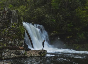
One of the biggest perks of hiking Abrams Falls is the drive to get there. The trailhead is located approximately 5 miles into the scenic Cades Cove Loop. Cades Cove is an adventure in itself. Keep your eye out for black bears, deer and wild turkey. If you are taking the self guided auto tour, Ab...
Read more
-
Dillard, Georgia
Starting at the trailhead you begin by following the yellow blazes. The trail isn't well marked so keep an eye out for the blazes you see. The trailhead starts at the dead end of Kelsey Mountain Trail. The path immediately starts to incline and doesn't stop. A few minutes in you will come to a fo...
Read more
-
Franklin, North Carolina
Begins at the parking lot for the Standing Indian Campground. (No permits are needed to park here) For the first 3.7 miles, take Kimsey Creek Trail, which runs along the water, until you meet up with the AT at Deep Gap. Rolling hills and lots of foliage throughout, leading up to Standing Indian M...
Read more
-
Otto, North Carolina
From the parking area (fits about 6 cars) follow the trail on the same side of the road up the ridge through dense rhododendron. Several spur trails branch off of the main trail and lead to rock outcroppings with excellent views. Getting to the parking area is slow. The narrow gravel road winds...
Read more
-
Green Mountain, North Carolina
4.0
8.05 mi
/ 1165 ft gain
Appalachian Trail: Indian Grave Gap to Chestoa is a point-to-point trail that takes you by a river located near Unicoi, Tennessee.
Read more
-
Green Mountain, North Carolina
5.0
2.13 mi
/ 1277 ft gain
Beauty Spot Gap is located on the Appalachian Trail on the border of North Carolina and Tennessee. The bald offers a panoramic view of Cherokee National Forest and the city of Erwin. This is a popular destination for hikers of the AT to set up camp and watch the sunset.
From the Tennessee side, t...
Read more
-
Micaville, North Carolina
4.9
2.83 mi
/ 525 ft gain
Starting from the old store parking area at MP 339.5 on the Blue Ridge Parkway, follow the trail through a meadow past the campground amphitheater. After crossing the paved road to the campground, the trail will come to a T-intersection. Take the trail to the right for the shortest way to the fal...
Read more


