Hays, North Carolina
Looking for the best hiking in Hays? We've got you covered with the top trails, trips, hiking, backpacking, camping and more around Hays. The detailed guides, photos, and reviews are all submitted by the Outbound community.
Top Hiking Spots in and near Hays
-
Mouth of Wilson, Virginia
Twin Pinnacles via Big Pinnacles Trail
5.02 mi / 525 ft gainTo reach the Big Pinnacle Trail Head, park at the Massie Gap Day Parking area, and then follow the road west (away from Massie Gap) until you reach the trail head located on the left side of the road. Follow the Big Pinnacles Trail for 0.4 miles until it intersects with the Twin Pinnacles Trail....Read more -
Mouth of Wilson, Virginia
Wilburn Ridge and Massie Gap Loop
5.02.32 mi / 318 ft gainTo reach the trail head, park in the Massie Gap Parking Lot. This is the parking lot for most of the trails in the park, so it can fill up very quickly, but you are able to park along the side of the road. Massie Gap as two parking areas: one intended for overnight hikers and one for day hikers...Read more -
Mouth of Wilson, Virginia
Mount Rogers Loop
5.015.6 mi / 1079 ft gainFor an awesome 2-3 day trip, start hiking at the Massie Gap trailhead, which can be reached from Grayson Highlands State Park. Take the Rhododendron Trail up the ridge to connect with the AT, keeping an eye out for wild ponies in the Massie Gap area as they like to hang out here. Some of these po...Read more -
Blowing Rock, North Carolina
Boone Fork Trail
4.05.06 mi / 1030 ft gainBoone Fork Trail is a loop trail that takes you by a waterfall located near Boone, North Carolina.Read more -
Blowing Rock, North Carolina
Price Lake Loop Trail
5.02.23 mi / 387 ft gainPrice Lake Loop Trail is a loop trail that takes you by a lake located near Blowing Rock, North Carolina.Read more -
Blowing Rock, North Carolina
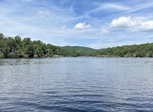
Camp and Paddle at Price Lake
This campground is all kinds of amazing, and if you get one of the sites in the A loop, you will have lakefront property (just be warned, if I see you there, I'll have to crash with you ;-). Price Lake is a gorgeous lake right off the Blue Ridge Parkway in North Carolina and perfect for canoeing...Read more -
Pinnacle, North Carolina
Hike the Jomeokee Trail at Pilot Mountain SP
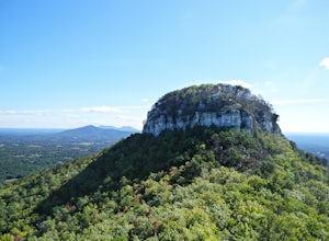
4.30.8 mi / 100 ft gainThis unique peak, also known as the Big Pinnacle, is in Pilot Mountain State Park. From the main parking area on top of the mountain on Pilot Knob Park Road, you can first view the Big Pinnacle from the overlook attached to the parking lot. The prominent mountain behind the Big Pinnacle is Hang...Read more -
Elk Creek, Virginia
Camp at Comers Rock Recreation Area
1 miI didn't have any issues putting "Comers Rock Recreation Area" into my phone's GPS (Waze) and arriving exactly where I was supposed to. When you turn off US 21 (aka the Grayson Turnpike/Elk Creek Parkway) to Jefferson National Forest Road 57, you'll see a sign a parking lot that says "road not su...Read more -
Hickory, North Carolina
Geitner Rotary Park Loop
5.02.65 mi / 354 ft gainGeitner Rotary Park Loop is a loop trail that takes you by a lake located near Hickory, North Carolina.Read more -
Troutdale, Virginia
Hike the Appalachian Trail from Elk Garden to Buzzard Rock
5.06.6 mi / 1000 ft gainStarting at the Elk Garden Parking Area hike the Appalachian Trail south (do not cross the road, follow the trail from the parking area). Hike along the trail following the white blazes and at 2.4 miles you'll reach a campsite on your left. This is a great place to camp overnight if you decide to...Read more -
Banner Elk, North Carolina
Calloway Peak via Daniel Boone Scout Trail
5.06.31 mi / 1991 ft gainAt 5,946 feet, Calloway Peak provides hikers with perhaps the best view of North Carolina's Blue Ridge Mountains. You'll have to earn this view - it is a tough climb up, although not terribly long. Begin at the trailhead for Tanawha Trail in the Boone Fork Parking Area on the Blue Ridge Parkway....Read more -
Banner Elk, North Carolina
Explore Boone Fork Creek
0.25 mi / 75 ft gainBoone Fork Bridge and creek is situated at the base of Grandfather Mountain, on the Blue Ridge Parkway, milepost 299.9. Elevation 3905'.The trailhead is at the left side of Boone Fork Creek parking area and the trail is a gentle meander through Rhododendrons and a hardwood forest.As you head tow...Read more -
Linville, North Carolina
Rough Ridge Lookout
4.30.5 mi / 92 ft gainThe trailhead for Rough Ridge will be on your righthand side when driving the Blue Ridge Parkway from Boone, NC. This trail gets busy in the warmer months, but parking usually is not too much of an issue. This trail is not open in the winter. Rough Ridge will take you around 30-45 minutes to rea...Read more -
Linville, North Carolina
Profile Trail to Calloway Peak
5.06.2 mi / 2300 ft gainIf you're looking for a challenge and hoping to escape the crowds at Grandfather Mountain, this is the hike for you. Climbing up the back side of the mountain (opposite the famed mile-high swinging bridge) this trail is fee-free and easy-to-access with its own parking lot. The trail, marked w...Read more -
Seven Devils, North Carolina
Calloway Peak via Profile Trail
7.11 mi / 2493 ft gainCalloway Peak via Profile Trail is an out-and-back trail with waterfall views located near Banner Elk, North Carolina in Grandfather Mountain State Park.Read more -
Newland, North Carolina
Beacon Heights Overlook
5.00.71 mi / 105 ft gainBeacon Heights is the perfect hike when you're on the Blue Ridge Parkway near Linville and Grandfather Mountain, Milepost 305.2. The trail is a steady climb uphill for less than a half mile. The last section being fairly steep and rocky. Once at the top, there are several rock outcroppings, but...Read more

