Gerton, North Carolina
Looking for the best hiking in Gerton? We've got you covered with the top trails, trips, hiking, backpacking, camping and more around Gerton. The detailed guides, photos, and reviews are all submitted by the Outbound community.
Top Hiking Spots in and near Gerton
-
Morganton, North Carolina
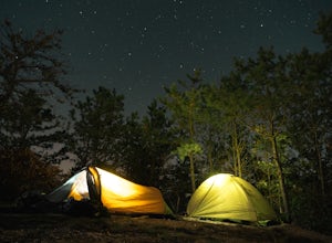
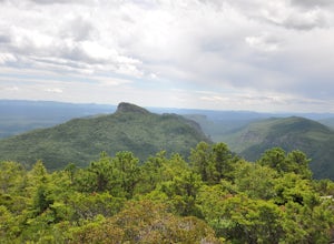
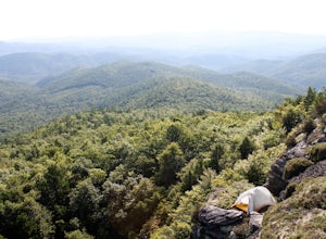
Camp at the Chimneys in the Linville Wilderness
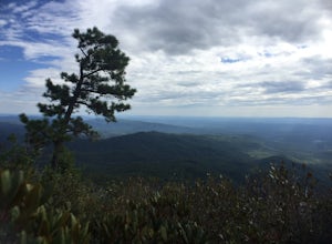
5.01 mi / 138 ft gainThe Chimneys area is a lesser-known camping destination within the Linville Wilderness. The Chimneys are a series of rock formations that rise above Linville Gorge and provide unobstructed panoramic views of the gorge and surrounding mountains. These rocks sit adjacent to Table Rock which hosts w...Read more -
Morganton, North Carolina
Little Table Rock Trail
5.02.73 mi / 1148 ft gainLittle Table Rock Trail is an out-and-back trail where you may see beautiful wildflowers located near Morganton, North Carolina.Read more -
Morganton, North Carolina
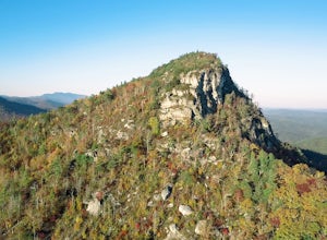
Hike to the Summit of Table Rock Mountain
4.62.2 mi / 572 ft gainOff of Highway 181, the trailhead is very clearly marked with a large parking lot. Although the trail is fairly short, make sure you have your footing, because the trail does switch back and forth in addition to gaining elevation -- it's pretty steep in some places! It's all worth it when you get...Read more -
Newland, North Carolina
Hike the Conley Cove Trail into Linville Gorge
5.02.6 mi / 1200 ft gainFollow the gravel old 105 to the parking lot at the Rock Jock Trailhead. Follow this trail a short distance until it splits to the left for Conley Cove. The Conley Cove trail descends over 1,200 ft. into the Linville Gorge, providing a glimpse into the dense and wild Pisgah National Forest. Shor...Read more -
Morganton, North Carolina
Hike to Hawksbill Mountain
5.02.1 mi / 660 ft gainStarting at the Hawksbill Mountain Trailhead, which is clearly marked start hiking up! The trail starts out with some easy uphill switchbacks and leads you to the first lookout point. Enjoy sometime at the lookout point, but you'll want to keep going for a more incredible view. Keep hiking uphill...Read more -
138 Silver Mine Road, North Carolina
Hike the Lovers Leap Loop Trail
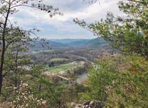
5.01.8 mi / 472 ft gainLovers Leap Loop trail is a 1.8 mile loop in Hot Springs, NC. The address of the trailhead is 138 Silver Mine Rd, Hot Springs, NC 28743. Once you arrive at the parking lot, you will see a trail leading up into the mountain with a post next to it. This is where you want to begin. It is part of the...Read more -
Morganton, North Carolina
Hawksbill Mountain Trail
4.91.87 mi / 633 ft gainHidden far above the beautiful Linville Gorge stands Hawksbill Mountain, among many other fantastic hikes. The roughly 1.7 mile hike from the dusty gravel parking lot is steep but worth every step. It took me about an hour to conquer with a few water bottle-guzzling stops. At the top, you are al...Read more -
Morganton, North Carolina
Photograph Hawksbill Mountain at Sunrise or Sunset
5.01.5 mi / 860 ft gainThe trail to the summit of Hawksbill begins on an unpaved road for the Pigsah National Forest. In about a half a mile the trail turns left just before reaching the Jonas Ridge Trail. This turn is an clearly marked turn with a sign for "Hawksbill Summit". The trail then becomes steeper and rocki...Read more -
Clyde, North Carolina
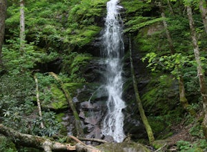
Hike to Little Fall Branch falls
0.3 mi / 300 ft gainThe trailhead to this hike is easy to find but the gps is hard to match so it might try to take you through the middle of the trees but its easy to follow the road. The best way to get here is to go off of I-40 at the Harmon Den exit and then go up the road towards Max Patch. To get to the trailh...Read more -
Newland, North Carolina
Linville Falls Trail
4.10.98 mi / 177 ft gainLinville falls is one of North Carolina's treasures and perhaps the most photographed water fall in the state. Bring the whole family out and explore the area surrounding the falls. There are about 4 total miles of trails meandering around and through the gorge and right up to the falls. There ar...Read more -
Del Rio, Tennessee
Max Patch to Hot Springs, N.C. via Appalachian Trail
3.014.06 mi / 2966 ft gainMake a weekend trip from Max Patch to Hot Springs N.C., and be sure to soak in the natural hot springs at the old inn after your hike! This is an incredible, relatively easy hike with the reward at the end being hot springs on the French Broad River. You can break this up however you like, this i...Read more -
Sunset, South Carolina
Virginia Hawkins Falls (Double Falls)
4.02.6 mi / 456 ft gainA moderate to advanced 2.6 mile hike has many stairs and a lot of ascents and descents along the way. The hike may not be the easiest but the payoff is worth it. The trail is easily marked so no need to worry about getting lost.Read more -
Del Rio, Tennessee
Max Patch Mountain
5.01.51 mi / 315 ft gainMax Patch Mountain was once cleared for pasture land, leaving an expansive flat summit that now serves as the ideal location for a picnic hike, flying a kite, or laying in the sun surrounded by the Great Smoky Mountains. With little elevation gain and a short distance it is also very family (and ...Read more -
Tuckasegee, North Carolina
Paradise Falls
4.30.74 mi / 167 ft gainTo the north of Panthertown lies a chain of dammed lakes that are some of the most peaceful waters in Western North Carolina. These make up the headwaters of the East Fork of the Tuckasegee River. The gorges that run between the top lakes are wild, scenic, and adventurous to even the most experie...Read more -
Connelly Springs, North Carolina
High Shoals Waterfall and H.Q. Loop Trail
4.83 mi / 1043 ft gainHigh Shoals Waterfall and H.Q. Loop Trail is a loop trail that takes you by a waterfall located near Connelly Springs, North Carolina.Read more -
Connelly Springs, North Carolina
Sawtooth Campground via Chestnut Knob Trail
5.06.18 mi / 1299 ft gainThis 6.2-mile total trip will take you through the highlights of South Mountains State Park with an overnight stay in one of the drier campsites. OPTIONAL: You can get a warm-up in by starting with a 2.5-mile loop to High Shoal Falls that you can do without packs before picking up with a 3-mile...Read more

