Cedar Mountain, North Carolina
Looking for the best hiking in Cedar Mountain? We've got you covered with the top trails, trips, hiking, backpacking, camping and more around Cedar Mountain. The detailed guides, photos, and reviews are all submitted by the Outbound community.
Top Hiking Spots in and near Cedar Mountain
-
Clayton, Georgia
Hike to Martin Creek Falls
5.00.6 miThere are two different ways to get to this waterfall.The easiest way is through a trail in the Warwoman Wildlife Management Area. To get to this trail head, drive east on Warwoman Road from Clayton, GA. At approximately 3.5 miles, take a left onto Finney Creek Road (FS 152). You will see a sign ...Read more -
Bryson City, North Carolina
Hike to Alarka Falls
5.01 mi / 100 ft gainTo visit the falls, take US-74 west from Bryson City to exit 64 . Take a left at the exit and drive on Alarka Road for about 10 miles. Follow the road all the way to the end where you will find a turnaround. Don't make the mistake of following the forest service road (it is gated), as it is not ...Read more -
Cherokee, North Carolina
Mingo Falls
4.20.22 mi / 148 ft gainAlthough it is not much of a hike at just 0.3 miles, it is accessible to people of all fitness levels. A climb up a series of stairs leads you to a trail overlooking Mingo creek. You will then find a 20 foot wide bridge which serves as the viewing platform of the falls. If you care to advent...Read more -
Old Fort, North Carolina
Green Knob Lookout Tower
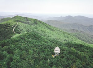
4.80.76 mi / 292 ft gainGreen Knob Lookout Tower is an abandoned fire tower near Mt. Mitchell and located directly off the Blue Ridge Parkway. The tower boasts a full 360-degree, unobstructed view of Mt. Mitchell, Craggy Mountains, Table Rock, Grandfather Mountain, and the Parkway. Unlike most fire towers, this tower is...Read more -
Burnsville, North Carolina
Mount Mitchell via the Old Mitchell Trail
5.03.74 mi / 1194 ft gainAfter arriving in the park off of the beautiful Blue Ridge Parkway, park at the first parking lot you encounter on the righthand side of the road. There is a visitor's center there where you can inquire about the park and pick up a park map. Once you do that walk outside and look to the left of t...Read more -
Clyde, North Carolina
Hike to Little Fall Branch falls
0.3 mi / 300 ft gainThe trailhead to this hike is easy to find but the gps is hard to match so it might try to take you through the middle of the trees but its easy to follow the road. The best way to get here is to go off of I-40 at the Harmon Den exit and then go up the road towards Max Patch. To get to the trailh...Read more -
Clayton, Georgia
Hike the James E. Edmond trail to Lookoff Mountain Overlook
4.07.5 mi / 2378 ft gainBlack Rock Mountain State Park is Georgia's highest elevation State Park. It is adorned with several waterfalls, sweeping overlooks, blooming Rhododendron's, and plenty of miles of trail. The James E. Edmond trail is the longest and by far most challenging hike in the park. Its medium-long dis...Read more -
Otto, North Carolina
Hike to and Climb Pickens Nose
4.81.5 mi / 200 ft gainFrom the parking area (fits about 6 cars) follow the trail on the same side of the road up the ridge through dense rhododendron. Several spur trails branch off of the main trail and lead to rock outcroppings with excellent views. Getting to the parking area is slow. The narrow gravel road winds...Read more -
Long Creek, South Carolina
Hike to the Brasstown Falls
4.50.5 miThese waterfalls are absolutely beautiful during the summer greenery and fall foliage, but open to access year around.Driving Directions: From Westminister, follow US 76 West for 11.8 miles and turn left onto Brasstown Road. Follow this road 4.1 miles to FS 751. (The pavement ends in 2.6 miles.) ...Read more -
Burnsville, North Carolina
Deep Gap Trail at Mt. Mitchell State Park
5.08.24 mi / 2310 ft gainI personally find this trail to be more difficult and have more rewarding views than the Mt. Mitchell summit trail. The Deep Gap Trail starts near the Mount Mitchell summit and heads into a forest of spruce and balsam fir trees. The trail then climbs along the ridgeline to neighboring summits. E...Read more -
Del Rio, Tennessee
Max Patch Mountain
5.01.51 mi / 315 ft gainMax Patch Mountain was once cleared for pasture land, leaving an expansive flat summit that now serves as the ideal location for a picnic hike, flying a kite, or laying in the sun surrounded by the Great Smoky Mountains. With little elevation gain and a short distance it is also very family (and ...Read more -
Newport, North Carolina
Hike to Mt. Sterling's Fire Tower
4.012 mi / 4200 ft gainOn your way in, stop at the ranger station parking lot to use the outhouses and grab a map for $1. Once at the Baxter Creek trailhead you have two options: 1. The Out and Back (12.2 miles) 2. The Loop (17 miles)Out and Back: Start on the Baxter Creek Trail and continue up for 6.1 miles until you...Read more -
Newport, North Carolina
Hike to Mouse Creek Falls
5.04.2 mi / 605 ft gainFollow Big Creek Trail on a moderate climb to this 45-foot waterfall. Around 1.3 miles in, you will begin to hike alongside Big Creek, and shortly afterwards you will pass Midnight Hole, a particularly deep pool. There are a number of other small falls en route. In spring you should see a number ...Read more -
Bryson City, North Carolina
Deep Creek to Clingmans Dome Loop
32.82 mi / 7400 ft gainThis is a ~36 mile loop that goes up Clingman's Dome (the tallest point in Tennessee). Pretty challenging, not for the novice backpacker. Park at Deep Creek campground in Bryson City, NC. We did it as a 3-day, 2-night camping at sites 53 and 61. As it is a loop it could easily be done in reverse....Read more -
Bryson City, North Carolina
Tom Branch and Indian Creek Falls
4.51.76 miFrom the Deep Creek Trailhead, you can hike to both waterfalls heading up the Deep Creek Trail. You will come across Tom Branch Falls quickly, after 0.2 miles. Once you've had your fill of Tom Branch, head further along the Deep Creek Trail for another 0.5 miles. Turn right on the Indian Creek Tr...Read more -
Bryson City, North Carolina
Hike the Juney Whank Falls Loop
4.00.65 mi / 150 ft gainStarting at the Deep Creek Trailhead, take a short walk until the trail meets up with Juney Whank Falls Trail. From here, hang a left and head onto the Juney Whank Falls Trail. Once you've reached the falls, continue the loop to get back to the trailhead. The falls are said to be named after Mr...Read more


