Cedar Mountain, North Carolina
Looking for the best chillin in Cedar Mountain? We've got you covered with the top trails, trips, hiking, backpacking, camping and more around Cedar Mountain. The detailed guides, photos, and reviews are all submitted by the Outbound community.
Top Chillin Spots in and near Cedar Mountain
-
Asheville, North Carolina
Photograph Haw Creek Valley Overlook
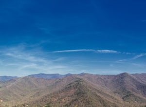
The Haw Creek Valley Overlook is only 8 miles from downtown Asheville. If you're in the downtown area, it's a rather easy place to zip on over to if you're in need of some time away from urban life. This overlook is a hot spot for sunset watching and picture taking. If you plan on seeing what th...Read more -
Highlands, North Carolina
Explore Cullasaja Falls
5.00.3 mi / 200 ft gainThis is an awesome waterfall that offers views from several different spots along the road as well as a quick hike down to the base! The small pull-off area is located towards the top of the falls. There isn't much space (3 maybe 4 cars at a time), but there are additional pull-off areas further ...Read more -
Walhalla, South Carolina
Hike to Issaqueena Falls and Stumphouse Tunnel
4.01.5 mi / 250 ft gainFrom Walhalla South Carolina, follow SC 28 westward 7 miles until you see Stumphouse Tunnel Park on the right-hand side of the road. Take this road halfway down, and park in the parking area on the right. From here, you can travel a short walk to the falls overlook, or, for the more adventurous ...Read more -
Walhalla, South Carolina
Hike to Yellow Branch Falls
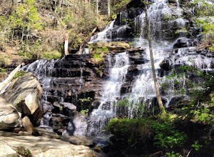
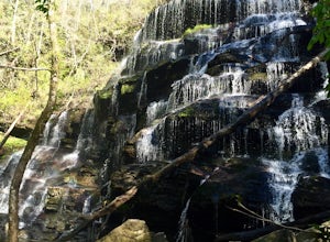
5.03 miOnce you have turned into the picnic area off of Highway SC 28, you will see the open and easy parking area. The trail begins at 2 points on the southern end of the parking area. These 2 points form a small loop about 0.2 miles long, with a spur in the middle of the loop onto the main yellow bran...Read more -
Dillard, Georgia
Hike to Rabun Bald
5.03 mi / 4696 ft gainStarting at the trailhead you begin by following the yellow blazes. The trail isn't well marked so keep an eye out for the blazes you see. The trailhead starts at the dead end of Kelsey Mountain Trail. The path immediately starts to incline and doesn't stop. A few minutes in you will come to a fo...Read more -
Montreat, North Carolina
Hike Lookout Mountain, Montreat
5.01.1 mi / 623 ft gainNestled in the Blue Ridge Mountains is Montreat, North Carolina. Just down the road from Asheville, it neighbors Black Mountain and doesn't disappoint for views. Montreat itself houses a plethora of hiking trails, but the cream of the crop HAS to be Lookout Mountain. After a weekend of checking o...Read more -
Waynesville, North Carolina
Explore Cataloochee Valley
5.0History, solitude and wildlife abound in this quiet corner of Great Smoky Mountains National Park, but getting here is not easy. Take the scenic route via Cove Creek Road from Cosby, TN. Drive 40 miles along the twisting, gravel road to Cataloochee, NC. The scenery along the way is outstanding, b...Read more -
Barnardsville, North Carolina
Douglas Falls
5.01.11 mi / 125 ft gainThe trail begins at the back of the parking area and is marked by a trail sign. Once on the trail, it is a straight shot to the waterfall with no turnoffs. Overall the trail is very easy and is a slight descent all the way down. Around .3 miles into the trail you enter a forest of now-dead hemloc...Read more -
Clayton, Georgia
Hike to Martin Creek Falls
5.00.6 miThere are two different ways to get to this waterfall.The easiest way is through a trail in the Warwoman Wildlife Management Area. To get to this trail head, drive east on Warwoman Road from Clayton, GA. At approximately 3.5 miles, take a left onto Finney Creek Road (FS 152). You will see a sign ...Read more -
Bryson City, North Carolina
Hike to Alarka Falls
5.01 mi / 100 ft gainTo visit the falls, take US-74 west from Bryson City to exit 64 . Take a left at the exit and drive on Alarka Road for about 10 miles. Follow the road all the way to the end where you will find a turnaround. Don't make the mistake of following the forest service road (it is gated), as it is not ...Read more -
Cherokee, North Carolina
Drive the Blue Ridge Parkway from the Southern Terminus
5.0The pinpoint for this particular entrance starts just outside of Cherokee, North Carolina, following the Parkway North. They say the Blue Ridge Parkway is more than just a road, it's a beautiful journey. Start this journey and you will quickly find this to be true. This 469 mile gateway connects...Read more -
Clyde, North Carolina
Photograph the Smokies from Buzzards Roost
This is an awesome place to check out if you are driving Interstate 40 or if you are visiting the area for awhile. The access point for Buzzards Roost is located on the same exit as the well known Max Patch Mountain, just in the other direction. Once off the exit, you will travel down a gravel Fo...Read more -
Del Rio, Tennessee
Max Patch Mountain
5.01.51 mi / 315 ft gainMax Patch Mountain was once cleared for pasture land, leaving an expansive flat summit that now serves as the ideal location for a picnic hike, flying a kite, or laying in the sun surrounded by the Great Smoky Mountains. With little elevation gain and a short distance it is also very family (and ...Read more -
Bryson City, North Carolina
Hike Three Waterfalls Loop
5.02.4 mi / 450 ft gainStart the loop by hiking the Juney Whank Falls Trail to Juney Whank Falls. The footbridge across the creek makes an excellent place to rest and take in the falls. Follow the trail across the bridge and up the bank. After about 300 feet take a right and follow Deep Creek Horse Trail towards Deep C...Read more


