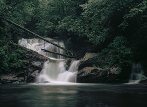
Burnsville, North Carolina
Burnsville, North Carolina is a great destination for outdoor adventures and a true outdoor enthusiast's delight. With its stunning and picturesque views, there are plenty of must-visit attractions to explore. From hidden gems to awe-inspiring trails, there are plenty of top outdoor activities to enjoy. Popular attractions include the Toe River, Mount Mitchell State Park, and the Blue Ridge Parkway. Whether you are looking for a peaceful excursion or an adrenaline-pumping adventure, Burnsville has something for everyone. So come and explore the best trails and outdoor activities in and near Burnsville, North Carolina.
Top Spots in and near Burnsville
-
Morganton, North Carolina
Camp on Shortoff Mountain in the Linville Gorge
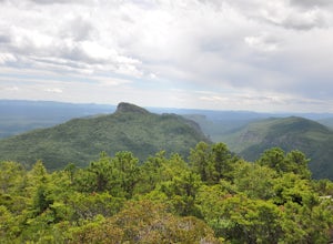
5.0The Linville Gorge Wilderness Area, also known as the Grand Canyon of the East, is one of the wildest, most rugged gorges in the eastern United States. It's also an outdoor paradise for hikers and backpackers. Camping here is always a treat and you are sure to enjoy your time spent in the gorge.D...Read more -
Appalachian Trail, Tennessee
Jones Falls via Appalachian Trail
5.010.65 mi / 2484 ft gainStarting at the Appalachian Trail (AT) trailhead at US 19E, follow the AT north for 3.1 miles until you reach the intersection of the trail with Buck Mountain Rd. This section of the AT has an elevation gain of almost 1000 ft, and large sections of trail with significant meadows offering magnific...Read more -
Johnson City, Tennessee
Sunset Point
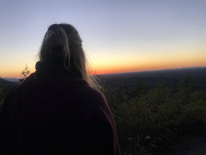
5.00.65 mi / 223 ft gainSunset Point is an overlook located in Buffalo Mountain State Park. The trail is a short hike up along the White Rock loop trail then a short walk off the trail to get to the overlook. There is a clearing with a few benches that has wide open views to the west. The short hike up to the point shou...Read more -
Johnson City, Tennessee
White Rock Loop
5.04.94 mi / 1457 ft gainWhite Rock Loop is a loop trail where you may see beautiful wildflowers located near Johnson City, Tennessee.Read more -
Johnson City, Tennessee
Fork Knob, White Rock and The Noggin Loop
5.03.12 mi / 1220 ft gainThe Fork Knob and White Rock Loop in Johnson City, Tennessee, is a moderately challenging hiking trail that spans approximately 3.12 miles. The trail is marked by a variety of natural features, including a prominent rock formation known as White Rock, which offers panoramic views of the surroundi...Read more -
Johnson City, Tennessee
Hike to Tip Top on Buffalo Mountain
4.05.4 mi / 1388 ft gainTip Top rests on one of the highest points of Buffalo Mountain. The overlook features tree coverage perfect for hammocking and benches while providing views of Downtown Johnson City as well as the other side of the mountain range. The hike from the trailhead to Tip Top is moderately steep. The tr...Read more -
Johnson City, Tennessee
White Rock Overlook
5.02.85 mi / 876 ft gainThe White Rock trailhead is less than a 10 minute drive from downtown Johnson City. When pulling up Highbridge Road, take a left at the fork. You will shortly encounter a vehicle gate where you will park to the side of the road (do not block the yellow vehicle gate). You have the option to walk ...Read more -
Morganton, North Carolina
Hike to Hawksbill Mountain
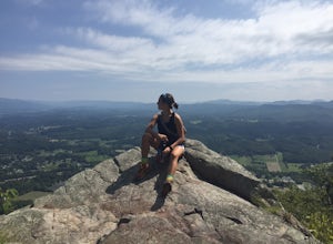
5.02.1 mi / 660 ft gainStarting at the Hawksbill Mountain Trailhead, which is clearly marked start hiking up! The trail starts out with some easy uphill switchbacks and leads you to the first lookout point. Enjoy sometime at the lookout point, but you'll want to keep going for a more incredible view. Keep hiking uphill...Read more -
Nebo, North Carolina
Explore Lake James State Park
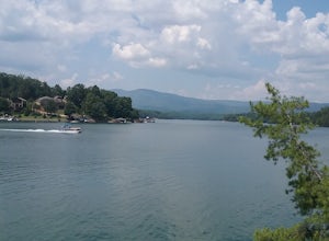
The park has about 15 miles of trails with different levels of difficulties . Hiked the Lake Channel Trail along the lake with good views of the lake and the Blue Ridge Mountains. Hiked the Mill's creek trail which is nicely shaded and offers good views of the lake and the Linville Gorge area. ...Read more -
Greeneville, Tennessee
Hike to Margarette Falls
5.02.7 mi / 715 ft gainTo reach the trail head, take exit number 39 to Erwin/Jonesborough and turn onto State Route 81/107 west and stay on this for 6.5 miles. Then you will turn left to stay on Route 107 and continue on for 16 more miles. Then you will take a left on Route 351 and drive 4.5 miles. Then you will take a...Read more -
Hampton, Tennessee
Laurel Falls via Appalachian Trail
5.02.43 mi / 449 ft gainLaurel Falls via Appalachian Trail is an out-and-back trail that takes you by a waterfall located near Hampton, Tennessee.Read more -
Hampton, Tennessee
Appalachian Trail: Dennis Cove to US 19E
21.27 mi / 4843 ft gainAppalachian Trail: Dennis Cove to US 19E is a point-to-point trail that takes you through a nice forest located near Roan Mountain, Tennessee.Read more -
Hampton, Tennessee
Appalachian Trail: Dennis Cove to Watauga Lake
8.08 mi / 1955 ft gainAppalachian Trail: Dennis Cove to Watauga Lake is a point-to-point trail that takes you by a waterfall located near Hampton, Tennessee.Read more -
Hampton, Tennessee
Hike to Laurel Fork Falls
4.62.6 mi / 600 ft gainFrom Hampton, Tennessee, take US-321S for about 3.5 miles. Turn right onto Dennis Cove Road and travel for 4 miles on this steep and very curvy mountain road. The trailhead is where the Appalachian Trail (AT) crosses the road at a small gravel lot on the left. Take the AT north on the trail lea...Read more -
Hampton, Tennessee
Hike and Traverse the Cables to Dennis Cove Falls
5.03.2 mi / 300 ft gainThe Hike to Dennis Cove Falls includes three water crossings and passes several small waterfalls. Sturdy cables spanning the width of the water crossings provide a fun way of traversing the creek without wading. It is completely possible to wade through the creek while holding onto the cables for...Read more -
Asheville, North Carolina
Relax at Martin Luther King Jr Park
The Martin Luther King Jr Park includes a large multi-purpose field as well as a playground that's great for kids. It's the perfect place to go solo to clear your head and chill with a book or with family and friends for an outdoor game. Right at the entrance to the Park stands a statue of Mart...Read more


