Arden, North Carolina
Top Spots in and near Arden
-
Mountain Rest, South Carolina
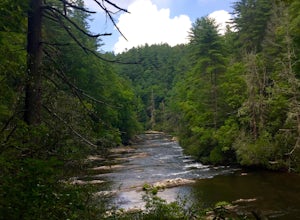
Hike along the Chattooga River to Spoonauger Falls
1 mi / 100 ft gainSpoonauger falls housed in Sumter National Forest, received its name after the Spoonauger family which historically lived above the falls. From Walhalla SC, drive north on Highway 28 until it meets SC 107 (right under 10 miles). Take a slight right onto SC 107 and drive another 10 miles until yo...Read more -
Highlands, North Carolina
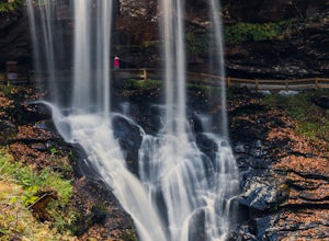
Photograph and Explore Bridal Veil Falls
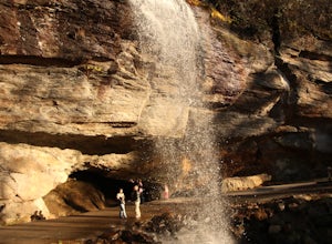
Bridal Veil Falls is located directly off of the road and is about a 100 feet tall in total. The falls makes for a great place to take pictures under the water falls. The falls itself is small and flows constant all year long getting to the bottom of the falls is not recommended because it is dan...Read more -
Greenville, South Carolina
Hike Swamp Rabbit Trail to Reedy River Falls
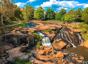
4.53 mi / 100 ft gainSwamp Rabbit Trail is a 21 mile-long paved walkway that closely follows the Reedy River in Downtown Greenville. Over a half-a-million people visit the trail each year, but few ever walk the whole thing. What most people don’t know, is that it begins on a different river: the Enoree river and wind...Read more -
Highlands, North Carolina
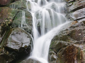
Explore Cullasaja Falls
5.00.3 mi / 200 ft gainThis is an awesome waterfall that offers views from several different spots along the road as well as a quick hike down to the base! The small pull-off area is located towards the top of the falls. There isn't much space (3 maybe 4 cars at a time), but there are additional pull-off areas further ...Read more -
Mountain Rest, South Carolina
Hike to Kings Creek Falls
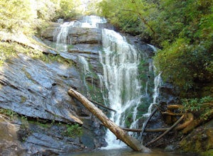
4.80.5 miThe trail to Kings Creek begins behind the bulletin board in the Burrells Ford primitive campground parking lot. It is an easy .5 mile trail to the falls. The falls are only 70ft high but they are beautiful, there is an area to the side of the falls with some nice sitting rocks and the area under...Read more -
Mountain Rest, South Carolina
Hike to King Creek Falls
0.6 miVery nice dog-friendly and family-friendly adventure! The hike is not long at all and the end result is a beautiful 70 ft waterfall with a pooled area at the bottom! Old logs are around for sitting on and relaxing while enjoying your lunch or snacks...Read more -
Bryson City, North Carolina
Hike to Alarka Falls
5.01 mi / 100 ft gainTo visit the falls, take US-74 west from Bryson City to exit 64 . Take a left at the exit and drive on Alarka Road for about 10 miles. Follow the road all the way to the end where you will find a turnaround. Don't make the mistake of following the forest service road (it is gated), as it is not ...Read more -
Greeneville, Tennessee
Hike to Margarette Falls
5.02.7 mi / 715 ft gainTo reach the trail head, take exit number 39 to Erwin/Jonesborough and turn onto State Route 81/107 west and stay on this for 6.5 miles. Then you will turn left to stay on Route 107 and continue on for 16 more miles. Then you will take a left on Route 351 and drive 4.5 miles. Then you will take a...Read more -
Mountain Rest, South Carolina
Hike to Big Bend Falls
5.06.5 miThe hike to Big Bend Falls begins on the Chattooga River Trail at the Burrell's Ford Campground. To get here you take Burrell's Ford Road off of SC 107. There will be a good sized gravel parking area off to the left about 3 miles down Burrell's Ford Road. When you park the car you can walk down t...Read more -
Highlands, North Carolina
Explore Dry Falls, North Carolina
4.60.42 mi / 95 ft gainDry Falls is located off of Hwy. 64, which has been designated as the Mountain Waters Scenic Byway, and the road does not disappoint. Hwy. 64 is a two lane road which hugs the northern side of Cullasaja Gorge, which has been carved by the Cullasaja River. Besides Dry Falls, Hwy. 64 leads you past...Read more -
Gatlinburg, Tennessee
Hike to the Ramsey Cascades
4.97.83 mi / 2190 ft gainThis multi-tiered waterfall is known as the tallest in the park – a worthwhile reward for the steep and sometimes tricky terrain you'll face on the way up. The popular route to the falls also passes through an impressive old-growth forest, which apparently boasts some of the tallest trees in the...Read more -
Bryson City, North Carolina
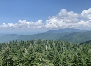
Deep Creek to Clingmans Dome Loop
32.82 mi / 7400 ft gainThis is a ~36 mile loop that goes up Clingman's Dome (the tallest point in Tennessee). Pretty challenging, not for the novice backpacker. Park at Deep Creek campground in Bryson City, NC. We did it as a 3-day, 2-night camping at sites 53 and 61. As it is a loop it could easily be done in reverse....Read more -
Bryson City, North Carolina
Tom Branch and Indian Creek Falls
4.51.76 miFrom the Deep Creek Trailhead, you can hike to both waterfalls heading up the Deep Creek Trail. You will come across Tom Branch Falls quickly, after 0.2 miles. Once you've had your fill of Tom Branch, head further along the Deep Creek Trail for another 0.5 miles. Turn right on the Indian Creek Tr...Read more -
Bryson City, North Carolina
Hike the Juney Whank Falls Loop
4.00.65 mi / 150 ft gainStarting at the Deep Creek Trailhead, take a short walk until the trail meets up with Juney Whank Falls Trail. From here, hang a left and head onto the Juney Whank Falls Trail. Once you've reached the falls, continue the loop to get back to the trailhead. The falls are said to be named after Mr...Read more -
Bryson City, North Carolina
Deep Creek Loop
5.05.01 mi / 892 ft gainAfter parking in the Deep Creek Campground parking lot follow the signs for the Deep Creek Trailhead. The Tom Branch waterfall is just .3 miles on the right side. Hike another .5 miles, at the next intersection stay right, and you will approach Indian Creek Falls. After viewing the falls you ca...Read more -
Bryson City, North Carolina
Hike Three Waterfalls Loop
5.02.4 mi / 450 ft gainStart the loop by hiking the Juney Whank Falls Trail to Juney Whank Falls. The footbridge across the creek makes an excellent place to rest and take in the falls. Follow the trail across the bridge and up the bank. After about 300 feet take a right and follow Deep Creek Horse Trail towards Deep C...Read more

