Almond, North Carolina
Looking for the best hiking in Almond? We've got you covered with the top trails, trips, hiking, backpacking, camping and more around Almond. The detailed guides, photos, and reviews are all submitted by the Outbound community.
Top Hiking Spots in and near Almond
-
Blairsville, Georgia
Nottely Reservoir Trail
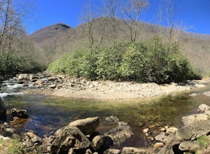
2.53 mi / 335 ft gainNottely Reservoir Trail is a loop trail that takes you by a river located near Blairsville, Georgia.Read more -
Canton, North Carolina
Shining Rock via Shining Creek Trail
4.38.69 mi / 2569 ft gainThere are several ways to access the Shining Rock Wilderness Area, but go for the main trail head off of Hwy 276. The trail is split by the Pigeon River, providing a seemingly infinite combinations of trails and routes, keeping in mind that this area intersects often with the well known Art Lobe ...Read more -
Canton, North Carolina
Hike Big East Fork Shining Rock Loop
4.014 miWe began this trip by camping overnight in Graveyard Fields. Those camp sites are .5 miles from the car, so we kept our food there over night. Bear activity has increased, so it's strongly advised to bring a bear canister and be wise about food storage. We woke up early the next morning made bre...Read more -
Clyde, North Carolina
Hike to Little Fall Branch falls
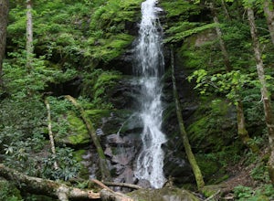
0.3 mi / 300 ft gainThe trailhead to this hike is easy to find but the gps is hard to match so it might try to take you through the middle of the trees but its easy to follow the road. The best way to get here is to go off of I-40 at the Harmon Den exit and then go up the road towards Max Patch. To get to the trailh...Read more -
Tamassee, South Carolina
Hike to Lee Falls
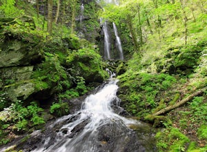
4.01.6 miThe Hike: Head out through the middle of the first of three fields, crossing creeks two times as you come to them. At the end of the last field, the trail enters the woods. Hike through the woods for 0.3 mile and take the left fork, crossing a creek , and head toward the larger branch of Tamassee...Read more -
Sautee Nacoochee, Georgia
Anna Ruby Falls
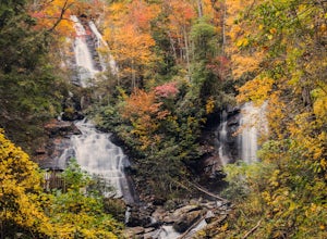
4.01 mi / 374 ft gainThe hike to Anna Ruby Falls located in the Chattahoochee National Forest, bordering and often mistaken for being located in Unicoi State Park, begins at the Anna Ruby Falls Visitor Center. There is a $3 per person fee (16 years and under are free) to access the parking lot of the visitor center a...Read more -
Lakemont, Georgia
Minnehaha Falls
4.20.39 mi / 98 ft gainDespite their beauty, not many hikers know about Minnehaha Falls. Even more shocking, these are some of the most accessible falls in all of North Georgia. Round trip, the hike to the falls will only take about a half a mile. Hikers can park along the side of the road at the trailhead. Follow the ...Read more -
Tellico Plains, Tennessee
Hike to Conasauga Falls
4.51.5 mi / 400 ft gainGetting to the trailhead can be a challenge if there has been any heavy precipitation or icy conditions due to the fact the last two miles are one mile of broken pavement and the last mile a dirt road. You should be fine in good conditions in any car; however, just make sure to take it easy on th...Read more -
Knoxville, Tennessee
Mead's Quarry Park
3.0This quarry is located near the Ijams Nature Center in South Knoxville. The quarry is right off of Island Home rd and has a large parking lot. The parking lot has about 30 spaces and about 50 spaces in overflow parking. There is a lot activities to do at the quarry. In the summer there is kayak a...Read more -
Brevard, North Carolina
Hike to John Rock
5.05 mi / 1000 ft gainThis 5 mile loop begins at the Pisgah Center for Wildlife Education and State Fish Hatchery near Brevard, NC. Ample parking is available adjacent to the trailhead with bathrooms and water accessible. Grab a map from inside as well. To start the hike, look at the education center, to the left is t...Read more -
Knoxville, Tennessee
River Boardwalk Trail
1.5 mi / 200 ft gainThis trail is located at the Ijams Nature Center. Ijams Nature Center is only 10 minutes from downtown Knoxville and is a great place to escape city life and enjoy the outdoors. The parking lot here is quite large and in the busy season it has an overflow lot too. Ijams Nature Center has many hik...Read more -
Knoxville, Tennessee
High Ground Park
1 mi / 50 ft gainThis park is located in south Knoxville right off of Cherokee trail road. The parking lot is very large and can accommodate 15-20 cars. The park is home to the historic Fort Higley which was a Civil War fort built by the Union to protect Knoxville. This is a great place to walk or run through t...Read more -
Knoxville, Tennessee
High Ground Park (Fort Higley)
0.66 mi / 89 ft gainHigh Ground Park (Fort Higley) is an out-and-back trail that takes you through a nice forest and park located near Knoxville, Tennessee.Read more -
Knoxville, Tennessee
Will Skelton Greenway
7 mi / 300 ft gainThis greenway starts at the Island Home Park and goes through Ijams Nature Center and the Forks of the River Wildlife Management Area. The trail is almost 4 miles one way so it makes for a great half day trip. From start to finish it is 8 miles long. The trail is mostly paved with only a small bi...Read more -
Tallulah Falls, Georgia
Camp at Tallulah Gorge State Park
4.7Tallulah Gorge is a must-see feature of Georgia. Campers can lay low and experience the gorge from its floor, engaging in river activities such as kayaking or swimming. Those seeking a thrill can hike the rim trails of the gorge, and even cross an 80' high suspension bridge. (Hikers who may be fe...Read more -
Tallulah Falls, Georgia
Hike to Hurricane Falls, Tallulah Gorge SP
4.41.85 mi / 564 ft gainThe trail is located in Tallulah Gorge State Park which is about 1 ½ hours northeast of Atlanta, off of Highway 441. There is a $5 per car entry fee into the park and they prefer the use of cash. From there, follow the signs to the Jane Hurt Yarn Interpretive Center, where there is parking and pl...Read more


