Saratoga Springs, New York
Looking for the best hiking in Saratoga Springs? We've got you covered with the top trails, trips, hiking, backpacking, camping and more around Saratoga Springs. The detailed guides, photos, and reviews are all submitted by the Outbound community.
Top Hiking Spots in and near Saratoga Springs
-
Caroga Lake, New York
Kane Mountain Fire Tower
4.22.1 mi / 518 ft gainThe Kane Mountain fire tower is one of the more frequented Adirondack towers due to the ease of the trail and its proximity to so many Caroga Lake camping areas. The short hike is family friendly and available year round, part of the trail doubles as a cross country skiing trail in fact. Driving...Read more -
Glen Road, Vermont
Hike the Lye Brook Falls Trail
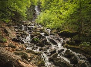
4.04.7 mi / 938 ft gainThe Lye Brook Falls Trail is a 4.7 mile hike through scenic trails just outside of Manchester Center, Vermont. The trail is open year-round, but the best time to go is during spring blooms or to see the fall colors. This hike is family friendly and fun for all ages. Dogs are allowed on this trail...Read more -
Clemons, New York
Hike to Black Mountain in Lake George, NY
6.7 mi / 1046 ft gainBlack Mountain is located on the Eastern side of Lake George and is the tallest mountain above Lake George. The trailhead is located on Pike Brook Road (off from Hulett's Rd, Route 6) in Clemons, NY. The parking area is about one mile up Pike Brook Road, on the right.This hike to Black Mountain i...Read more -
Woodford, Vermont
Woodford State Park Loop
2.41 mi / 203 ft gainA great loop for the summer, Woodford is also amazing when winter winter comes to the State Park. It also comes earlier than just about anywhere else in Southern Vermont. At 2,400 feet above sea level, this is an easy spot to find winter without spending a fortune at the local ski resorts. Woodfo...Read more -
Poultney, Vermont
Camp on Mount St. Catherine
5.0Looking for the best view in all of Poultney, Vermont? Look no further than Lake St. Catherine Mountain. Located within Deane's Nature Preserve, this fast and easy hike tops as one of the best views and camping spots for the little time and energy needed to reach the summit. Only 30-45 minutes fr...Read more -
East Nassau, New York
Kinderhook Creek
5.01.62 mi / 308 ft gainKinderhook Creek is a loop trail that takes you by a river located near Stephentown, New York.Read more -
Williamstown, Massachusetts
Hike Mt. Greylock via Money Brook Trail
9.7 mi / 3034 ft gainPark in the parking lot on Hopper Rd. Walk to the end of the road where you will find the Hopper Trailhead. Take the right fork. The Money Brook trail will take you to a waterfall, the Mt. Greylock summit, and back to the end of Hopper Rd. The trail is long but worth the hike, exploring parts of ...Read more -
North Creek, New York
Hike Gore Mountain
5.010 mi / 3040 ft gainYou will start this hike following the blue blazed Schaefer trail. Though the sign shows 5.8 miles to the summit it is actually only 5.0 miles. Much of the way you follow Roaring Brook which has many waterfalls along the way. Just after the North Creek Reservoir you will get your first glance at...Read more -
Williamstown, Massachusetts
Hike the March Cataract Falls Trail
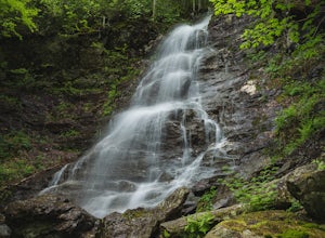
4.02.2 mi / 511 ft gainPark at the Junction of Sperry Rd and Rockwell Rd. To get to the trailhead, hike along Sperry Road for about 30 minutes. (Not to the end of the road, see map below.) Then hike along the March Cataract Trail, an out-and-back. You can bring dogs on leash. The trail is short but steep in some parts ...Read more -
Lake Pleasant, New York
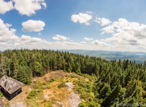
Hike Pillsbury Mountain Fire Tower
5.0Pillsbury Mountain is a fairly short but satisfying hike, ending with beautiful views of surrounding mountain ranges and lakes, and home to a defunct ranger station and fire tower. To get to the parking area within the Perkins Clearing wilderness area, head north on Route 30 out of Speculator and...Read more -
Wallingford, Vermont
Hike the White Rocks Ice Beds Trail
1.6 mi / 180 ft gainThis 1.6 mile round trip hike starts from the Ice Beds parking lot in the Green Mountain National Forest in Vermont. The trailhead is close to the parking lot entrance, following the blue-blazed trail. Be sure to read the signs, as the far trailhead is a hike to the cliffs, not the ice beds. Af...Read more -
Lake Pleasant, New York
Backpack to Cedar Lakes Lean-to #2 in the West Canada Lakes Wilderness
5.3 mi / 705 ft gainKnow before you go! It’s a bumpy road in and a bumpy road out so be sure your vehicle is ready to handle a long, winding dirt and rocky road back to the trail head. The road is approximately 7 miles to the trailhead starting on Jessup River Road off of State Route 30 in Speculator, NY. Follow Jes...Read more

