Pawling, New York
Looking for the best chillin in Pawling? We've got you covered with the top trails, trips, hiking, backpacking, camping and more around Pawling. The detailed guides, photos, and reviews are all submitted by the Outbound community.
Top Chillin Spots in and near Pawling
-
Rye, New York
Hike the Marshlands Conservancy Loop
4.01.55 mi / 125 ft gainLocated along the Long Island Sound, this 147-acre conservancy is home to a plethora of different birds, including marsh wrens, seaside sparrows, and American woodcocks. The conservancy has 3 miles of trails, all easy to navigate. Starting out from the visitor's center, take the trail to the rig...Read more -
Closter, New Jersey
Hike Alpine White Trail (Stateline Lookout)
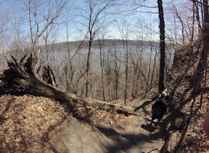
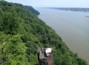
5.05 mi / -520 ft gainStarting at about 520 feet, the White path takes you along the Stateline Lookout which is a small stone building overlooking the Hudson River. The initial descent is your average hike through the woods and across a couple of wooden bridges until you reach the Giant Steps. The Giant Steps take you...Read more -
Meriden, Connecticut
Higby Mountain Trail
2.11 mi / 486 ft gainThe popular route for this hike is to park your car at the base of the trail which is located right before merging onto 91-S in Middlefield, CT. The parking lot does seem to get crowded mid-day, especially if the weather is nice! The beginning of the hike is mostly flatter land and an incline w...Read more -
Ringwood, New Jersey
Explore Ringwood Manor State Park
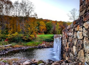
5.01.3 miOn my way to the drive-in, I saw a sign for Ringwood Manor estate and wanted to adventure around. The parking is easy and the property was beautiful!As we walked through the estate, we found:a quaint tree foresta small cemetery with headstones hundreds of years olda river with a small waterfall ...Read more -
Closter, New Jersey
Hike to Huyler's Landing/ Closter Dock Loop
4.05.4 mi / 450 ft gainThe easiest way to access this loop hike is by parking at the Palisades State Park Headquarters. This is just off exit 2 from the Palisades Interstate Parkway. Parking here is free and it is a short walk down a road to the Closter Dock Trail. The Closter Dock Trail is more of a wide fire road ...Read more -
Simsbury, Connecticut
Hike to the Heublein Tower on Talcott Mountain
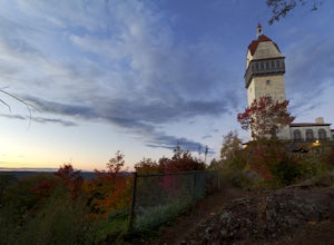
4.32.54 mi / 404 ft gainThe Heublien Tower Trail, located just inside the Talcott Mountain State Park entrance off of Route 185 in Simsbury CT, is a short 1.25 miles. While the hike isn't long, the first 1/3 of a mile is a steep incline that will get your heart pumping. The trail itself it very well kept, and although ...Read more -
Granby, Connecticut
Hiking Enders Falls
4.0Enders State Forest sprawls over approximately 2000 acres, and is found within the towns of Granby and Barkhamsted in Connecticut. Enders has a good sized parking lot directly on Route 219. From the junction of Route 219 and Route 20, visitors will proceed west on Route 219 for 1.2 miles and tu...Read more -
Warwick, New York
Enjoy a Film at the Historic Warwick Drive-In
Take a trip back in time at the Warwick Drive-In and watch a feature film on the big screen. The Drive-In shows movies just in theaters and older films with three different screens / options to chose from. The theater sells tickets for both one movie and for double features, i.e. watch two movies...Read more -
Elka Park, New York
Hike to Huckleberry Point
4.54.5 mi / 644 ft gainThis is a 4.5 mile hike that is great for hikers of all skill levels. Because it is short and not overly difficult, beginners will enjoy this hike. There are some steep sections that will get your heart pumping, though, and a stunning payoff is waiting for you at the end.From the trailhead, follo...Read more -
Elka Park, New York
Backpack the Eastern Half of Devil's Path in the Catskill Mountains
5.014 mi / 3900 ft gainThe Eastern half of Devil's Path has four major summits: Indian Head, Twin, Sugarloaf and Plateau. Each summit is a straight climb up and down, then back up to as much as 3,900 ft. There are some sparse sections of level ground, but most is a steep descent uphill or steep slide downhill. Your ...Read more -
Middletown, Connecticut
Explore Wadsworth Falls
5.00.25 miWhen it comes to exploring Wadsworth Falls its ease of access couldn't be better. As soon as you pull into the parking lot you hear the falls roaring. Take the quick walk to see the picturesque scenery.Facts about Wadsworth Falls:Height: 25ft tall and doubled in width Rock: Hampden Basalt -the ro...Read more -
West Milford, New Jersey
Hike the Terrace Pond North - South Loop
10.7 mi / 1200 ft gainFrom Warwick Road, parking at the northernmost road side parking area, cross the road, and the Terrace Pond North trail (marked with blue blazes) begins as a steady climb until you gain a ridge that offers some great views for several miles. Eventually, you'll reach a power line where you turn ri...Read more -
Grahamsville, New York
Swim at Peekamoose Blue Hole
3.8To get there: From Sundown, NY, head 10 miles on Route 42 until you see a large parking area on the right with a sign for the Peekamoose Mountain area. Follow the signs from the parking area to the creek. Swimming Hole Coordinates: (41.9182, -74.4215) You can cool off from NY's warm weather and d...Read more -
Greene County, United States
Hike to Newman's Ledge
4 mi / 584 ft gainLocated in the beautiful Catskill Mountains, this is an outdoors-mans(and woman's) dream spot! Although this hike is accessible year round, if you decide to go during the summer you should expect crowds. Luckily, there are so many different trails and activities that it won't even matter. North-S...Read more -
Elka Park, New York
Camp at Sugarloaf Mountain in the Catskills
4.06 mi / 1500 ft gainBegin by parking at the end of Mink Road in Elka Park (GPS:N42 08.593, W74 09.479). It will be a .7 mile hike to camp. Follow the rocky woods road to the junction where there is a SPRING sign. Continuing straight will take you to the water source. If you do not need water, turn left when you see ...Read more


