Lake Luzerne, New York
Top Spots in and near Lake Luzerne
-
Caroga Lake, New York
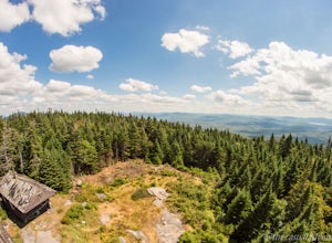
Kane Mountain Fire Tower
4.22.1 mi / 518 ft gainThe Kane Mountain fire tower is one of the more frequented Adirondack towers due to the ease of the trail and its proximity to so many Caroga Lake camping areas. The short hike is family friendly and available year round, part of the trail doubles as a cross country skiing trail in fact. Driving...Read more -
Cropseyville, New York
Hike Dickinson Hill Fire Tower
4.53 mi / 200 ft gainOnce you drive onto N. Long Pond Road you will follow it appproximately 1.5 miles to the end. From the parking you can take the short walk back on the road to the start of the trail. The trail is actually a rough Fire Tower Road. You will follow this for about 1.3 miles. Here you will see a se...Read more -
Albany, New York
Blueberry Hill East
1.73 mi / 59 ft gainBlueberry Hill East is a loop trail where you may see beautiful wildflowers located near Albany, New York.Read more -
Albany, New York
Blueberry Hill West Red and Yellow Trail
1.37 mi / 52 ft gainBlueberry Hill West Red and Yellow Trail is a loop trail where you may see beautiful wildflowers located near Albany, New York.Read more -
Glen Road, Vermont
Hike the Lye Brook Falls Trail
4.04.7 mi / 938 ft gainThe Lye Brook Falls Trail is a 4.7 mile hike through scenic trails just outside of Manchester Center, Vermont. The trail is open year-round, but the best time to go is during spring blooms or to see the fall colors. This hike is family friendly and fun for all ages. Dogs are allowed on this trail...Read more -
Indian Lake, New York
Hike to OK Slip Falls
5.06.4 miStarting at the parking area you will walk 0.2 miles west on Route 28 to the north side of the road to locate the marked trailhead. After signing the trail register you will follow the the red marked trail approximately 0.5 miles to the first junction. At the junction you will branch right and f...Read more -
Altamont, New York
Hike through the Wolf Creek Falls Preserve
3.03 mi / 200 ft gainOver 3 miles of trails provide access to all parts of the preserve, and end up winding through mixed terrain including a wetland, waterfalls, and old stone walls. The property crosses the Bozenkill Road at two points on either side of private parcels (with beautiful homes), so be vigilant there; ...Read more -
Indian Lake, New York
Hike Snowy Mountain Fire Tower
4.77.5 mi / 2142 ft gainSnowy Mountain is the largest mountain in this region of the Adirondacks, and with a 2100'+ elevation gain over the 3.5 mile ascent is actually more work than some of the famed High Peaks. Going north on Rt 30, the parking lot is marked as Snowy Mountain on the right hand side. If you make it to ...Read more -
Lake Pleasant, New York
Hike Pillsbury Mountain Fire Tower
5.0Pillsbury Mountain is a fairly short but satisfying hike, ending with beautiful views of surrounding mountain ranges and lakes, and home to a defunct ranger station and fire tower. To get to the parking area within the Perkins Clearing wilderness area, head north on Route 30 out of Speculator and...Read more -
Lake Pleasant, New York
Backpack to Cedar Lakes Lean-to #2 in the West Canada Lakes Wilderness
5.3 mi / 705 ft gainKnow before you go! It’s a bumpy road in and a bumpy road out so be sure your vehicle is ready to handle a long, winding dirt and rocky road back to the trail head. The road is approximately 7 miles to the trailhead starting on Jessup River Road off of State Route 30 in Speculator, NY. Follow Jes...Read more -
Ticonderoga, New York
Hike to Lost Pond
3.9 mi / 260 ft gainFrom the parking area, follow the trail from the back of the parking area. Very quickly you will hike up to a trail register. The trail is mostly flat with a few inclines and is very well beaten. There are also yellow plastic trail markers to keep you on track. After 1.4 miles you'll reach the ju...Read more -
Voorheesville, New York
Hike the Indian Ladder Trail
4.53.5 mi / 200 ft gainThere are many parking areas within the park. Park at the overlook parking. From here you head west following the wood fence. This is the Cliff Top trail. Approximately after walking 0.5 miles you will reach the stairs that will lead you to the base of the cliffs. This marks the start of the...Read more -
Castleton, Vermont
Hike around Taconic Mountains Ramble State Park
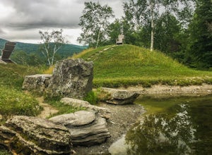
Taconic Mountains Ramble State Park is a unique collection of hiking trails and walking paths that meander more than 204 acres of fields, forests, gorges, cliffs, and gardens. The best way to explore these enchanting trails is to pack a picnic and lace up your hiking boots for a full-day ramble. ...Read more -
Wallingford, Vermont
Hike the White Rocks Ice Beds Trail
1.6 mi / 180 ft gainThis 1.6 mile round trip hike starts from the Ice Beds parking lot in the Green Mountain National Forest in Vermont. The trailhead is close to the parking lot entrance, following the blue-blazed trail. Be sure to read the signs, as the far trailhead is a hike to the cliffs, not the ice beds. Af...Read more -
Woodford, Vermont
Woodford State Park Loop
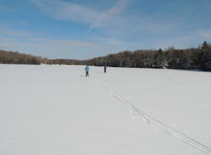
2.41 mi / 203 ft gainA great loop for the summer, Woodford is also amazing when winter winter comes to the State Park. It also comes earlier than just about anywhere else in Southern Vermont. At 2,400 feet above sea level, this is an easy spot to find winter without spending a fortune at the local ski resorts. Woodfo...Read more -
Voorheesville, New York
Hike the Keleher Preserve Loop
2.03 mi / 1636 ft gainThe historic preserve is operated by the Mohawk Hudson Land Conservancy, so trails are clearly marked and extremely well maintained. There are features of the original farm that the land was used for from the 18th Century, including hand-thrown stone walls and an old logging road that cuts throug...Read more

