Greenville, New York
Looking for the best hiking in Greenville? We've got you covered with the top trails, trips, hiking, backpacking, camping and more around Greenville. The detailed guides, photos, and reviews are all submitted by the Outbound community.
Top Hiking Spots in and near Greenville
-
89 Van Orden Road, New Jersey
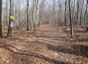
Hike the Hank's Pond Loop
7 mi / 500 ft gainHank's Pond loop can be accessed from the south at the corner of Clinton road and Van Orden road or from the north, parking at the lot on Stephens road. I hiked from the south on this trip. Follow the wide trail known as Hank's East trail marked with white blazes. Soon you will reach a trail c...Read more -
Rockaway, New Jersey
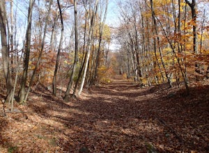
Hike the Timberbrook Pond - Riley's Rise Loop
5 mi / 500 ft gainThe trailhead parking is at the end of Timberbrook Road, before the road enters Camp Winnebago (Boy Scouts). I hiked this in a clockwise directions starting on the Timberbrook Trail (yellow markers). After about 1 mile the trail ends at a junction with the Four Birds Trail (white markers). Turn...Read more -
Bridgeport, Connecticut
Stroll around Fayerweather Island
0.5 miParking is at the end of Barnum Road in the Seaside Park. Though the lighthouse grounds are accessible the tower itself is not open to the public. To access the island you must walk across the breakwater. Please use caution as it is uneven footing and at times can be slippery. From the isla...Read more -
Staten Island, New York
Hike the Staten Island Greenbelt
4.07.6 miThe white trail offers one of the two more ambitious hikes, passing through Egbertville Ravine, Heyerdahl Hill and Buck’s Hollow parks on Staten Island, offering an up-close view of the forest and marshland that once covered the island. About midway, the trail also passes the Greenbelt Nature Cen...Read more -
Beacon, New York
Mt. Beacon Fire Tower
4.83.83 mi / 1332 ft gainMount Beacon is a very popular trail along the Hudson River, and for good reason. It offers a good workout, fantastic views for both sunrise and sunset (and of course the time in between), a recently rebuilt fire tower, and all with incredibly easy access right on the edge of a lively town. The ...Read more -
Beacon, New York
Malouf's Mountain Camp on Mt. Beacon
7.02 mi / 2087 ft gainStarting in the quaint town of Beacon there are a couple of options for hikes of varying difficulty. From the station the walk is about 1.5 miles to the trail heads, alternatively if you choose to stay the night at Malouf's Mountain Sunset Campground you can arrange for the host to meet you, take...Read more -
Beacon, New York
Hike the Scofield Ridge Loop
7.5 mi / 1850 ft gainThere are some great view points along this route. Start from the Mount Beacon Park trailhead parking area. This leads to the Casino Trail (red markers). The trail climbs steeply to some old ruins of a casino. Most of what remains is only the brick structure housing the mechanics for a trolle...Read more -
Beacon, New York
Hike Fishkill Ridge
Fishkill Ridge is a strenuous but rewarding hike, and one of the less known areas in the Hudson Valley. The parking area is at the very end of Sunnyside Road in Beacon, along with the information board at the trailhead. The red trail leaves the lot and will take you up to the first peak on the ri...Read more -
Beacon, New York
Hudson Highlands Overlook Trail
3.29 mi / 1017 ft gainHudson Highlands Overlook Trail is an out-and-back trail that takes you through a nice forest located near Beacon, New York.Read more -
Beacon, New York
Explore Long Dock and Dennings Point Parks
4.0Long Dock and Dennings Point are two of the most popular parks in Beacon, that just so happen to be connected by a train track turned trail. Plenty of parking is available at Long Dock, and its a perfect spot to picnic, launch your kayak into the Hudson, or cast your line hoping to reel in the bi...Read more -
Vernon Township, New Jersey
Stairway to Heaven
4.86.8 mi / 1089 ft gainThis popular hike starts out on the Appalachian Trail (AT, white blazes). You begin on a boardwalk that crosses over a marsh, then you leave the boardwalk and enter a forested area. At around 1.4 miles, follow a bicycle path, Canal Road, then turn right, cross over a bridge, and take a left throu...Read more -
Gillette, New Jersey
Great Swamp National Wildlife Refuge Loop
5.00.94 mi / 43 ft gainNestled within the more urban and suburban communities in Northern New Jersey, you can escape back to nature at Great Swamp National Wildlife Refuge. The name says it all - this place is the perfect opportunity to get up close to a variety of different wildlife that call this protected land home....Read more -
New Fairfield, Connecticut
Hike Squantz Pond Trail
2.2 mi / 321 ft gainThe hike is rated as moderate and is accessible all year round. While it’s accessible during all seasons, the sights of the leaves changing colors in the autumn makes it an exceptionally beautiful time to do this hike. You’ll definitely want to snap some photos along the way of the foliage reflec...Read more -
Matawan, New Jersey
Cheesequake Yellow and Blue Loop Trail
4.03.43 mi / 328 ft gainCheesequake Yellow and Blue Loop Trail is a loop trail that takes you by a lake located near Old Bridge, New Jersey.Read more -
Patchogue, New York
Fire Island's Watch Hill
4.02 miIf departing from NYC, catch the early LIRR train from Penn Station (or Atlantic Terminal) towards Patchogue. You may have to transfer at both Jamaica & Babylon, but it's an easy hop across the platform. Trip will take approximately an hour and a half and cost around $15, Off Peak, each way. ...Read more -
Wantage, New Jersey
Hike the Iris Tail - Appalachian Tail Loop
4.09 mi / 1000 ft gainStart this hike from the Appalachian Trail parking area off route 23, south bound side, south of the park office. Follow the Blue Dot trail until is intersects with the Iris Trail. The Iris Trail (marked with red blazes) is a through hike that is about 5 miles long. It parallels the Appalachian T...Read more

