Ghent, New York
Looking for the best hiking in Ghent? We've got you covered with the top trails, trips, hiking, backpacking, camping and more around Ghent. The detailed guides, photos, and reviews are all submitted by the Outbound community.
Top Hiking Spots in and near Ghent
-
Cropseyville, New York
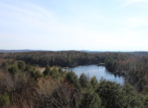
Hike Dickinson Hill Fire Tower
4.53 mi / 200 ft gainOnce you drive onto N. Long Pond Road you will follow it appproximately 1.5 miles to the end. From the parking you can take the short walk back on the road to the start of the trail. The trail is actually a rough Fire Tower Road. You will follow this for about 1.3 miles. Here you will see a se...Read more -
Schenectady, New York
Hike the Lisha Kill Preserve Loop
5.02.3 mi / 324 ft gainThis 2.3 mile loop trail is lightly trafficked and great for all skill levels. Starting out the trail register, you will see signs from The Nature Conservancy which manages the preserve. Descending down a hill with lots of exposed tree roots, you will then cross over the meandering Lisha Kill and...Read more -
Altamont, New York
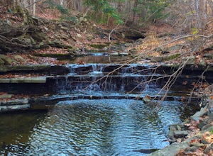
Hike through the Wolf Creek Falls Preserve
3.03 mi / 200 ft gainOver 3 miles of trails provide access to all parts of the preserve, and end up winding through mixed terrain including a wetland, waterfalls, and old stone walls. The property crosses the Bozenkill Road at two points on either side of private parcels (with beautiful homes), so be vigilant there; ...Read more -
Sharon, Connecticut
Hike the Pine Knob Loop, Housatonic Meadows SP
5.02.5 mi / 770 ft gainThe Pine Knob loop is a 2.5 mile loop trail that takes you through beautiful thick woods filled with vistas, wild flowers and tons of wild life. You will start your adventure at the Pine Knob Trail head where you will be able to a Connecticut Appalachian trail guide. Pine Knob is a blue blaze ...Read more -
Savoy, Massachusetts
Tannery Falls Loop
0.54 mi / 135 ft gainThe hike to Tannery Falls may be a little confusing, I'll clear it up for you before you even go there! To get to The falls you will travel down a dirt road that isn't very well maintained during the winter. As you keep driving down the dirt road you will notice a pond , which means you are almos...Read more -
Kent, Connecticut
Hike the Ridge Loop Trail, Macedonia Brook SP
3.0For a quick weekend trip from Newport, RI, Macedonia Brook State Park had a lot to offer for its size. In three or four hours, with lunch, you can hike the 6.4 mile ridge trail and get some fresh air without having to hike on too busy of trails. The elevation gain is only around 700 ft, however, ...Read more -
Kent, Connecticut
Explore Kent Falls
5.00.75 mi / 250 ft gainEvery now and then you need a day to rest those sore muscle from all your recent adventures. The only issue is, you don't want to sit around inside, you want to be outside. Insert a trip to Kent Fall State Park. The perfect rest adventure day.Located 1 hour and 45 minutes north of New York City i...Read more -
Dover Plains, New York
Hike Dover's Stone Church
4.5Dover Stone Church has been a beautiful and popular destination in the Hudson Valley for some time, and recently the park purchased a new parcel of land and added three trails through the nearby woods. But the gem of the park is, and always will be, the impressive cave with the creek and waterfal...Read more -
Schenectady, New York
Hike Plotter Kill Preserve
4.35.5 mi / 820 ft gainThere are a few entries into the preserve' however, this hike has you entering off of Mariaville Road. There is a kiosk here and you will enter on the Red trail. Shortly after you can go out and back on the Blue trail to view the Upper and Lower Falls from lookouts above. Once back to the Red t...Read more -
Phoenicia, New York
Hike Mt. Wittenberg
4.3Looking for a great day hike in the Catskill region of NY? Then you should definitely look into and consider tackling Mt. Wittenberg then. A challenging climb up but a very rewarding summit view.Starting at Woodland Valley Campgrounds visitor registration house (where you can pay for parking for ...Read more -
Phoenicia, New York
Camp at Woodland Valley
3.0If you are looking for a great campground up in the Catskill Mountains of New York then you definitely have to check out Woodland Valley Campgrounds. Located about 2 hours north of New York City, it is the perfect place to go to get off the grid. No service for about 30 minutes in any direction.T...Read more -
High Falls, New York
Scramble Bonticou Crag and Table Rocks
4.5This is not a hike for the inexperienced. There is a very steep rock scramble that has some dangerous section if you are not aware of your footing and positioning. For those up to the challenge, it is extremely rewarding at the top.To start, each person has to pay $12 to access the Monhonk Preser...Read more -
Big Indian, New York
Camp on Giant Ledge
4.51.5 mi / 975 ft gainGiant Ledge is a great hike in the Catskills if you are looking for something short, with incredible views, and camping options. There are not many hikes with better views then this in the Catskills, so why not spend as much time as possible up there? There are a few camping spots you can grab w...Read more -
Big Indian, New York
Hike Giant Ledge
4.53.74 miThe trail starts across the street from the parking area you will see a sign. After a short walk in you will cross a foot bridge. At approximately 0.75 mile you will reach a junction. You will turn left toward Giant Ledge. The next half mile is fairly flat. At 1.5 miles you will reach a spur ...Read more -
Granby, Connecticut
Hiking Enders Falls
4.0Enders State Forest sprawls over approximately 2000 acres, and is found within the towns of Granby and Barkhamsted in Connecticut. Enders has a good sized parking lot directly on Route 219. From the junction of Route 219 and Route 20, visitors will proceed west on Route 219 for 1.2 miles and tu...Read more -
High Falls, New York
Mohonk Mountain House Labyrinth and Lemon Squeeze Hike
4.5Mohonk Mountain House is a historic resort located just outside the Catskills in the Hudson Valley just 90 miles north of New York City. With 85 miles of winding trails throughout the Mohonk Preserve, you'll have endless hiking options upon your arrival.Parking at the Gatehouse is limited, so be ...Read more

