Berne, New York
Looking for the best hiking in Berne? We've got you covered with the top trails, trips, hiking, backpacking, camping and more around Berne. The detailed guides, photos, and reviews are all submitted by the Outbound community.
Top Hiking Spots in and near Berne
-
Elka Park, New York
Backpack the Eastern Half of Devil's Path in the Catskill Mountains
5.014 mi / 3900 ft gainThe Eastern half of Devil's Path has four major summits: Indian Head, Twin, Sugarloaf and Plateau. Each summit is a straight climb up and down, then back up to as much as 3,900 ft. There are some sparse sections of level ground, but most is a steep descent uphill or steep slide downhill. Your ...Read more -
Elka Park, New York
Backpack Devil's Path in the Catskills
24.2 mi / 9000 ft gainDevil's Path is roughly more than 24 miles long, althought it feels like an eternity of milage. Going thru the summits of Indian head, Twin, Sugarloaf, Plateau, Hunter, and Westkill Mountains.Its brutal. Its painful, Its unique. Be prepared for anything and everything. You will encounter wild lif...Read more -
Elka Park, New York
Hike to Huckleberry Point
4.54.5 mi / 644 ft gainThis is a 4.5 mile hike that is great for hikers of all skill levels. Because it is short and not overly difficult, beginners will enjoy this hike. There are some steep sections that will get your heart pumping, though, and a stunning payoff is waiting for you at the end.From the trailhead, follo...Read more -
Elka Park, New York
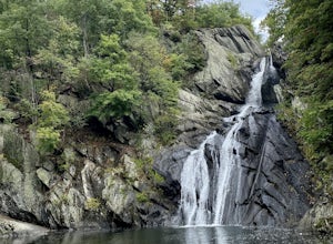
Hike to Plattekill Falls
0.5 mi / 137 ft gainJust outside of Elka Park, New York, Plattekill Falls is accessible from Albany and New York City alike. This is a great hike for families and all skill levels. The falls are spectacular year-round, but the best time to visit is in the spring. From the trailhead, walk left past the red house unt...Read more -
Hudson, New York
High Falls Conservation Area Loop
1.41 mi / 194 ft gainHigh Falls Conservation Area Loop is a loop trail that takes you by a waterfall located near Philmont, New York.Read more -
Woodstock, New York
Sugarloaf Mountain via Blue Trail
6.54 mi / 2297 ft gainSugarloaf Mountain, is one the 35 highest peaks in New York's Catskills at 3806 ft. There are many ways to approach this peak, and this is an out-and-back hike via Mink Hollow. The parking area is located at the end of Milk Hollow Rd (42.10405386879072, -74.17148500019927). From here, get on the...Read more -
Cropseyville, New York
Hike Dickinson Hill Fire Tower
4.53 mi / 200 ft gainOnce you drive onto N. Long Pond Road you will follow it appproximately 1.5 miles to the end. From the parking you can take the short walk back on the road to the start of the trail. The trail is actually a rough Fire Tower Road. You will follow this for about 1.3 miles. Here you will see a se...Read more -
Big Indian, New York
Hike to Balsam Mountain in the Catskills
5.4 mi / 2910 ft gainTimeline: Weekend, though can easily be done as an overnight trip or just a day hike Summary: Day 1: Hike to camp (0.7 miles, 340' elevation gain) Day 2: Hike to Balsam Mountain and back to camp (4 miles round-trip) Day 3: Relax & hike back to car (0.7 miles) Details: Park the car at McKinle...Read more -
Phoenicia, New York
Hike Mt. Wittenberg
4.3Looking for a great day hike in the Catskill region of NY? Then you should definitely look into and consider tackling Mt. Wittenberg then. A challenging climb up but a very rewarding summit view.Starting at Woodland Valley Campgrounds visitor registration house (where you can pay for parking for ...Read more -
Phoenicia, New York
Camp at Woodland Valley
3.0If you are looking for a great campground up in the Catskill Mountains of New York then you definitely have to check out Woodland Valley Campgrounds. Located about 2 hours north of New York City, it is the perfect place to go to get off the grid. No service for about 30 minutes in any direction.T...Read more -
Caroga Lake, New York
Kane Mountain Fire Tower
4.22.1 mi / 518 ft gainThe Kane Mountain fire tower is one of the more frequented Adirondack towers due to the ease of the trail and its proximity to so many Caroga Lake camping areas. The short hike is family friendly and available year round, part of the trail doubles as a cross country skiing trail in fact. Driving...Read more -
Big Indian, New York
Camp on Giant Ledge
4.51.5 mi / 975 ft gainGiant Ledge is a great hike in the Catskills if you are looking for something short, with incredible views, and camping options. There are not many hikes with better views then this in the Catskills, so why not spend as much time as possible up there? There are a few camping spots you can grab w...Read more -
Big Indian, New York
Hike Giant Ledge
4.53.74 miThe trail starts across the street from the parking area you will see a sign. After a short walk in you will cross a foot bridge. At approximately 0.75 mile you will reach a junction. You will turn left toward Giant Ledge. The next half mile is fairly flat. At 1.5 miles you will reach a spur ...Read more -
Williamstown, Massachusetts
Hike Mt. Greylock via Money Brook Trail
9.7 mi / 3034 ft gainPark in the parking lot on Hopper Rd. Walk to the end of the road where you will find the Hopper Trailhead. Take the right fork. The Money Brook trail will take you to a waterfall, the Mt. Greylock summit, and back to the end of Hopper Rd. The trail is long but worth the hike, exploring parts of ...Read more -
Williamstown, Massachusetts
Hike the March Cataract Falls Trail
4.02.2 mi / 511 ft gainPark at the Junction of Sperry Rd and Rockwell Rd. To get to the trailhead, hike along Sperry Road for about 30 minutes. (Not to the end of the road, see map below.) Then hike along the March Cataract Trail, an out-and-back. You can bring dogs on leash. The trail is short but steep in some parts ...Read more -
Mount Washington, Massachusetts
Explore Bash Bish Falls
4.21 miOne of my favorite walks to a spectacular falls. The trail is easy to follow and one mile from NY parking lot and 0.5 from the parking lot. The apparent place to swim. There are several very nice, family safe swimmable pools in the creek above and after the falls. There are signs at the top of t...Read more

