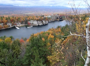
Bear Mountain, New York
Looking for the best hiking in Bear Mountain? We've got you covered with the top trails, trips, hiking, backpacking, camping and more around Bear Mountain. The detailed guides, photos, and reviews are all submitted by the Outbound community.
Top Hiking Spots in and near Bear Mountain
-
West Milford, New Jersey
Hike Bearfort Mountain
5.05.06 mi / 1007 ft gainBearfort Mountain is a great weekend morning hike that borders NJ and NY. Parking can be tricky as the entrance to the lot looks like it is Greenwood Lake Marina's boat storage area. Once parked, find the trail entrance at the top of the little hill and continue to the blue on white marked trail....Read more -
West Milford, New Jersey
Hike the Terrace Pond North - South Loop
10.7 mi / 1200 ft gainFrom Warwick Road, parking at the northernmost road side parking area, cross the road, and the Terrace Pond North trail (marked with blue blazes) begins as a steady climb until you gain a ridge that offers some great views for several miles. Eventually, you'll reach a power line where you turn ri...Read more -
Pound Ridge, New York
Leatherman's Loop
1.25 mi / 1183 ft gainThis loop trail is moderately rated and reaches a total elevation gain of approximately 1,183 feet. It’s located in the Ward Pound Ridge Reservation, which spans roughly 4,315 acres. It is Westchester County’s largest park and includes roughly 35 plus miles of hiking trails to explore. The Ward...Read more -
Closter, New Jersey
Hike Alpine White Trail (Stateline Lookout)
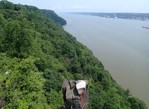
5.05 mi / -520 ft gainStarting at about 520 feet, the White path takes you along the Stateline Lookout which is a small stone building overlooking the Hudson River. The initial descent is your average hike through the woods and across a couple of wooden bridges until you reach the Giant Steps. The Giant Steps take you...Read more -
Yonkers, New York
Run the Old Croton Aqueduct Trail
5.026.5 miThis trail traces the route of the Old Croton Aqueduct, which carried water to New York City between 1842 and 1955. Our recommended route starts near the Greystone Station in Yonkers, NY (Metro-North Hudson Line) and ends by the Scarborough Station, but you can easily modify your route – the enti...Read more -
Vernon Township, New Jersey
Stairway to Heaven
4.86.8 mi / 1089 ft gainThis popular hike starts out on the Appalachian Trail (AT, white blazes). You begin on a boardwalk that crosses over a marsh, then you leave the boardwalk and enter a forested area. At around 1.4 miles, follow a bicycle path, Canal Road, then turn right, cross over a bridge, and take a left throu...Read more -
Closter, New Jersey
Hike to Huyler's Landing/ Closter Dock Loop
4.05.4 mi / 450 ft gainThe easiest way to access this loop hike is by parking at the Palisades State Park Headquarters. This is just off exit 2 from the Palisades Interstate Parkway. Parking here is free and it is a short walk down a road to the Closter Dock Trail. The Closter Dock Trail is more of a wide fire road ...Read more -
Ridgefield, Connecticut
Hike the Hemlock Hills & Pine Mountain Loop
7.5 mi / 1174 ft gainThere are several trailheads for Hemlock Hills But the least crowded is at the intersection of Ned's Mountain road and Bogus Road. I took my 3 year old black lab. There are ton's of little ponds for your dog to jump in and do dog things. For the most part the hike is flat but at some parts it c...Read more -
89 Van Orden Road, New Jersey
Hike the Hank's Pond Loop
7 mi / 500 ft gainHank's Pond loop can be accessed from the south at the corner of Clinton road and Van Orden road or from the north, parking at the lot on Stephens road. I hiked from the south on this trip. Follow the wide trail known as Hank's East trail marked with white blazes. Soon you will reach a trail c...Read more -
Danbury, Connecticut
Hike Middle Mountain To Thomas Mountain Loop
3.7 mi / 856 ft gainMiddle Mountain to Thomas Mountain Loop is a 3.7 mile loop hike that takes you past great forest setting located near Danbury, Connecticut.Read more -
Jefferson, New Jersey
Thru Hike the Four Birds Trail
19 mi / 1200 ft gainThe Four Birds Trail is about 19 miles long and is a great thru hike or can be done in sections as out and back hikes or part of loop hikes with other trails. Starting from the north, the trail ascends gradually over easy terrain until you reach a cliff ridge. There are several good view points...Read more -
Rye, New York
Hike the Marshlands Conservancy Loop
4.01.55 mi / 125 ft gainLocated along the Long Island Sound, this 147-acre conservancy is home to a plethora of different birds, including marsh wrens, seaside sparrows, and American woodcocks. The conservancy has 3 miles of trails, all easy to navigate. Starting out from the visitor's center, take the trail to the rig...Read more -
Englewood Cliffs, New Jersey
Hike the Dyckman Hill/Huyler's Landing Loop
9 mi / 980 ft gainThere is two ways to access this loop hike. The first is from the Englewood Picnic area just off Exit 1 from the Palisades Interstate Parkway. Parking here requires a fee of $5 May through September. The second is to drive past the Englewood Picnic area turnoff on Henry Hudson Drive and continu...Read more -
New Paltz, New York
Hike Mohonk Preserve's Gatehouse to Skytop Tower
5.09 mi / 1268 ft gainBegin at the intersection of Gatehouse Rd and Mohonk Private Rd. There is a small shoulder to park on here. Begin hiking into the preserve along the gatehouse road. There will be signs stating you need a membership or pass to enter. Don't worry about these, there will be a place on the trail ...Read more -
New Fairfield, Connecticut
Hike Squantz Pond Trail
2.2 mi / 321 ft gainThe hike is rated as moderate and is accessible all year round. While it’s accessible during all seasons, the sights of the leaves changing colors in the autumn makes it an exceptionally beautiful time to do this hike. You’ll definitely want to snap some photos along the way of the foliage reflec...Read more -
3197 U.S. 44, New York
Hike to Sky Top via the Undercliff Road
7.3 mi / 900 ft gainStarting from the East Trapps parking area ascend the East Trapps connector trail marked with yellow blazes. You can also park at the Mohonk Preserve visitor center where you can purchase your access pass ($15 per person) and pick up a free map of the presere trails and carriage roads. The conn...Read more

