Warren, New Hampshire
Looking for the best photography in Warren? We've got you covered with the top trails, trips, hiking, backpacking, camping and more around Warren. The detailed guides, photos, and reviews are all submitted by the Outbound community.
Top Photography Spots in and near Warren
-
Crawford Notch Road, New Hampshire
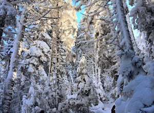
Snowshoe Mount Pierce
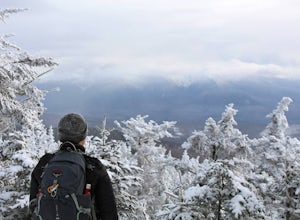
6.4 mi / 2500 ft gainThe hike begins right across from the AMC Highland Center, which is great because you can utilize their spacious parking lot! Once you locate the trailhead, the elevation begins almost immediately. Begin on the Crawford Connector Trail for 0.4 miles.You will come to a foot bridge over Gibbs Brook...Read more -
Crawford Notch Road, New Hampshire
Hike the Tom, Field, Willey and Avalon Traverse
10.2 mi / 3300 ft gainFor hikers en route to climbing the 67 4,000 footers of Northern New England, or for those looking for a day-long mini-adventure, this four-peaks-in-one traverse is a spectacular must. Mount Tom, Mount Field, and Mount Willey are all above 4,000 feet, and Mount Avalon caps at 3,442 feet. The tota...Read more -
Jackson Webster Trail, New Hampshire
Hike Mount Jackson
4.5 mi / 2109 ft gainThe Jackson Webster trailhead is located on Crawford Notch Road a little ways down from the AMC Highland Center where they have bathrooms, food, a store, info, etc. There's a parking lot at the Center as well as a smaller lot right across from the trailhead. These lots often get filled up but you...Read more -
Carroll, New Hampshire
Hike Mt. Pierce
5.06.2 mi / 2412 ft gainMount Pierce (elevation 4312 ft.) is part of the Presidential Region in the White Mountain National Forest. Upon reaching the summit, you will be rewarded with 360 degree views of the surrounding mountains. To begin your hike, park at the Crawford Connector Trailhead. You will follow the Crawfo...Read more -
Hartford, Vermont
Camp at Quechee State Park
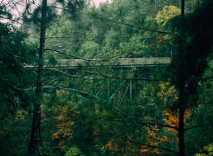
4.0Located on the Ottauquechee River, Quechee State Park offers camping options right beside one of Vermont's most famous gorges—Quechee Gorge. The steel bridge that passes over the 165 ft. gorge is just one of many spectacular views in this area. Quechee State Park is on Route 4 and easily accessi...Read more -
Groton, Vermont
Hike to Owl's Head Trail Overlook
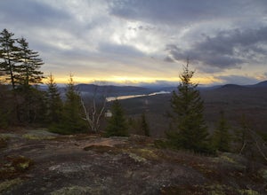
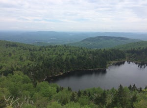
3.03 mi / 200 ft gainStarting at 1746 ft of elevation, this easy 3 mile hike (RT) pays off with a dramatic view of Lake Groton, Kettle Pond and the Green Mountains of Vermont. The trail head begins in New Discovery Park, along the dirt road to Osmore Pond. There is room to pull off the dirt road and park near the t...Read more -
Gilford, New Hampshire
Hike the Lockes Hill Trail
4.01.8 mi / 419 ft gainThis trail, beginning at a parking lot adjacent to the lake, leads to one of the best views of Lake Winnipesaukee. Although not very high in elevation, it is one of the tallest crests in the area, providing some of the best views, and the actual hike is not challenging in most conditions. Due to ...Read more -
Jefferson, New Hampshire
Hiking at Pondicherry Wildlife Refuge
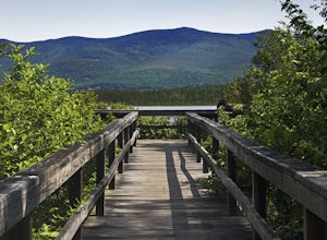
4.5As hiking in the White Mountain area goes, this is a pretty easy one. This is a family friendly hike along a rail trail and well maintained forest trails. The main attraction here isn't the difficultly. The main attraction here is the spectacular views and the abundant wildlife.This trail begi...Read more -
Randolph, New Hampshire
Summit Mount Jefferson, Mount Clay, and Mount Washington
4.010.5 mi / 4455 ft gainHike with at least one other and take two cars. First drop one car at the Cog Railway parking lot (Base Station Rd, Bretton Woods, NH). Jump into the second car and drive about 15 minutes to the Caps Ridge Trailhead on Jefferson Notch Road ( N 44° 18' 15"W 71° 21' 42" )The Caps Ridge Trail will l...Read more -
Randolph, New Hampshire
Hike Mount Jefferson
5 mi / 2700 ft gainMount Jefferson stands at 5712 feet, the third tallest mountain of the Presidential's in the White Mountain National Forest. The trail head begins at the Caps Ridge Trail on Jefferson Notch Rd. While 2.5 miles sounds easy, this hike is not for the once in while day hiker. Challenging rock scrambl...Read more -
Bartlett, New Hampshire
Hike Cathedral Ledge
4.03.4 mi / 722 ft gainDuring spring, summer and fall there is a road that allows you to drive to the top of Cathedral Ledge. In winter the road is closed off to vehicles so reaching the top requires a 1.7 mile hike. Once at the top, there is a fenced in lookout with a 180 degree view of North Conway and the surroundin...Read more -
Conway, New Hampshire
Drive the Kancamagus Highway
4.834.5 miThe Kancamagus Highway is designated an American Scenic Byway. It cuts through the White Mountains of New Hampshire. The highest point along the drive is 3000 feet. It is known as one of the best fall viewing areas in the country. If your interested there is also several campgrounds along thi...Read more -
Jackson, New Hampshire
Hike Tuckerman's Ravine Trail on Mt. Washington
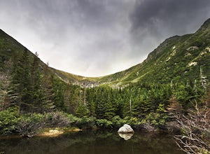
4.99 miWhile this trail is open year round with winter hiking/skiing down the ravine walls, this entry will focus on hiking in the warmer months.Your hike starts behind the Pinkham Notch AMC Center in Jackson, NH at an elevation of approximately 2050 ft. There is plenty of parking at the visitors cente...Read more -
Jefferson, New Hampshire
Summit Mount Waumbek via the Starr King Trail
5.07.2 mi / 1500 ft gainThe hike starts out at the Starr King trailhead because you will summit Starr King Mountain (3,907 ft - so close to being a 4000 footer!) before moving on to Waumbek. The 2.6 miles that it takes to get to the first summit are gradual and forgiving. The majority of the total elevation is completed...Read more -
Jackson, New Hampshire
Drive Mt. Washington Auto Road
3.0Starting at roughly 3,000ft above sea level the Mt. Washington Auto Road will take you up nearly eight miles of beautiful, scenic, and well maintained mountain auto roads to The Mount Washington Summit. The summit sits at 6,289 and offers stunning 360° views of New Hampshire's Presidential Range,...Read more -
Newbury, New Hampshire
Hike to Lake Solitude, NH
4.04.8 mi / 2510 ft gainThe two most popular routes to Lake Solitude are the Newbury Trail and Andrew Brook Trail. The round-trip distance of the hikes are 4.8 miles and 3.8 miles. Both could be described as moderate in terms of difficulty. The Newbury trail is accessed from Lakeview Ave and Andrew Brook Trail can be a...Read more

