Tuftonboro, New Hampshire
Looking for the best photography in Tuftonboro? We've got you covered with the top trails, trips, hiking, backpacking, camping and more around Tuftonboro. The detailed guides, photos, and reviews are all submitted by the Outbound community.
Top Photography Spots in and near Tuftonboro
-
Franconia, New Hampshire
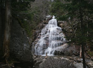
Hike Falling Waters Trail
4.03 mi / 1100 ft gainFalling Waters Trail takes you up to the summit of Little Haystack Mountain, and Mount Lincoln and Mount Lafayette if you continue to the Franconia Ridge Trail / Appalachian Trail, then over to Old Bridle Path.Also along Falling Waters Trail are stunning waterfalls. The most popular one is Cloudl...Read more -
Franconia, New Hampshire
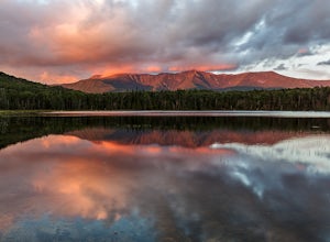
Lonesome Lake
4.53.05 mi / 1027 ft gainThe Franconia Notch area of New Hampshire has many roadside adventures to go on, bringing in thousands of visitors every year, but my favorite place in the notch is Lonesome Lake. At 3 miles, the hike is easy enough for the whole family, but most people visiting the notch stick to the roadside a...Read more -
Franconia, New Hampshire
Backpack the Franconia Ridge Loop
4.514.5 mi / 3000 ft gainThis is a multi-day backpacking loop in Franconia Notch State Park, New Hampshire (located in the the White Mountains).Leave the car at the Lafayette Place Campground, (about 1700' elevation), then head up 1.4mi to Lonesome Lake. If you start hiking in the evening, as the sun is setting, you can ...Read more -
Franconia, New Hampshire
Camp at Lafayette Campground, White Mountains
5.08.3 miThe White Mountains offer some of the most prime foliage sightseeing (aka 'leaf peeping') in New England. Tourists flock to the Franconia Notch State Park area and surrounding parts of the White Mountains every October, but camping is generally less common. October can be a cold month in New Hamp...Read more -
Jackson, New Hampshire
Hike Tuckerman's Ravine Trail on Mt. Washington
4.99 miWhile this trail is open year round with winter hiking/skiing down the ravine walls, this entry will focus on hiking in the warmer months.Your hike starts behind the Pinkham Notch AMC Center in Jackson, NH at an elevation of approximately 2050 ft. There is plenty of parking at the visitors cente...Read more -
Warren, New Hampshire
Hike the Mt. Moosilauke Glencliff Trail
5.07.1 mi / 2454 ft gainTo get to the trailhead, take the 25N, turn right onto High Street and continue along this road until it comes to an end. The Mt Moosiulauke Glencliff Trail takes you through seven miles of forest and mountain scenery. The trail features impressive vistas and eye-catching wildflowers, which might...Read more -
Franconia, New Hampshire
Hike to the Summit of Cannon Mountain via Kinsman Ridge trail
5.04 mi / 3000 ft gainDriving north on I-93 in New Hampshire, Cannon Mountain can be seen on the left just a few miles after exit 32. It is a massive cliff that towers over the highway, thousands-of-feet tall. Parking for the trail head is left off of exit 34B. If you look left as you're driving into the paved parking...Read more -
Jackson, New Hampshire
Drive Mt. Washington Auto Road
3.0Starting at roughly 3,000ft above sea level the Mt. Washington Auto Road will take you up nearly eight miles of beautiful, scenic, and well maintained mountain auto roads to The Mount Washington Summit. The summit sits at 6,289 and offers stunning 360° views of New Hampshire's Presidential Range,...Read more -
Franconia, New Hampshire
Hike Artists Bluff
4.31.5 miStarting from the Bald Mountain trailhead, the Artists Bluff trail takes you up a short but steep 1.5 mile path to a beautiful rocky overlook of Franconia Notch State Park. This is the perfect hike to find incredible views of the park and some amazing foliage in autumn. We parked across the stree...Read more -
Jefferson, New Hampshire
Hike the Sugarloaf Trail
3.3 mi / 1099 ft gainThe Sugarloaf Trail begins at the Sugarloaf trailhead on Zealand Road off of US 302. There are two trails that begin at this trailhead--be sure to cross the bridge over the Ammonoosuc and look for the "Sugarloaf Trail" sign. The trail begins following the Ammonoosuc River for a short while before...Read more -
Waterford, Maine
Hike Hawk Mountain
5.02.2 mi / 500 ft gain1.4 mile Out-and-Back trail hike is family friendly and provides spectacular views, especially at sunset. Trail closes right after dusk though, so be careful to not wander too long. Turn onto Hawk Mountain Road, and drive until you see the parking lot on the left and trail head on the right, abou...Read more -
Wells, Maine
Hike the Carson Trail in Rachel Carson National Wildlife Refuge
4.01 mi / 0 ft gainPull into the well marked Wildlife Refuge off Port Rd. There's several official building as well as an interpretive center and bathroom very close to the parking lot.The only trail, the Carson Trail, is feet from the parking area. It's an extremely well groomed gravel trail easily accessible for ...Read more -
Jefferson, New Hampshire
Ski Touring the Pemigewasset Wilderness Traverse
23 mi / 4500 ft gainThe Pemigewasset Wilderness is a 45,000-acre treasure embedded within the spectacular “Whites” of New Hampshire. It’s a remote, less often travelled wilderness than the nearby Presidential Range but no less spectacular. The winter “Pemi Traverse”, a 23 mile tour from Bretton Woods to Lincoln, jum...Read more -
Wells, Maine
Hike to Laudholm Beach at Wells National Estuarine Reserve
1.5 mi / 0 ft gainFrom the main parking area take the Beach Barrier Trail which takes you through several different types of environment; fields, forests, and marshland before reaching Laudholm Beach to further explore or take a dip.Walk the length of Laudholm Beach if you have time where barrier beaches protect a...Read more -
Gorham, New Hampshire
Snowshoe to Carter Notch Hut
7.8 mi / 2200 ft gainThe nineteen mile brook trail is a winding path up approximately 2200 feet of elevation over the course of 3.9 miles. That distance feels a lot farther when you are breaking trail in 18-24 inches of snow and you are carrying 35 lb packs on your backs. Luckily we started out early and we able to ...Read more -
Randolph, New Hampshire
Summit Mount Jefferson, Mount Clay, and Mount Washington
4.010.5 mi / 4455 ft gainHike with at least one other and take two cars. First drop one car at the Cog Railway parking lot (Base Station Rd, Bretton Woods, NH). Jump into the second car and drive about 15 minutes to the Caps Ridge Trailhead on Jefferson Notch Road ( N 44° 18' 15"W 71° 21' 42" )The Caps Ridge Trail will l...Read more

