Randolph, New Hampshire
Top Spots in and near Randolph
-
Lincoln, New Hampshire
Summit Mount Hancock and South Hancock
9.8 mi / 2220 ft gainThe Hancock trailhead is located at the infamous hairpin turn of the Kancamagus Highway in the White Mountains. The trail itself crosses the road and starts at 2000 feet of elevation on the Hancock Notch trail. It remains fairly flat for the first 3 miles of the trail. After 1.8 miles you will hi...Read more -
Lincoln, New Hampshire
Franconia Brook Trail
15.94 mi / 1122 ft gainThe Franconia Brook Trail is a 16 mile out and back trail in White Mountain National Forest. The trail features a river, and is primarily used for hiking. This trail is also great for cross country skiing or snowshoeing in the winter. The trailhead is approximately eight miles from Thirteen Fall...Read more -
Lincoln, New Hampshire
Franconia Falls
6.77 mi / 459 ft gainFranconia Falls Trail, starting at the Lincoln Woods Trailhead, features natural waterslides, a swimming hole, and fun for all ages. The Franconia Falls Trail is located in White Mountain National Forest, allows dogs, and is a perfect day trip year round! This trail is also frequently used in th...Read more -
Lincoln, New Hampshire
Hike to Bondcliff
5.018 mi / 3110 ft gainPark at the Lincoln Woods Visitors Center off the Kancamagus Highway where the Lincoln Woods Trailhead begins. Because of such a long hike, it's best to start at daybreak, or as early as possible to make it back before dark. The trail starts at the beginning of a suspension bridge crossing the Ea...Read more -
Maine 26, Maine
Hike Eyebrow Trail to Old Speck Mountain Loop
7.8 mi / 3000 ft gainThe first time I attempted this trail was in mid April, and the slush and mud I encountered was absolutely unbelievable. Snowshoes were useless. Crampons were useless. Boots alone meant dirty, wet, muddy feet. So, I had to bail. But I came back in October and I’m so glad I did because the views o...Read more -
Newry, Maine
Table Rock Trail
4.51.91 mi / 761 ft gainTable Rock Trail is a loop trail that takes you past a cave located near Newry, Maine.Read more -
Sugar Hill, New Hampshire
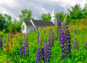
Photograph Lupines in Sugar Hill
Every year, more or less around the second week of June, the village of Sugar Hill boasts a magnificent show of lupines. There are several concentrations of lupines in fields along the road, but the highlight of a visit to Sugar Hill is the small hillside near St. Matthew's Church. The vistas tow...Read more -
Lincoln, New Hampshire
Osceola Mountain via Greeley Pond
4.06.8 mi / 2677 ft gainStart out at the Greeley Pond trailhead off of the Kancamagus Highway. After 1.3 miles the trail splits--bear right to get onto the Mt. Osceola Trail. Continue 1.5 miles to the summit. This summit hike offers a different kind of reward. Views are limited from the peak of Mt. Osceoloa, which allow...Read more -
Albany, New Hampshire
Rocky Gorge Scenic Area Loop
2 mi / 266 ft gainA beautiful area of the Kancamagus Highway, the Rocky Gorge section is home to rushing rapids and scenic lakes. When visiting in the fall the colors are amazing however be ready for traffic and more crowds. This location has a parking lot and walking trails along the river to multiple viewpoints.Read more -
Newry, Maine
Photograph Screw Auger Falls
4.00.2 mi / 6 ft gainAfter parking in the allotted parking area at screw auger, make your way down to the falls to explore! There are several "smaller waterfalls" that the river flows over before making its way to the 27 foot main attraction. Going in April, the falls were at their most powerful. It made taking pictu...Read more -
Lincoln, New Hampshire
Hike the Flume Gorge
4.82 mi / 300 ft gainThe Flume Gorge in Franconia State Park is beautiful year round and every season has it's unique benefits. During the summer, the Flume is a highly frequented tourist destination and is usually crowded with groups of kids and families. Technically, the Gorge is closed during the winter and there ...Read more -
Lincoln, New Hampshire
Bike Franconia Notch Bike Path
9 miFor the point to point option first drop a car off at one end of the trail then return to the other. The south end is located at the Flume Gorge Parking lot and the north end is at a parking lot located about a half mile off Route 93, Exit 35 which takes you onto route 3 (44°12'11.3"N 71°40'51.7...Read more -
Waterville Valley, New Hampshire
Sabbaday Falls
4.70.7 mi / 171 ft gainThis awesome waterfall is located right off of the Kancamagus Highway (rt 112) that runs from Lincoln to North Conway, NH. The highway itself is a very scenic drive through the White Mountains that has pull off spots every couple of miles. From I93 take exit 32 for Lincoln. Drive straight throug...Read more -
Albany, New Hampshire
Champney Falls - Bolles Chocura Loop
5.09.18 mi / 2904 ft gainChampney Falls - Bolles Chocura Loop is a loop trail that takes you by a waterfall located near Lincoln, New Hampshire.Read more -
Lincoln, New Hampshire
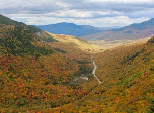
Photograph Fall Foliage on the Kancamagus Highway
4.032 mi / 2855 ft gainDriving the Kancamagus Highway is something you can do as a way to cross the White Mountain National Forest quickly from I-93 in the east to Conway, or it can be an entire day's activity. In the fall, it's almost impossible not to stop at every turn-off on the scenic highway as it winds through t...Read more -
Conway, New Hampshire
Drive the Kancamagus Highway
4.834.5 miThe Kancamagus Highway is designated an American Scenic Byway. It cuts through the White Mountains of New Hampshire. The highest point along the drive is 3000 feet. It is known as one of the best fall viewing areas in the country. If your interested there is also several campgrounds along thi...Read more

