Benton, New Hampshire
Top Spots in and near Benton
-
Randolph, New Hampshire
Summit Mount Jefferson, Mount Clay, and Mount Washington
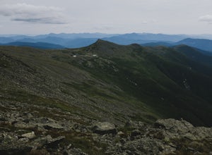
4.010.5 mi / 4455 ft gainHike with at least one other and take two cars. First drop one car at the Cog Railway parking lot (Base Station Rd, Bretton Woods, NH). Jump into the second car and drive about 15 minutes to the Caps Ridge Trailhead on Jefferson Notch Road ( N 44° 18' 15"W 71° 21' 42" )The Caps Ridge Trail will l...Read more -
Randolph, New Hampshire
Hike Mount Jefferson
5 mi / 2700 ft gainMount Jefferson stands at 5712 feet, the third tallest mountain of the Presidential's in the White Mountain National Forest. The trail head begins at the Caps Ridge Trail on Jefferson Notch Rd. While 2.5 miles sounds easy, this hike is not for the once in while day hiker. Challenging rock scrambl...Read more -
Jefferson, New Hampshire
Summit Mount Waumbek via the Starr King Trail
5.07.2 mi / 1500 ft gainThe hike starts out at the Starr King trailhead because you will summit Starr King Mountain (3,907 ft - so close to being a 4000 footer!) before moving on to Waumbek. The 2.6 miles that it takes to get to the first summit are gradual and forgiving. The majority of the total elevation is completed...Read more -
Albany, New Hampshire
Champney Falls - Bolles Chocura Loop
5.09.18 mi / 2904 ft gainChampney Falls - Bolles Chocura Loop is a loop trail that takes you by a waterfall located near Lincoln, New Hampshire.Read more -
Alexandria, New Hampshire
High Cabin
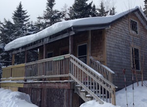
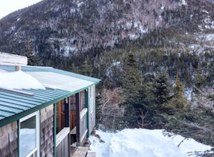
5.04 mi / 1275 ft gainHigh Cabin, located in Cardigan State Forest, is owned and operated by the Appalachian Mountian Club (AMC). It was originally built in 1931 and since renovated in 2004. Renovations included a new roof, siding, bunk beds, a wood stove, and a composting toilet. It comes supplied with wood, bunks(st...Read more -
Albany, New Hampshire
Rocky Gorge Scenic Area Loop
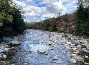
2 mi / 266 ft gainA beautiful area of the Kancamagus Highway, the Rocky Gorge section is home to rushing rapids and scenic lakes. When visiting in the fall the colors are amazing however be ready for traffic and more crowds. This location has a parking lot and walking trails along the river to multiple viewpoints.Read more -
Orange, New Hampshire
Hike Cardigan Mountain via the West Ridge Trail
4.73 mi / 1200 ft gainCardigan Mountain is located in Cardigan Mountain State forest just outside of Canaan, New Hampshire. Just make sure to go to The Cardigan Mountain state park parking lot, via Cardigan Mountain Road and not the AMC Cardigan Lodge. The trail begins right from the parking lot where there is a port...Read more -
Jackson, New Hampshire
Lake of the Clouds from Mount Washington Summit via Crawford Path
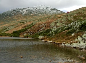
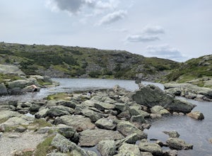
5.02.81 mi / 1224 ft gainLake of the Clouds from Mount Washington Summit via Crawford Path is an out-and-back trail that provides a good opportunity to view wildlife located near Randolph, New Hampshire.Read more -
Bristol, New Hampshire
Drive around Newfound Lake
As a kid, I spent many of my summer and winter vacations on Newfound Lake in New Hampshire and can say without a doubt that it is one of the first places to spark my love for the outdoors. If your'e heading up to the White Mountains in the winter time to ski/snowboard, a drive around Newfound Lak...Read more -
Jackson, New Hampshire
Hike Tuckerman's Ravine Trail on Mt. Washington
4.99 miWhile this trail is open year round with winter hiking/skiing down the ravine walls, this entry will focus on hiking in the warmer months.Your hike starts behind the Pinkham Notch AMC Center in Jackson, NH at an elevation of approximately 2050 ft. There is plenty of parking at the visitors cente...Read more -
Jackson, New Hampshire
Winter Ascent of Mt. Washington Via Lion Head Trail
8 mi / 4200 ft gainPark at the Pinkham Notch visitor center off of Route 16, your stopping point for all things Tuckerman’s Ravine and Mt. Washington related. The ranger station is open year round and there is food and up to date weather conditions from the summit. There is also a locker room with showers available...Read more -
Randolph, New Hampshire
Madison Spring Hut to Lake of the Clouds Hut via Gulfside Trail
5.06.76 mi / 2441 ft gainMadison Spring Hut to Lake of the Clouds Hut via Gulfside Trail is a point-to-point trail that provides a good opportunity to view wildlife located near Randolph, New Hampshire.Read more -
Randolph, New Hampshire
Hike the Northern Presidentials
15.6 miThe Presidential Range is a mountain range located in the White Mountains of New Hampshire. They contain the highest peaks of the Whites and are named after Presidents of the U.S. I also want to add that this range is known for having some of the worst weather in America, mainly because of the un...Read more -
Jackson, New Hampshire
Drive Mt. Washington Auto Road
3.0Starting at roughly 3,000ft above sea level the Mt. Washington Auto Road will take you up nearly eight miles of beautiful, scenic, and well maintained mountain auto roads to The Mount Washington Summit. The summit sits at 6,289 and offers stunning 360° views of New Hampshire's Presidential Range,...Read more -
Gorham, New Hampshire
Snowshoe to Carter Notch Hut
7.8 mi / 2200 ft gainThe nineteen mile brook trail is a winding path up approximately 2200 feet of elevation over the course of 3.9 miles. That distance feels a lot farther when you are breaking trail in 18-24 inches of snow and you are carrying 35 lb packs on your backs. Luckily we started out early and we able to ...Read more -
Bartlett, New Hampshire
Hike Cathedral Ledge
4.03.4 mi / 722 ft gainDuring spring, summer and fall there is a road that allows you to drive to the top of Cathedral Ledge. In winter the road is closed off to vehicles so reaching the top requires a 1.7 mile hike. Once at the top, there is a fenced in lookout with a 180 degree view of North Conway and the surroundin...Read more

