Whitefish, Montana
Ski and mountain-bike trails wind downhill at Whitefish Mountain Resort, just outside town. Or use the town as a jumping-off point for more adventures in nearby Glacier National Park and more.
Top Spots in and near Whitefish
-
West Glacier, Montana
Explore Avalanche Creek
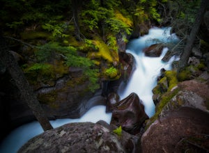
5.00.7 miAvalanche Creek is one of Glacier National Park's easiest features to access and also one of its most unique. The old-growth cedar forest is home to towering trees, moss-covered boulders, and a rushing stream of glacial water. A small loop trail winds through the lower forest and leads to a bri...Read more -
West Glacier, Montana
Trail of the Cedars
5.00.88 mi / 121 ft gainTrail of the Cedars Trail is a loop trail that takes you by a river located near Lake Mc Donald, Montana.Read more -
West Glacier, Montana
Avalanche Lake via Trail of Cedars
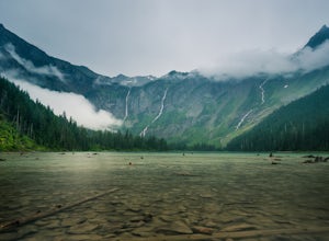
4.95.91 mi / 730 ft gainThis very scenic Glacier National Park hike off of Going-to-the-Sun road is 4.5 miles with a total elevation gain of 730 feet. The hike to Avalanche Lake begins from the Trail of the Cedars trailhead. Be prepared for a lot of incline. Approximately one half mile from the trailhead you’ll reach...Read more -
Bigfork, Montana
Swim in Graves Bay Swimming Hole
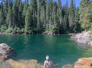
To get to this swimming hole you drive south from Hungry Horse on the West Side Road (Forest Road 895) 33.6 miles to the Graves Creek Campground. Park in the small parking lot with the bear box and outhouse, opposite the campground closer to the lake. Follow the path as it leads you past the casc...Read more -
Bigfork, Montana
Explore Graves Creek Falls
Graves Creek Falls are a series of pleasant waterfalls viewable without much effort. To get here From Hungry Horse drive south on the West Side Road (Forest Road 895) 33.6 miles to the Graves Creek Campground. From here turn right into the campground, park and take a short walk of a couple hundre...Read more -
Essex, Montana
Hike to Dickey Lake
5.2 mi / 1463 ft gain*Parking for this hike is very limited, as the parking area can hold one, maybe two, vehicles. This 5.2 mile roundtrip hike begins near Essex, Montana, at 4,620 feet of elevation, and leads to a small, hidden lake nestled in the Great Bear Wilderness. Immediately after leaving the parking area, ...Read more -
Flathead County, Montana
Camp Out at the Hornet Lookout
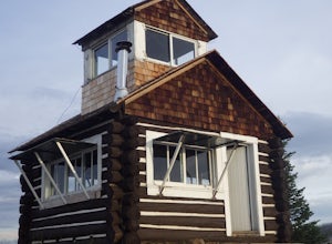
1 mi / 800 ft gainReservations for Hornet Lookout are obtained via Recreation.gov, and can be made up to six months in advance. Consider a four-wheel or all-wheel drive vehicle with some clearance if available, as the forest service roads aren't always well maintained. Although the hike is short, it is all switc...Read more -
West Glacier, Montana
Bike Glacier's Going to the Sun Road
5.016 mi / 2460 ft gainBike up the road towards Logan Pass. Make sure to stay alert for traffic coming up and down the road. Helmets and flashing red, rear lights are required when biking at night in Glacier National Park. A forward facing light is also recommended to see gravel and other obstacles. Make sure to keep e...Read more -
West Glacier, Montana
Waterton Lakes via Packers Roost
5.022.15 mi / 4596 ft gainDay 1: This gorgeous backpacking adventure begins at the Packer's Roost trailhead, which is almost halfway between West and East Glacier on the Going-to-the-Sun Road. This trailhead is marked on the highway before you get to the "Loop." It's a quick left turn so keep your eyes peeled as you pass ...Read more -
Browning, Montana
Photography on Logan Pass
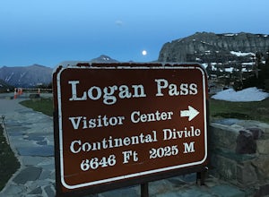
5.0Disclaimer: Glacier National Park has closed any off-trail activity in this area. The majority of the photos can be taken on-trail. Please be sure to adhere to the park's policy.With a short window of opportunity for visiting, Logan Pass offers a wealth of photographic options. As the winter sno...Read more -
Browning, Montana
Hidden Lake Overlook
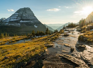
5.02.83 miThe trail starts at the Logan Pass Visitor Center, which is right in the middle of Going-To-The-Sun Road. It can be very busy during the middle of the day, but early morning and early evening will have less of a crowd. It's a pretty short hike in a beautiful wide open alpine meadow. We were gree...Read more -
Browning, Montana
Hike Dragon's Tail Ridge
3.53 mi / 1800 ft gainStarting from Logan's Pass, make your way along the boardwalk that leads to the Hidden Lake Overlook. Depending on the previous winter, there may be quite a bit of snow covering large portions of the boardwalk and trail that leads to Dragon's Tail, so it is suggested that you take any necessary p...Read more -
48.696704,-113.718345
Grinnell Glacier Overlook via Highline Trail
4.015.23 mi / 1000 ft gainThere are two ways to get to this trail. Preferred route: Start the Highline Trail at Logan Pass. Hike 7.5 miles on a pleasantly gradual trail to get to the overlook trail. Alternate route: You can instead start at The Loop (shuttle stop), hike up to the Granite Park Chalet, and then hike an addi...Read more -
West Glacier, Montana
Highline Trail
5.015.01 mi / 700 ft gainStarting at the top of Logan Pass at the visitor's center, walk across the street to the well marked Highline Loop Trailhead. This is written as an out-and-back hike, where you will simply hike back to where you started from. However, if you'd like to catch a ride back to the trailhead, check out...Read more -
West Glacier, Montana
Granite Park Chalet via Highline Trail
4.511.49 mi / 1950 ft gainThe trailhead for the Highline Trail is located near the west side of Logan's Pass. Parking is limited at the Pass so arriving early to guarantee a spot, or taking a park shuttle (no fee) is suggested. The shuttles run consistently during the day at different locations throughout the Park. Howeve...Read more -
Browning, Montana
Reynolds Mountain
4.511 mi / 2500 ft gainReynolds Mountain stands high above the Logan Pass Visitors Center. Because of it's easy location, be prepared to get caught in the heavy rush of tourists on the way up. Though most will not be going to Reynolds Mountain, you will still need to "wade" through heavy tourism to reach the trail he...Read more

