Roscoe, Montana
Top Spots in and near Roscoe
-
Yellowstone National Park, Wyoming
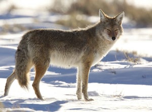
Photograph Wildlife in Lamar Valley
5.0This adventure is a little harder to pinpoint on a map because the Lamar Valley of Yellowstone encompasses a large area of the park. Also, the premier wildlife photography can be found on either end of what is officially "Lamar Valley" so you want to pay attention for a good part of the drive. Yo...Read more -
Yellowstone National Park, Wyoming
Backpack to Slough Creek's Backcountry Campsites
20.49 mi / 1286 ft gainAccess to Slough Creek is via the Slough Creek Road that starts 6 miles east on the Northeast Entrance Road from Tower Junction. It is 2.5 miles to the Slough Creek Campground located at the end of the road. Starting at the Slough Creek Trailhead you will find a small parking area and a restroom...Read more -
Yellowstone National Park, Wyoming
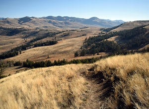
Lamar Valley Outlook near Specimen Ridge
5.03.61 mi / 1699 ft gainThe parking area for this hike is .3 miles west of the bridge crossing the Lamar River on the NE Entrance Road. The parking area is on the east side of the road. The trail isn't well marked but is clear and pretty easy to follow. The trail starts off on a flat stretch of valley. Follow the trail ...Read more -
Yellowstone National Park, Wyoming
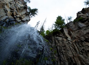
Hike to Lost Creek Falls, Yellowstone NP
1 mi / 200 ft gainThis 1 mile hike begins behind the Roosevelt Lodge in the Tower-Roosevelt area of Yellowstone. There is plenty of parking in the area. After you park your car start heading behind the gift shop. Once you find the trail, hike about a tenth of a mile to a bulletin board. The trail here splits in tw...Read more -
Livingston, Montana
Summit Arrow Peak
2.4 mi / 3600 ft gainStarting in Livingston, MT, take Hwy 89 for 16 miles and take a left on Mill Creek Road. A junction with Road 540 will be reached. At this junction, continue on Mill Creek Road for another 8 miles until a large rock gully on the left is present and a wooden fence is on the right. The route is not...Read more

