Kalispell, Montana
Looking for the best hiking in Kalispell? We've got you covered with the top trails, trips, hiking, backpacking, camping and more around Kalispell. The detailed guides, photos, and reviews are all submitted by the Outbound community.
Top Hiking Spots in and near Kalispell
-
West Glacier, Montana
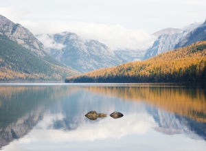
Bowman Lake to Quartz Lake Loop
5.013.3 mi / 2618 ft gainThe trail to Quartz lake begins on southend of the Bowman Lake beach. I recommend going in a clockwise direction and getting the steep bit out of the way, but the ~13 mile loop can be done either way. Follow the Bowman Lake shore on the West Lakes Trail for about half a mile and then you will fi...Read more -
Browning, Montana
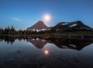
Hidden Lake Overlook
5.02.83 miThe trail starts at the Logan Pass Visitor Center, which is right in the middle of Going-To-The-Sun Road. It can be very busy during the middle of the day, but early morning and early evening will have less of a crowd. It's a pretty short hike in a beautiful wide open alpine meadow. We were gree...Read more -
Browning, Montana
Hike Dragon's Tail Ridge
3.53 mi / 1800 ft gainStarting from Logan's Pass, make your way along the boardwalk that leads to the Hidden Lake Overlook. Depending on the previous winter, there may be quite a bit of snow covering large portions of the boardwalk and trail that leads to Dragon's Tail, so it is suggested that you take any necessary p...Read more -
Browning, Montana
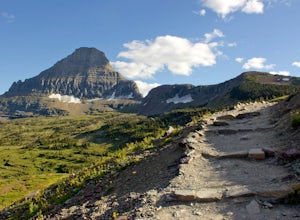
Reynolds Mountain
4.511 mi / 2500 ft gainReynolds Mountain stands high above the Logan Pass Visitors Center. Because of it's easy location, be prepared to get caught in the heavy rush of tourists on the way up. Though most will not be going to Reynolds Mountain, you will still need to "wade" through heavy tourism to reach the trail he...Read more -
Browning, Montana
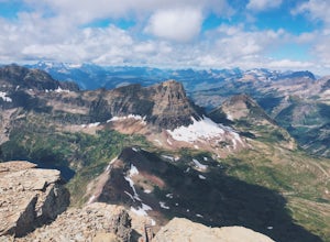
Summit Reynolds Mountain via the North Face Ascent Route
7.9 mi / 2500 ft gainMt. Reynolds is a premier peak in Glacier National Park (GNP). The views from the beginning to the summit are incredible all the way around. Reynolds offers those who are starting to climb an introductory climb with little technicality and a reward that is well earned at the top. GNP requires an ...Read more -
48.696704,-113.718345
Grinnell Glacier Overlook via Highline Trail
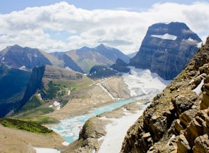
4.015.23 mi / 1000 ft gainThere are two ways to get to this trail. Preferred route: Start the Highline Trail at Logan Pass. Hike 7.5 miles on a pleasantly gradual trail to get to the overlook trail. Alternate route: You can instead start at The Loop (shuttle stop), hike up to the Granite Park Chalet, and then hike an addi...Read more -
Browning, Montana
The Garden Wall
15.16 mi / 3944 ft gainThe Garden Wall Trail is an out-and-back trail where you may see beautiful wildflowers located near West Glacier, Montana.Read more -
West Glacier, Montana
Highline Trail
5.015.01 mi / 700 ft gainStarting at the top of Logan Pass at the visitor's center, walk across the street to the well marked Highline Loop Trailhead. This is written as an out-and-back hike, where you will simply hike back to where you started from. However, if you'd like to catch a ride back to the trailhead, check out...Read more -
West Glacier, Montana
Granite Park Chalet via Highline Trail
4.511.49 mi / 1950 ft gainThe trailhead for the Highline Trail is located near the west side of Logan's Pass. Parking is limited at the Pass so arriving early to guarantee a spot, or taking a park shuttle (no fee) is suggested. The shuttles run consistently during the day at different locations throughout the Park. Howeve...Read more -
Browning, Montana
Piegan Mountain
5.05 mi / 3000 ft gainStart this hike at the Lunch Creek parking lot just over Logan Pass. Follow the climber's trail which will lead you above a waterfall and into Lunch Creek Basin. Looking straight ahead, you will see Pollock Mountain. Continue to your right for the peak approach (if you go all the way to the right...Read more -
Browning, Montana
Climb Pollock Mountain and Bishop's Cap
8 mi / 4300 ft gainStarting at Logan Pass, drive 0.8 mi. east to Lunch Creek parking area. Parking during the summer at Glacier National Park is often difficult. Plan on arriving at the parking lot before 8 am to guarantee a parking spot. From Lunch Creek, follow the well established trail north until cliffs are re...Read more -
Browning, Montana
Gunsight Pass to Gunsight Lake Campsite
5.013.06 mi / 1667 ft gainHow to Get There: Get your backcountry pass at the St. Mary visitor center and then head over to the hike, which begins from the Jackson Glacier Overlook, located 12.6 miles west of the center on the Going-to-Sun-Road. The Hike: The first mile of the hike is a downhill, and then the trail is ...Read more -
West Glacier, Montana
Waterton Lakes via Packers Roost
5.022.15 mi / 4596 ft gainDay 1: This gorgeous backpacking adventure begins at the Packer's Roost trailhead, which is almost halfway between West and East Glacier on the Going-to-the-Sun Road. This trailhead is marked on the highway before you get to the "Loop." It's a quick left turn so keep your eyes peeled as you pass ...Read more -
Browning, Montana
Hike Mount Siyeh
5.08.45 mi / 4209 ft gainOnce the Going-To-The-Sun Road has opened fully, this massive peak is accessible by driving to Siyeh Bend on the east side of the Logan Pass Visitors Center. Plan on a sun up to sun down adventure. Choose a sunny summer day and head up to hit the trail! Park at Siyeh Bend, and start on the Pie...Read more -
Rising Sun, Montana
Baring Falls via Piegan Pass Trail
1.96 mi / 246 ft gainBaring Falls via Piegan Pass Trail is an out-and-back trail to a waterfall located near the southern end of St. Mary Lake in East Glacier Park Village, Montana.Read more -
Browning, Montana
Baring, St. Mary, and Virginia Falls in Glacier NP
4.75.43 mi / 500 ft gainThis 5.4 mile out-and-back hike will take you to Baring, St. Mary, and Virginia Falls. Start your hike at the Sunrift Gorge parking area. Hike down the stairs on the south side of the road. Here you’ll see the trailhead for Baring Falls. Descend until you reach the Baring Falls/Sun Point junc...Read more

