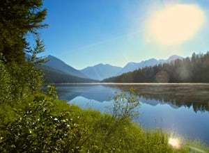
Flathead National Forest, Montana
Looking for the best hiking in Flathead National Forest? We've got you covered with the top trails, trips, hiking, backpacking, camping and more around Flathead National Forest. The detailed guides, photos, and reviews are all submitted by the Outbound community.
Top Hiking Spots in and near Flathead National Forest
-
West Glacier, Montana
Highline Trail
5.015.01 mi / 700 ft gainStarting at the top of Logan Pass at the visitor's center, walk across the street to the well marked Highline Loop Trailhead. This is written as an out-and-back hike, where you will simply hike back to where you started from. However, if you'd like to catch a ride back to the trailhead, check out...Read more -
West Glacier, Montana
Granite Park Chalet via Highline Trail
4.511.49 mi / 1950 ft gainThe trailhead for the Highline Trail is located near the west side of Logan's Pass. Parking is limited at the Pass so arriving early to guarantee a spot, or taking a park shuttle (no fee) is suggested. The shuttles run consistently during the day at different locations throughout the Park. Howeve...Read more -
48.696704,-113.718345
Grinnell Glacier Overlook via Highline Trail
4.015.23 mi / 1000 ft gainThere are two ways to get to this trail. Preferred route: Start the Highline Trail at Logan Pass. Hike 7.5 miles on a pleasantly gradual trail to get to the overlook trail. Alternate route: You can instead start at The Loop (shuttle stop), hike up to the Granite Park Chalet, and then hike an addi...Read more -
Flathead County, Montana
Hike Demer's Ridge
7.47 mi / 3420 ft gainThis trail is a point to point, so two cars are necessary. The ending point is where Camas Rd intersects the North Fork Road at the Blankenship Bridge. The starting point for the hike is at Demer's Pit. Driving 22 miles from Columbia Falls, MT, make your way to the parking spot, Demer's Pit. From...Read more -
Browning, Montana
Climb Pollock Mountain and Bishop's Cap
8 mi / 4300 ft gainStarting at Logan Pass, drive 0.8 mi. east to Lunch Creek parking area. Parking during the summer at Glacier National Park is often difficult. Plan on arriving at the parking lot before 8 am to guarantee a parking spot. From Lunch Creek, follow the well established trail north until cliffs are re...Read more -
Browning, Montana
Hike Mount Siyeh
5.08.45 mi / 4209 ft gainOnce the Going-To-The-Sun Road has opened fully, this massive peak is accessible by driving to Siyeh Bend on the east side of the Logan Pass Visitors Center. Plan on a sun up to sun down adventure. Choose a sunny summer day and head up to hit the trail! Park at Siyeh Bend, and start on the Pie...Read more -
Choteau, Montana
Hike Jones Creek
5.04 mi / 300 ft gainThe trail head to Jones Creeks is just off of Teton River Road (the road that takes you up to Teton Pass Ski Area) and is marked with a sign, however it's only visible when you're coming down from Teton Pass. If you miss the sign, keep in mind it's about two miles past the Cave Mountain Forest Se...Read more -
West Glacier, Montana
Waterton Lakes via Packers Roost
5.022.15 mi / 4596 ft gainDay 1: This gorgeous backpacking adventure begins at the Packer's Roost trailhead, which is almost halfway between West and East Glacier on the Going-to-the-Sun Road. This trailhead is marked on the highway before you get to the "Loop." It's a quick left turn so keep your eyes peeled as you pass ...Read more -
West Glacier, Montana
Backpack to Logging Lake
8.8 miBackcountry camping is the best plan if you’d like to visit Logging Lake, and the primitive campsites lay at the end of a four and a half mile hike through some of the most unspoiled sections of the park. The trail follows logging creek most of the way to the lake traversing through a variety of ...Read more

