East Glacier Park Village, Montana
Looking for the best hiking in East Glacier Park Village? We've got you covered with the top trails, trips, hiking, backpacking, camping and more around East Glacier Park Village. The detailed guides, photos, and reviews are all submitted by the Outbound community.
Top Hiking Spots in and near East Glacier Park Village
-
West Glacier, Montana
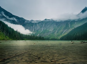
Avalanche Lake via Trail of Cedars
4.95.91 mi / 730 ft gainThis very scenic Glacier National Park hike off of Going-to-the-Sun road is 4.5 miles with a total elevation gain of 730 feet. The hike to Avalanche Lake begins from the Trail of the Cedars trailhead. Be prepared for a lot of incline. Approximately one half mile from the trailhead you’ll reach...Read more -
West Glacier, Montana
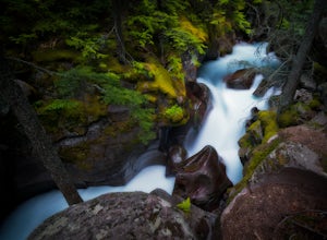
Explore Avalanche Creek
5.00.7 miAvalanche Creek is one of Glacier National Park's easiest features to access and also one of its most unique. The old-growth cedar forest is home to towering trees, moss-covered boulders, and a rushing stream of glacial water. A small loop trail winds through the lower forest and leads to a bri...Read more -
Browning, Montana
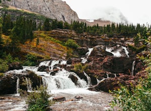
Redrock Falls
4.53.73 mi / 100 ft gainThe hike to Redrock Falls begins at the Swiftcurrent Pass Trailhead in the Many Glacier area of Glacier National Park. The trailhead is located at the western end of the Swiftcurrent Motor Inn parking lot. From the trailhead, head straight toward Swiftcurrent Pass and Redrock Falls. At approxi...Read more -
West Glacier, Montana
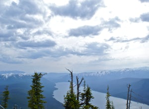
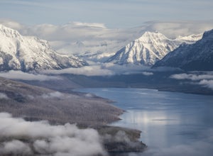
Hike to the Mt. Brown Lookout
5.0The trail is accessible (though sometimes covered in snow) year-round because the trailhead lies in the lower elevation area of the park. It begins at the Sperry Trailhead, located directly across the street from the lake McDonald Lodge. Follow the Sperry Trail for 1.6 miles until you reach the M...Read more -
Browning, Montana
Swiftcurrent Lookout
16.68 mi / 4491 ft gainTake this beautiful hike up Swiftcurrent Mountain to the Fire Lookout (8436 ft). The hike is 7.1 miles one-way from from the Swiftcurrent Inn parking lot trailhead. The elevation gain is 2,307 feet. The First 3 miles or so are a flat hike where you'll pass by several famous lakes and gain only ...Read more -
Browning, Montana
Ptarmigan Tunnel
5.010.68 mi / 2713 ft gainThis amazing 11 mile hike with 2,300 feet of vertial gain begins behind the Swiftcurrent Motor Inn cabins. If you start early enough you can park by the trailhead, but if you get a little later start you may need to park in the main lot of the Motor Inn. As you begin your hike, you will pass the...Read more -
Swiftcurrent, Montana
Glacier's North Circle Route (North East Section)
9.7 miPlanning & Preparations As amazing as this trek is, it's certainly not without its challenges, and the first one you will run into is obtaining a backcountry permit for camping. As it absolutely should, backcountry camping is very regulated. Essentially, you request permits and multiple da...Read more -
Browning, Montana
Iceberg Lake
4.99.7 mi / 1200 ft gainThe 9.7-mile out-and-back trail starts in the Many Glacier area of Glacier National Park, near the Swiftcurrent Motor Inn. The trailhead is easy to find at the northwest corner of the Inn area and the trail is well marked the whole way. The trail heads northwest almost the entire time except for ...Read more -
Glacier County, Montana
Ptarmigan Falls
5.05.11 mi / 768 ft gain...The hike to Ptarmigan Falls begins next to the cabins near the Swiftcurrent Motor Inn. There’s enough parking for about 10-16 vehicles in the lot next to the trailhead. This is a heavily trafficked area, so extra parking is available in front of the Swiftcurrent Motor Inn. This is where I park...Read more -
Glacier County, Montana
Ptarmigan Lake Trail
8.78 miPtarmigan Lake Trail is an 8.6 mile out and back hike that takes you by a waterfall located near Babb, Montana in Glacier National Park.Read more -
West Glacier, Montana
Backpack to Lincoln Lake
16.75 mi / 3747 ft gainIt's a 1600 ft slow increase in elevation. You can walk around the loose rocks going around the lake for an additional 2 miles of hiking. There is a back-country campground at the base of the glacier-fed lake and an amazing waterfall at the opposite end of the of the campground. To camp overnig...Read more -
West Glacier, Montana
Waterton Lakes via Packers Roost
5.022.15 mi / 4596 ft gainDay 1: This gorgeous backpacking adventure begins at the Packer's Roost trailhead, which is almost halfway between West and East Glacier on the Going-to-the-Sun Road. This trailhead is marked on the highway before you get to the "Loop." It's a quick left turn so keep your eyes peeled as you pass ...Read more -
Bigfork, Montana
Explore Graves Creek Falls
Graves Creek Falls are a series of pleasant waterfalls viewable without much effort. To get here From Hungry Horse drive south on the West Side Road (Forest Road 895) 33.6 miles to the Graves Creek Campground. From here turn right into the campground, park and take a short walk of a couple hundre...Read more -
Hungry Horse, Montana
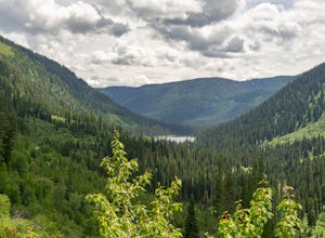
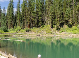
Hike to the Blue Lakes
2 mi / 100 ft gainThe drive out to the trailhead where this hike starts is an adventure in and of itself. As the Forest Service website describes it. "Silvertip Trailhead is accessed from Highway 2. From the town of Hungry Horse, drive east on Highway 2 for ½ mile to the East Side Reservoir Road #38. Turn right (s...Read more -
Columbia Falls, Montana
Hike to Apgar Lookout
4.57 mi / 1850 ft gainPrecursor: I completed this hike in November, hence the snow in the photos. Due to a lack of tree coverage, this hike is best suited for a cool summer day, or in the late spring and early autumn. It is doable in the heat of the summer, but be sure to pack plenty of water. This hike begins by tre...Read more -
Martin City, Montana
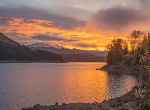
Drive around Hungry Horse Reservoir
About 100 miles of mostly gravel roads (14 miles of pavement) will take you around this beautiful reservoir. With that many miles of road and the shoreline to go with it, it is obvious that there is plenty to see and do in the Hungry Horse area. Check out some of my other adventures for ideas of...Read more

