Coram, Montana
Looking for the best hiking in Coram? We've got you covered with the top trails, trips, hiking, backpacking, camping and more around Coram. The detailed guides, photos, and reviews are all submitted by the Outbound community.
Top Hiking Spots in and near Coram
-
Browning, Montana
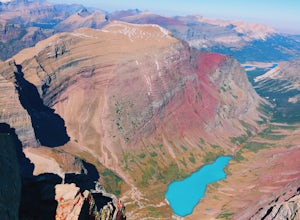
Hike Mount Siyeh
5.08.45 mi / 4209 ft gainOnce the Going-To-The-Sun Road has opened fully, this massive peak is accessible by driving to Siyeh Bend on the east side of the Logan Pass Visitors Center. Plan on a sun up to sun down adventure. Choose a sunny summer day and head up to hit the trail! Park at Siyeh Bend, and start on the Pie...Read more -
Browning, Montana
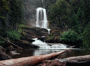
Baring, St. Mary, and Virginia Falls in Glacier NP
4.75.43 mi / 500 ft gainThis 5.4 mile out-and-back hike will take you to Baring, St. Mary, and Virginia Falls. Start your hike at the Sunrift Gorge parking area. Hike down the stairs on the south side of the road. Here you’ll see the trailhead for Baring Falls. Descend until you reach the Baring Falls/Sun Point junc...Read more -
Browning, Montana
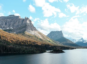
Hike to Sun Point
5.01.6 mi / 250 ft gainWith panoramic views of St. Mary Lake and it’s surrounding peaks, Sun Point is the perfect spot to chill/relax in Glacier National Park. It can be reached via the Sun Point Nature Trail or the Sun Point picnic area.To reach Sun Point via the nature trail, start at Sunrift Gorge parking area. Cl...Read more -
Kalispell, Montana
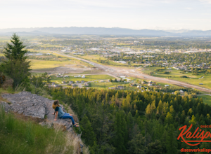
Western Larch and Cliff Trail Loop
2.77 mi / 656 ft gainWestern Larch and Cliff Trail Loop is a loop trail that takes you through a nice forest located near Kalispell, Montana.Read more -
West Glacier, Montana
Backpack to Logging Lake
8.8 miBackcountry camping is the best plan if you’d like to visit Logging Lake, and the primitive campsites lay at the end of a four and a half mile hike through some of the most unspoiled sections of the park. The trail follows logging creek most of the way to the lake traversing through a variety of ...Read more -
West Glacier, Montana
Waterton Lakes via Packers Roost
5.022.15 mi / 4596 ft gainDay 1: This gorgeous backpacking adventure begins at the Packer's Roost trailhead, which is almost halfway between West and East Glacier on the Going-to-the-Sun Road. This trailhead is marked on the highway before you get to the "Loop." It's a quick left turn so keep your eyes peeled as you pass ...Read more -
Glacier County, Montana
Explore Two Medicine Lake
5.0Two Medicine Lake sits in the southeastern part of Glacier NP away from the more popular Going-to-the-Sun Road. The 2-mile long lake has a 100 site campground that serves visitors on a first-come-first-serve basis; the campground opens mid-April and closes in November. From the main parking area...Read more -
Glacier County, Montana
Hike to Two Medicine Pass
7.9 mi / 2350 ft gainStarting at the South Shore trailhead on Two Medicine Lake (parking available), you'll follow the lake through alternating forest and meadows and eventually cross a small suspension bridge. Afterwards the trail forks. Take the "Two Medicine Pass" trail on the left rather than the Twin Falls/Upp...Read more -
East Glacier Park, Montana
Dawson Pass
5.012.01 mi / 2450 ft gainThis is a somewhat strenuous but extremely rewarding hike in Glacier National Park. It is much less crowded than the more popular Logan Pass and High Line trails, and in my opinion, more rewarding. Dawson Pass is on the Continental Divide at an elevation of 7,598 feet. It sits between Mt. Helen ...Read more -
Glacier County, Montana
Pitamakan Pass
15.36 mi / 3064 ft gainThis gripping, 16 mile round trail reveals adventure at every turn. Nestled behind Pray Lake in Glacier National Park, the Pitamakan Pass hike will begin at the North Shore Trailhead. To access this trailhead, a fifteen dollar fee may be payed to cross Pray Lake by boat. If your pocket book is ru...Read more -
Glacier County, Montana
Upper Two Medicine Lake
9.67 mi / 719 ft gainI did this trip during the end of autumn, and was pretty much the only person on the entire lake. With it being so serene and so quiet, I had the perfect nature getaway. I made sure to watch an epic sunrise on Two Medicine Lake, then spend the day taking my time to the upper lake and back, with a...Read more -
Glacier County, Montana
Hike to Scenic Point in Glacier National Park
5.07.74 mi / 2205 ft gainPark at the trailhead and begin the hike. The trail starts out relatively flat until you reach a small waterfall. Then, hike up the switchbacks for about 4 miles while gaining around 2300 feet. From the top, you can see both Upper Two Medicine Lake and Two Medicine Lake. The views are stunning. ...Read more -
Glacier County, Montana
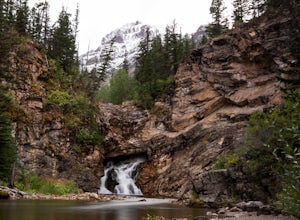
Running Eagle Falls
5.00.68 mi / 33 ft gainRunning Eagle Falls is located just 1.1 miles west from the Two Medicine entrance in Glacier National Park. The trailhead parking lot is just off the main road going to the lake– it is essentially impossible to miss. It mimics parking spots on the side of a city street. This hike is handicap ac...Read more -
Kalispell, Montana
Notch Trail, Overlook Trail, and Plum Creek Road Loop
3.85 mi / 801 ft gainNotch Trail, Overlook Trail, and Plum Creek Road Loop is a loop trail where you may see local wildlife located near Kalispell, Montana.Read more -
Glacier County, Montana
Triple Divide Pass Trail to Red Eagle Lake
29.22 mi / 5499 ft gainA couple of notes to keep in mind before you start... this is a loop that takes you to a different part of the park so you will either need two vehicles (one for the pickup spot and one to take you to the trailhead) or you will need to hitchhike back to you drop off vehicle. Also you will need to...Read more -
Browning, Montana
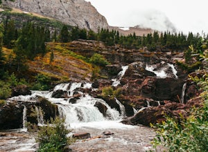
Redrock Falls
4.53.73 mi / 100 ft gainThe hike to Redrock Falls begins at the Swiftcurrent Pass Trailhead in the Many Glacier area of Glacier National Park. The trailhead is located at the western end of the Swiftcurrent Motor Inn parking lot. From the trailhead, head straight toward Swiftcurrent Pass and Redrock Falls. At approxi...Read more

