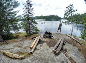
Silver Bay, Minnesota
Looking for the best chillin in Silver Bay? We've got you covered with the top trails, trips, hiking, backpacking, camping and more around Silver Bay. The detailed guides, photos, and reviews are all submitted by the Outbound community.
Top Chillin Spots in and near Silver Bay
-
Tofte, Minnesota
Hike Oberg Mountain
4.52.3 mi / 230 ft gainThe hike to the top of Oberg Mountain is short and sweet. The trail starts off with a climb of roughly 230ft in about a half of a mile before getting to the top of Oberg Mountain. At the top of the climb the trail forks, you can go either way since the trail loops around the top. I suggest you go...Read more -
La Pointe, Wisconsin
Camp on Madeline Island
5.0The largest of Wisconsin's Apostle Islands, Madeline Island is about the size of Manhattan, but extremely sparsely populated and a great place to explore a north woods ecosystem. The best way to get to the island is by ferry from Bayfield to La Pointe. From La Pointe, it is about a ten minute dri...Read more -
Grand Marais, Minnesota
Cliff Jump at Beth Lake in the BWCA
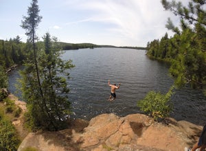
Beth Lake is part of the "Lady Chain" of lakes in the Boundary Waters Canoe Area. It's secluded, serene and worth the trip, especially if you're up for an afternoon of cliff jumping.You can reach Beth Lake in half of a day, assuming you set out in the morning and are efficient with your time. But...Read more -
Grand Marais, Minnesota
Camp at Alton Lake in the BWCA
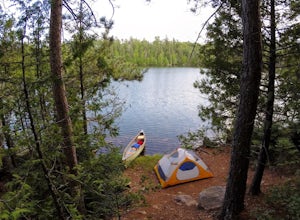
5.0A trip to the Boundary Waters Canoe Area requires some planning ahead. First, you'll need to book a permit/reservation via recreation.gov. Specify how many people are in your group, the number of watercraft you plan to use and how many days you'll be in the BWCA. You'll also need to select a grou...Read more -
La Pointe, Wisconsin
Camp at Big Bay State Park
5.0Make a reservation (fees here) to secure a campsite. Find your campsite by entering GPS coordinates 46° 47' 18" N, 90° 40' 25" W or by using this map. Take advantage of the beautiful setting you are in! Take a dip in Lake Superior or go for a trek through beautiful Wisconsin nature.Read more -
La Pointe, Wisconsin
Hike Bay View Trail, Big Bay State Park
2.6 miStarting at the parking lot, you will walk into an open field with a couple picnic tables. On the right side of the field, the trail enters into a forest and walks along Lake Superior. There are several spots along the trail that you can find to cliff jump and go for a swim. The lake is so clear ...Read more -
La Pointe, Wisconsin
Hike the Point Trail at Big Bay State Park
1.7 miLocated at the tip of Wisconsin on Madeline Island, Big Bay State Park is a must see for any Wisconsinite. To get to Madeline Island, you'll need to purchase a round trip ferry ride in Bayfield. The ferry is a quick 20 minute trip across Lake Superior. Once you get onto Madeline Island, head out ...Read more -
Ely, Minnesota
Camp on BWCA's Lake 2
A trip to the Boundary Waters Canoe Area requires some planning ahead. First, you'll need acquire a permit/reservation via recreation.gov . Specify how many people are in your group, the number of watercraft you plan to use and how many days you'll be in the BWCA. You'll also need to select a gro...Read more -
Ely, Minnesota
Explore Rifle Lake in the BWCA
The best part of Rifle Lake is how remote it is. There's no quick way to find this small, secluded lake in the Boundary Waters Canoe Area. The lake supports just one campsite and is less than a half-mile long, according to rook.org. It is also part of the Rifle/Bridge Loop, which is a good option...Read more

