New Bedford, Massachusetts
Top Spots in and near New Bedford
-
New Shoreham, Rhode Island
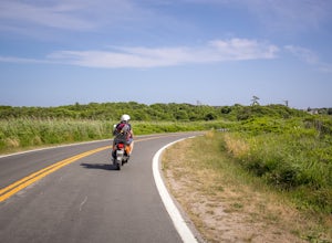
Block Island offers beautiful beaches, lighthouses, cliffs, and harbors - but what's the best way to see them all? Mopeds of course! We went through Island Moped & Bike but there are other options if you want to shop around. We chose them because they had a special rate for an afternoon/eveni...
Read more
-
Provincetown, Massachusetts
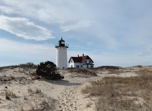
Hatches Harbor & Race Point Lighthouse trail is not super long or difficult. Pretty straight forward, at least up to Hatches Harbor.
There is a small parking lot that fits about six cars off Province Lands Rd. I think we had a good amount of rain leading up to that day and the trail reflect...
Read more
-
New Shoreham, Rhode Island
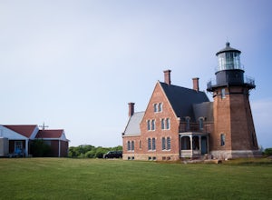
If you're visiting the Mohegan Bluffs, you should take the extra time to see the Lighthouse next to them. There's a beautiful overlook looking out onto the Atlantic and a bench to relax in the grassy hill. It's free to walk around the grounds and it's only about 2 miles from the town the ferry po...
Read more
-
New Shoreham, Rhode Island
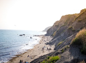
If you make the ferry ride to Block Island the bluffs are a must-see. From the town where the ferry ports, it's about two miles to get there. If you don't travel with your car you can always walk there via the road, bike ride, or rent a moped! There is no fee to use the beach and it can be access...
Read more
-
Boston, Massachusetts
Park in the Jamaica Pond parking area. You can go either direction on this loop trail, which is highly trafficked and dog-friendly. Keep a lookout for (and a respectful distance from) the wildlife that live here. The loop around Jamaica Pond itself is 1.5 miles. The best part about running in thi...
Read more
-
Wellesley, Massachusetts
Note: The campus is currently closed due to COVID-19 restrictions. This is a lake on Wellesley College Campus. It is easy to get to from just about any direction. Just park and walk toward the lake, and there are paths that will take you there. The easiest place to park (pinned on the map) is ju...
Read more
-
-
Provincetown, Massachusetts
Cape Cod, Massachusetts is full of campgrounds and dunes to explore, but the best of the two are located at the very end of the cape, around the areas of Truro and Provincetown.
Travel to the very beginning (or end, depending on how you look at it) of historic U.S. Route 6, which spans from Prov...
Read more
-
Ashland, Massachusetts
Park in the lot on State Park Road (see map) to access the trail. It's a popular trail that is dog-friendly. Pay attention to the trail as at parts it is not well marked.
Read more
-
Boston, Massachusetts
Park along the trail and then hop on. The Freedom Trail allows you to not only see the most beautiful parts of Boston (which is an absolutely gorgeous city) but you can learn some history too! Head off the trail a bit to explore the Charles River, the waterfront near the aquarium and picturesque ...
Read more
-
Provincetown, Massachusetts
Begin your journey from a small parking area that holds 3 cars just off route 6 (additionally you can park on the side of the road) The trail head is unmarked until about 50' into the woods where you will find a sign describing the rich history of the area. Continue up the large sand dune immedia...
Read more
-
Douglas, Massachusetts
Douglas State Forest is located off of Rte 16 in south central Massachusetts. To access trails and the lake, head to the parking area on Wallum Lake Park Road. From the parking lot, you can access the Coffeehouse Loop Trail, as well as a few other shorter trails by the lake. The Coffeehouse Loop ...
Read more
-
-
Cambridge, Massachusetts
The Charles River Path becomes a center of activity in Boston, especially during the summer, and you can run (or bike) it! It is a paved pathway that travels along both sides of the Charles River from the North End of the city to Allston and beyond. There are several bridges along the way with pe...
Read more

