Great Barrington, Massachusetts
Top Spots in and near Great Barrington
-
Elka Park, New York
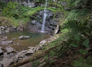
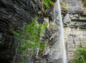
Just outside of Elka Park, New York, Plattekill Falls is accessible from Albany and New York City alike. This is a great hike for families and all skill levels. The falls are spectacular year-round, but the best time to visit is in the spring.
From the trailhead, walk left past the red house unt...
Read more
-
-
Simsbury, Connecticut
4.3
2.54 mi
/ 404 ft gain
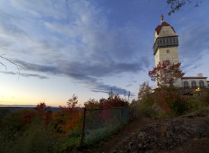
The Heublien Tower Trail, located just inside the Talcott Mountain State Park entrance off of Route 185 in Simsbury CT, is a short 1.25 miles. While the hike isn't long, the first 1/3 of a mile is a steep incline that will get your heart pumping.
The trail itself it very well kept, and although ...
Read more
-
Elka Park, New York
The DEC Parking lot, is located at the very end of a dead end, along Prediger Rd. Start at the trail head to the right of the trail kiosk and sign in sheet. The trail starts out very easy going as you approach the base of Twin. At mile 0.25, you’ll hit a junction where you’ll turn RIGHT towards T...
Read more
-
Elka Park, New York
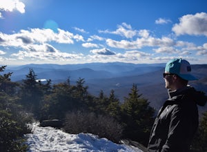
The view from the summit of this hike is incredible. Bring a sack lunch and a camera - you'll want to stay for a while! This trail is open for use year-round and provides great snowshoeing in the winter and fabulous wildflowers in the spring and summer. This is also a great location for birding!
Read more
-
Elka Park, New York
The Eastern half of Devil's Path has four major summits: Indian Head, Twin, Sugarloaf and Plateau. Each summit is a straight climb up and down, then back up to as much as 3,900 ft. There are some sparse sections of level ground, but most is a steep descent uphill or steep slide downhill. Your ...
Read more
-
Elka Park, New York
Devil's Path is roughly more than 24 miles long, althought it feels like an eternity of milage. Going thru the summits of Indian head, Twin, Sugarloaf, Plateau, Hunter, and Westkill Mountains.Its brutal. Its painful, Its unique. Be prepared for anything and everything. You will encounter wild lif...
Read more
-
Elka Park, New York
Begin by parking at the end of Mink Road in Elka Park (GPS:N42 08.593, W74 09.479). It will be a .7 mile hike to camp. Follow the rocky woods road to the junction where there is a SPRING sign. Continuing straight will take you to the water source. If you do not need water, turn left when you see ...
Read more
-
Cropseyville, New York
Once you drive onto N. Long Pond Road you will follow it appproximately 1.5 miles to the end. From the parking you can take the short walk back on the road to the start of the trail.
The trail is actually a rough Fire Tower Road. You will follow this for about 1.3 miles. Here you will see a se...
Read more
-
Woodstock, New York
Sugarloaf Mountain, is one the 35 highest peaks in New York's Catskills at 3806 ft. There are many ways to approach this peak, and this is an out-and-back hike via Mink Hollow.
The parking area is located at the end of Milk Hollow Rd (42.10405386879072, -74.17148500019927). From here, get on the...
Read more
-
Voorheesville, New York
The historic preserve is operated by the Mohawk Hudson Land Conservancy, so trails are clearly marked and extremely well maintained. There are features of the original farm that the land was used for from the 18th Century, including hand-thrown stone walls and an old logging road that cuts throug...
Read more
-
Windham, New York
The Escarpment Trail runs the length of the Catskill Escarpment. The Escarpment rises steeply from the valley below forming the northeast corner of the Catskill Mountains. It offers great views toward the Adirondack Mountains to the north and the great Hudson River to the east. The trail is moder...
Read more
-
Albany, New York
Blueberry Hill East is a loop trail where you may see beautiful wildflowers located near Albany, New York.
Read more
-
-
Albany, New York
Blueberry Hill West Red and Yellow Trail is a loop trail where you may see beautiful wildflowers located near Albany, New York.
Read more
-
Voorheesville, New York
There are many parking areas within the park. Park at the overlook parking. From here you head west following the wood fence. This is the Cliff Top trail. Approximately after walking 0.5 miles you will reach the stairs that will lead you to the base of the cliffs. This marks the start of the...
Read more

