Ashburnham, Massachusetts
Looking for the best hiking in Ashburnham? We've got you covered with the top trails, trips, hiking, backpacking, camping and more around Ashburnham. The detailed guides, photos, and reviews are all submitted by the Outbound community.
Top Hiking Spots in and near Ashburnham
-
Concord, Massachusetts
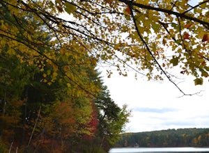
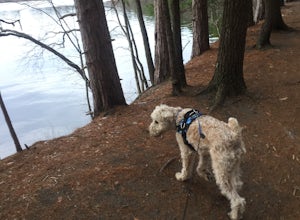
Hike around Walden Pond
4.51.69 mi / 45 ft gainPark in the lot ($8 for MA residents) by Walden Pond to access the trail, and head out either direction on the loop around the pond. Trail is accessible from April-October.Read more -
Andover, Massachusetts
Deer Jump Reservation Loop
5.02.09 mi / 171 ft gainDeer Jump Reservation Loop is a loop trail that takes you by a river located near Andover, Massachusetts.Read more -
Ashland, Massachusetts
Hike the Ashland Reservoir Trail
5.03.2 mi / 68 ft gainPark in the lot on State Park Road (see map) to access the trail. It's a popular trail that is dog-friendly. Pay attention to the trail as at parts it is not well marked.Read more -
Andover, Massachusetts
Haggetts Rail Trail to Haggetts Pond
5.02.08 mi / 16 ft gainHaggetts Rail Trail to Haggetts Pond is an out-and-back trail that takes you through a nice forest located near Lawrence, Massachusetts.Read more -
Sutton, Massachusetts
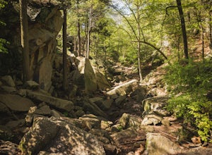
Hike the Purgatory Chasm Trail
4.71 mi / 115 ft gainFor this 1-mile hike, you can park at the Purgatory Chasm Visitor Center. From there hit the trail and explore the unusual gap between the tall granite walls, which might be adorned with climbers. Great for all ages and dogs are welcome too. The trail is open March-November.Read more -
Deerfield, Massachusetts
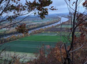
South Sugarloaf Trail
1.48 mi / 404 ft gainSouth Sugarloaf Trail is a loop trail that takes you by a river located near South Deerfield, Massachusetts.Read more -
Wellesley, Massachusetts
Walk along Lake Waban
3 miNote: The campus is currently closed due to COVID-19 restrictions. This is a lake on Wellesley College Campus. It is easy to get to from just about any direction. Just park and walk toward the lake, and there are paths that will take you there. The easiest place to park (pinned on the map) is ju...Read more -
Douglas, Massachusetts
Hike the Coffeehouse Loop, Douglas State Forest
3.02.2 mi / 500 ft gainDouglas State Forest is located off of Rte 16 in south central Massachusetts. To access trails and the lake, head to the parking area on Wallum Lake Park Road. From the parking lot, you can access the Coffeehouse Loop Trail, as well as a few other shorter trails by the lake. The Coffeehouse Loop ...Read more -
Medford, Massachusetts
Hike Southern Middlesex Fells Loop
4.73.5 mi / 756 ft gainPark in the parking area near Bellevue Pond. There are multiple entrances to the reservation (some closer to the reservoir itself than others). I have spent days in there hiking around and never seeing the water and there are days when I just hiked right in to the water and sat and enjoyed it. Th...Read more -
Holyoke, Massachusetts
Whiting Street Reservoir Loop
3.74 mi / 138 ft gainWhiting Street Reservoir Loop is a loop trail that takes you by a lake located near Holyoke, Massachusetts.Read more -
Boston, Massachusetts
Run the Arnold Arboretum Trail
5.02.6 mi / 150 ft gainPark in the lot off of Arborway to access the trail. This place is gorgeous year round. The winter offers a quiet solitude, fall boasts bright colors, spring is the most beautiful as the flowers start to burst and cherry blossoms take over, and summer is overwhelmingly green. There are dozens of ...Read more -
Blackstone, Massachusetts
Hike the Blackstone Gorge Trail
5.00.7 mi / 72 ft gainPark at the lot at the corner of Staples Lane and County Street. From here you can access the Blackstone Gorge Trail. Dogs are allowed on leash, and you can enjoy various paths along the river or through the forest. At multiple points you can find yourself looking down at the Blackstone River fro...Read more -
Hampden, Massachusetts
Goat Rock Trail
2.67 mi / 659 ft gainGoat Rock Trail is an out-and-back trail where you may see beautiful wildflowers located near Hampden, Massachusetts.Read more -
Boston, Massachusetts
Freedom Trail
4.72.9 mi / 121 ft gainPark along the trail and then hop on. The Freedom Trail allows you to not only see the most beautiful parts of Boston (which is an absolutely gorgeous city) but you can learn some history too! Head off the trail a bit to explore the Charles River, the waterfront near the aquarium and picturesque ...Read more -
Newbury, New Hampshire
Hike to Lake Solitude, NH
4.04.8 mi / 2510 ft gainThe two most popular routes to Lake Solitude are the Newbury Trail and Andrew Brook Trail. The round-trip distance of the hikes are 4.8 miles and 3.8 miles. Both could be described as moderate in terms of difficulty. The Newbury trail is accessed from Lakeview Ave and Andrew Brook Trail can be a...Read more -
Concord, New Hampshire
Hike to the Oak Hill Fire Tower
4.03 mi / 500 ft gainClimbing to the Fire Tower on Oak Hill is a great urban adventure, short enough for a lunch break trail run or a morning hike with the family. The trail is primarily wooded, with a panoramic view from the Fire Tower for those brave enough to ascend it's wooden steps.Park at the well signed dirt l...Read more

