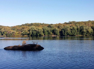
Cockeysville, Maryland
Top Spots in and near Cockeysville
-
Marietta, Pennsylvania
Climb At Chickies Rock
From parking at the fairly new lot on Furnace Road, head down river on the walking trail about a half mile to an obvious large face next to the train tracks. From here you choose from a variety of routes including some two pitch routes like Witches’ Brew 5.4 to Main Street 5.5 over to some of the...Read more -
Boyds, Maryland
Hike or Bike the Hoyles Mill Trail
9.16 mi / 390 ft gainPark on Clarksburg Road (see map) and head onto the marked trail. It can get muddy at times so pack accordingly. Great for kids, and dog friendly too.Read more -
Washington, District of Columbia
Visit Kenilworth Aquatic Gardens
4.51.5 miThe Kenilworth Aquatic Gardens are a unique spot in Washington, D.C. The grounds are full of ponds, boardwalks, and a trail that connects you to the Anacostia River Trail. The main draw of this park are the ponds full of lotus flowers. During the summer months, they grow tall with colors ranging ...Read more -
Dickerson, Maryland
Hike the Sugarloaf Mountain Trail
4.76.05 mi / 1509 ft gainPark on Sugarloaf Mountain Drive (as indicated on the map below) to access the trail. It is open from March-November and is dog friendly.Read more -
Lewisberry, Pennsylvania
Hike Quaker Race's Lakeside Trail
4.03 miThis trail is best accessed from the Quaker Race Day Use Area or from the Cabin Colony for cabin occupants. This trail has a dirt or rocky surface, uneven terrain and one steep but short hill. This trail connects to Lakeside Trail at its end to form a 3-mile loop that passes through diverse habit...Read more -
Washington, District of Columbia
Hike the Soapstone Valley Trail
4.02 miThis is an out-and-back trail that starts and ends on different roads, but you will have better luck parking on Albemarle Street NW (where I have indicated the trailhead is on the map). This is a long street with plenty of street parking, just pay attention to the signs to see how long you can le...Read more -
Thurmont, Maryland
Hike Catoctin Mountain
4.58.4 mi / 1370 ft gainPark at Catoctin Mountain Visitor Center. The hike starts at the end of the gravel parking lot across from the visitor center. This is definitely a popular hiking location, so come early on the weekends to guarantee a parking spot and to avoid the crowds. To start, take the right trail towards th...Read more -
Thurmont, Maryland
Hike Chimney Rock at Catoctin Mountain Park
4.25 mi / 600 ft gainChimney Rock is the quintessential breathtaking view that makes a hike worthwhile. By parking at the most northeast parking lot on the trail map you are able to include the sweeping views of Thurmont Vista, and Wolf Rock on your way to Chimney Rock. Highly recommend visiting in the fall, and on w...Read more -
Thurmont, Maryland
Hike the Catoctin Mountain Extended Loop Trail
4.58.6 mi / 1696 ft gainThis 8.6 mile loop trail in Catoctin Mountain Park is good for both hikers and trail runners. This loop is the larger loop in the park, comprised of Cunningham Falls, Hog Rock, Blue Ridge Summit, Thurmont Vista, Wolf Rock, and Chimney Rock. The trail gets a moderate rating because it's mostly roc...Read more -
Thurmont, Maryland
Cat Rock via Old Misery Trail
3.02.89 mi / 797 ft gainThe best place to park is on Catoctin Hollow Road in the parking lot that's on the same side of the road as the lake. It's not a huge lot but we were here mid-summer around 10 am and found a spot easily. The trailhead is on the other side of the street from this parking lot; there is a sign letti...Read more -
Stevensville, Maryland
Bike or Run the Kent Island South Trail
12 mi / 20 ft gainRun, bike, walk or use any other means to travel this paved route from the Romacoke Pier Park up to the Metapeake Public Beach. 6 miles one way, this path is paved the entire way and stays off the main road. Public parking at either end and beautiful views of the bay. The path winds through fo...Read more -
Smithsburg, Maryland
Hike to Cunningham Falls
4.22.8 miThis 78-foot waterfall, among the largest in the state, is easily accessible by two short trails. Lower Trail (0.5 miles) leads directly to the falls, whereas Cliff Trail (0.75 miles) has slightly more difficult terrain and takes you to a viewing platform. To lengthen the adventure, Hunting Creek...Read more -
McLean, Virginia
Hike at Turkey Run Park, McLean
4.02 mi / 200 ft gainTurkey Run Park is available to hikers year-around and is located just off of George Washington Parkway in McLean, Virginia. The exits are clearly marked and you simply drive to parking lot C-1 to start this hike.Turkey Run has numerous trail options available but I chose an out-and-back. When yo...Read more -
Great Falls, Virginia
Hike from Riverbend Regional Park to Great Falls National Park
5.02.5 mi / 75 ft gainThis hike utilizes the Potomac Heritage Trail from Riverbend Park to Great Falls National Park. This section is an easy, mostly flat trail that will take you along the Potomac until you reach Great Falls National Park. When you reach Riverbend Park turn right into the parking lot. At the end of t...Read more -
Great Falls, Virginia
Canoe from Algonkian Regional Park to Riverbend Park
4.0Starting at Algonkian Regional Park and ending at Riverbend Park, this 8.5 mile canoe trip is a perfect way to get away from the traffic that is Northern Virginia. Paddling hard, people have completed it in 4 hours. It can easily be turned into an all day trip lasting 8 or more hours, if paddli...Read more -
Arlington, Virginia
Fish the Potomac River in Arlington
Parking along 36th Road in Arlington, VA, head down the path on the Gulf Branch Trail. Walk northeast for roughly a quarter mile, where you will intersect with the Potomac River. Find a spot along the sand, cast out, and watch the catfish bite! Chicken liver seems to work well. Don't forget to h...Read more

