Clarksburg, Maryland
Top Spots in and near Clarksburg
-
Aldie, Virginia
Relax at Aldie Park
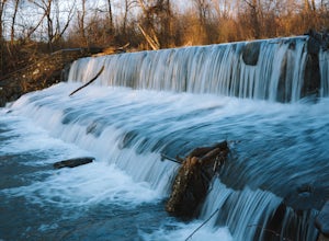
Small park with nice walking trails, picnic tables, and a waterfall that cascades down from a dam. Its a wonderful place to take the family or just go for a breath of fresh air. Its also right near the downtown area of Aldie, which has a bakery, juice/smoothie shop, and other great shops to stop ...Read more -
Washington, District of Columbia
Visit the National Mall in Washington D.C.
4.67 miEveryone has so many things on their plates these days that take all their time up. It is hard to get away for adventures or to experience new things. The National Mall in Washington D.C. is within an hour from millions of people on the East Coast. This centralized location makes the National Mal...Read more -
Washington, District of Columbia
Photograph Sunrise at the Lincoln Memorial
4.8Located on the far-west portion of the National Mall in Washington, D.C. stands the Lincoln Memorial. At almost 100 feet tall, this majestic structure overlooks the reflecting pool and offers an iconic view of the Washington Monument. Parking is almost always an issue near the Lincoln Memorial, ...Read more -
Elkridge, Maryland
Hike the Cascade Falls and Rootball Loop Trail
4.72.4 mi / 285 ft gainPark on the shoulder of Landing Drive (see map) to access the trailhead. This trail is open April-September. Dogs allowed on leash.Read more -
Sharpsburg, Maryland
Antietam National Battlefield Trail
3 mi / 358 ft gainAntietam National Battlefield Trail is a loop trail that takes you by a river located near Sharpsburg, Maryland.Read more -
Elkridge, Maryland
Cascade Falls Loop
3.02.31 mi / 381 ft gainThis hike is a great place to escape the city feel of Baltimore and disappear into the wilderness. Enter through the Avalon Area entrance. There is a cash fee to enter the park. Once you pass the front gate continue past the initial picnic area. Continue through the park to the Orange Grove Area...Read more -
Thurmont, Maryland
Cat Rock via Old Misery Trail
3.02.89 mi / 797 ft gainThe best place to park is on Catoctin Hollow Road in the parking lot that's on the same side of the road as the lake. It's not a huge lot but we were here mid-summer around 10 am and found a spot easily. The trailhead is on the other side of the street from this parking lot; there is a sign letti...Read more -
Smithsburg, Maryland
Hike to Cunningham Falls
4.22.8 miThis 78-foot waterfall, among the largest in the state, is easily accessible by two short trails. Lower Trail (0.5 miles) leads directly to the falls, whereas Cliff Trail (0.75 miles) has slightly more difficult terrain and takes you to a viewing platform. To lengthen the adventure, Hunting Creek...Read more -
Thurmont, Maryland
Hike Catoctin Mountain
4.58.4 mi / 1370 ft gainPark at Catoctin Mountain Visitor Center. The hike starts at the end of the gravel parking lot across from the visitor center. This is definitely a popular hiking location, so come early on the weekends to guarantee a parking spot and to avoid the crowds. To start, take the right trail towards th...Read more -
Thurmont, Maryland
Hike Chimney Rock at Catoctin Mountain Park
4.25 mi / 600 ft gainChimney Rock is the quintessential breathtaking view that makes a hike worthwhile. By parking at the most northeast parking lot on the trail map you are able to include the sweeping views of Thurmont Vista, and Wolf Rock on your way to Chimney Rock. Highly recommend visiting in the fall, and on w...Read more -
Thurmont, Maryland
Hike the Catoctin Mountain Extended Loop Trail
4.58.6 mi / 1696 ft gainThis 8.6 mile loop trail in Catoctin Mountain Park is good for both hikers and trail runners. This loop is the larger loop in the park, comprised of Cunningham Falls, Hog Rock, Blue Ridge Summit, Thurmont Vista, Wolf Rock, and Chimney Rock. The trail gets a moderate rating because it's mostly roc...Read more -
Washington, District of Columbia
Visit Kenilworth Aquatic Gardens
4.51.5 miThe Kenilworth Aquatic Gardens are a unique spot in Washington, D.C. The grounds are full of ponds, boardwalks, and a trail that connects you to the Anacostia River Trail. The main draw of this park are the ponds full of lotus flowers. During the summer months, they grow tall with colors ranging ...Read more -
Laurel, Maryland
Hike the South Tract Trails at Patuxent Research Refuge
5 miFrom the visitors center, start on the Fire Road trail. From there, it's a choose-your-own adventure (choose-your-own ecosystem, actually). Pick the Laurel and Valley Trails to stay in the quiet (and maybe enchanted? It felt enchanted) forest. Goose Pond trail is a short jut to a--yup--pond, wher...Read more -
Sabillasville, Maryland
Camp at the Adirondack Shelters in Catoctin Mountain Park
5.04 mi / 1200 ft gainFor outdoor enthusiasts, Maryland is an ideal place to live. Between the mountains and the Bay--and the rivers, bike paths, and trails along the way--we couldn't ask for much more. But if we were feeling greedy, we would probably ask for additional backpacking options, right? Of course, there are...Read more -
Bluemont, Virginia
Hike to Bears Den Overlook
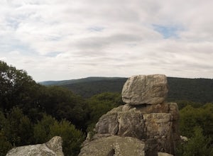
4.41.31 mi / 164 ft gainBears Den is a collection of rocks and boulders that overlooks the Shenandoah Valley in northern Virginia, just off the Appalachian Trail. You have two options to access this overlook: park at the bottom of the mountain and hike up to the overlook via the trail, or drive to the top and access the...Read more -
Bluemont, Virginia
Hike to Raven Rock
4.35 mi / 1000 ft gainStarting at a small parking lot right off of Route 7 (wuick right onto Pine Grove Road) this hike takes you North on the Appalachian Trail in a very hilly/rocky part of the trail. Expect to gain and lose 300 feet+ multiple times! It's about 2.5 miles each way so budget at least a few hours to go ...Read more

