Porter, Maine
Top Spots in and near Porter
-
Gorham, New Hampshire
Backpack to Osgood Tentsite and Hike Mount Madison
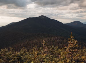
5.09.3 mi / 4521 ft gainBegin at Great Gulf Trailhead (located on the west side of NH Route 16, about 1.5 mi. south of the junction with Dolly Copp Rd.) which offers a large fee for parking lot. Bring cash and pay at the self service pay station then display your receipt in car. Walk towards the back of the parking lot ...Read more -
Pownal, Maine
Snowshoe the Northern Loop Trail at Bradbury Mountain
2 mi / 407 ft gainBradbury mountain has ample parking and multiple trails that lead around the mountain and up to the summit. We took the Northern Loop, which is the longest trail up the small mountain. It is a gradual incline of 407 ft over 1.0 mile. It is a perfect out and back trail just to get outside for a b...Read more -
Thompson and Meserves, New Hampshire
Hike Mt. Washington via Ammonoosuc Ravine Trail and Jewell Trail
5.07.4 mi / 3720 ft gainTo begin this hike, drive to Marshfield Station on Base Station Road in Jefferson, NH. There are several large parking lots capable of holding both hiker and Cog Railway traffic even on busy days. Parking in the lots at the Marshfield Station costs $5.00/day, there is a lot for hiker parking at t...Read more -
Rollinsford, New Hampshire
Scoutland Road Trail
4.03.88 mi / 108 ft gainScoutland Road Trail is an out-and-back trail where you may see beautiful wildflowers located near Rollinsford, New Hampshire.Read more -
Gorham, New Hampshire
Hike the Imp Face Trail
6.1 mi / 2080 ft gainStart a few miles north of the Joe Dodge Lodge and Pinkham Notch. If starting in Gorham, the trailhead is 6-8 miles south and will be on the east side of the road. Starting at about 1000 ft, hike in about 5 miles and 5 miles back to beginning. Two routes back, both about the same distance.Startin...Read more -
Cape Elizabeth, Maine
Hike around Cape Elizabeth's Dyer Cove
5.01 miIf you venture to Cape Elizabeth, you may be lucky enough to see it in the dense fog that I was able to.You'll take a windy road near Portland, Maine surrounded by cute, quaint homes on either side down to the rocky coastline. Park in the designated parking area (very easy to spot as the road's e...Read more -
Lincoln, New Hampshire
Photograph Fall Foliage on the Kancamagus Highway
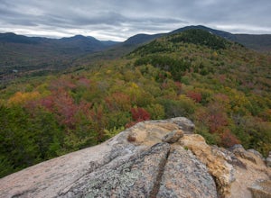
4.032 mi / 2855 ft gainDriving the Kancamagus Highway is something you can do as a way to cross the White Mountain National Forest quickly from I-93 in the east to Conway, or it can be an entire day's activity. In the fall, it's almost impossible not to stop at every turn-off on the scenic highway as it winds through t...Read more -
Randolph, New Hampshire
Summit Mount Jefferson, Mount Clay, and Mount Washington
4.010.5 mi / 4455 ft gainHike with at least one other and take two cars. First drop one car at the Cog Railway parking lot (Base Station Rd, Bretton Woods, NH). Jump into the second car and drive about 15 minutes to the Caps Ridge Trailhead on Jefferson Notch Road ( N 44° 18' 15"W 71° 21' 42" )The Caps Ridge Trail will l...Read more -
Randolph, New Hampshire
Hike Mount Jefferson
5 mi / 2700 ft gainMount Jefferson stands at 5712 feet, the third tallest mountain of the Presidential's in the White Mountain National Forest. The trail head begins at the Caps Ridge Trail on Jefferson Notch Rd. While 2.5 miles sounds easy, this hike is not for the once in while day hiker. Challenging rock scrambl...Read more -
Randolph, New Hampshire
Madison Spring Hut to Lake of the Clouds Hut via Gulfside Trail
5.06.76 mi / 2441 ft gainMadison Spring Hut to Lake of the Clouds Hut via Gulfside Trail is a point-to-point trail that provides a good opportunity to view wildlife located near Randolph, New Hampshire.Read more -
Freeport, Maine
Sport Clays in Freeport
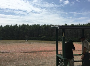
Try shooting a gun with L.L. Bean's Discovery Sporting Clay course. You can book courses in the morning or afternoon and will meet at a specified location (the range) where you will meet with the guide and other participants. You will be introduced to the sport of shooting a gun at artificial tar...Read more -
Ogunquit, Maine
Watch the Sunrise from the Marginal Way Trail
5.02 mi / 70 ft gainPark near the Oceanside Oarweed restaurant or any other public spots on the cove's peninsula. Marginal Way is a nicely paved 1.25 mile out and back path, perfect for a morning walk or run on the rocky coast. Catch fishermen, lobstermen, and recreational boats as they leave, or choose to sit at on...Read more -
Lincoln, New Hampshire
Hike Mt. Liberty and Camp at Liberty Springs Tent Site
7 mi / 2870 ft gainLiberty Springs Trail is a moderately trafficked out and back trail in the heart of Franconia Notch State Park and the White Mountains. The trail is a part of the Appalachian Trail, which allows it to remain very well maintained throughout the year. The trail is listed as difficult and strenuous ...Read more -
Jefferson, New Hampshire
Hike the Sugarloaf Trail
3.3 mi / 1099 ft gainThe Sugarloaf Trail begins at the Sugarloaf trailhead on Zealand Road off of US 302. There are two trails that begin at this trailhead--be sure to cross the bridge over the Ammonoosuc and look for the "Sugarloaf Trail" sign. The trail begins following the Ammonoosuc River for a short while before...Read more -
Lincoln, New Hampshire
Hike the Flume Gorge
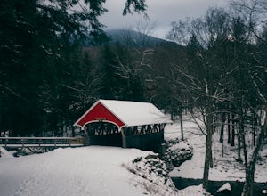
4.82 mi / 300 ft gainThe Flume Gorge in Franconia State Park is beautiful year round and every season has it's unique benefits. During the summer, the Flume is a highly frequented tourist destination and is usually crowded with groups of kids and families. Technically, the Gorge is closed during the winter and there ...Read more -
Lincoln, New Hampshire
Bike Franconia Notch Bike Path
9 miFor the point to point option first drop a car off at one end of the trail then return to the other. The south end is located at the Flume Gorge Parking lot and the north end is at a parking lot located about a half mile off Route 93, Exit 35 which takes you onto route 3 (44°12'11.3"N 71°40'51.7...Read more

