Porter, Maine
Looking for the best hiking in Porter? We've got you covered with the top trails, trips, hiking, backpacking, camping and more around Porter. The detailed guides, photos, and reviews are all submitted by the Outbound community.
Top Hiking Spots in and near Porter
-
Cape Elizabeth, Maine
Hike around Cape Elizabeth's Dyer Cove
5.01 miIf you venture to Cape Elizabeth, you may be lucky enough to see it in the dense fog that I was able to.You'll take a windy road near Portland, Maine surrounded by cute, quaint homes on either side down to the rocky coastline. Park in the designated parking area (very easy to spot as the road's e...Read more -
Lincoln, New Hampshire
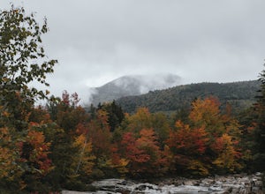
Photograph Fall Foliage on the Kancamagus Highway
4.032 mi / 2855 ft gainDriving the Kancamagus Highway is something you can do as a way to cross the White Mountain National Forest quickly from I-93 in the east to Conway, or it can be an entire day's activity. In the fall, it's almost impossible not to stop at every turn-off on the scenic highway as it winds through t...Read more -
Randolph, New Hampshire
Summit Mount Jefferson, Mount Clay, and Mount Washington
4.010.5 mi / 4455 ft gainHike with at least one other and take two cars. First drop one car at the Cog Railway parking lot (Base Station Rd, Bretton Woods, NH). Jump into the second car and drive about 15 minutes to the Caps Ridge Trailhead on Jefferson Notch Road ( N 44° 18' 15"W 71° 21' 42" )The Caps Ridge Trail will l...Read more -
Randolph, New Hampshire
Hike Mount Jefferson
5 mi / 2700 ft gainMount Jefferson stands at 5712 feet, the third tallest mountain of the Presidential's in the White Mountain National Forest. The trail head begins at the Caps Ridge Trail on Jefferson Notch Rd. While 2.5 miles sounds easy, this hike is not for the once in while day hiker. Challenging rock scrambl...Read more -
Randolph, New Hampshire
Madison Spring Hut to Lake of the Clouds Hut via Gulfside Trail
5.06.76 mi / 2441 ft gainMadison Spring Hut to Lake of the Clouds Hut via Gulfside Trail is a point-to-point trail that provides a good opportunity to view wildlife located near Randolph, New Hampshire.Read more -
Lincoln, New Hampshire
Hike Mt. Liberty and Camp at Liberty Springs Tent Site
7 mi / 2870 ft gainLiberty Springs Trail is a moderately trafficked out and back trail in the heart of Franconia Notch State Park and the White Mountains. The trail is a part of the Appalachian Trail, which allows it to remain very well maintained throughout the year. The trail is listed as difficult and strenuous ...Read more -
Jefferson, New Hampshire
Hike the Sugarloaf Trail
3.3 mi / 1099 ft gainThe Sugarloaf Trail begins at the Sugarloaf trailhead on Zealand Road off of US 302. There are two trails that begin at this trailhead--be sure to cross the bridge over the Ammonoosuc and look for the "Sugarloaf Trail" sign. The trail begins following the Ammonoosuc River for a short while before...Read more -
Lincoln, New Hampshire
Hike the Flume Gorge
4.82 mi / 300 ft gainThe Flume Gorge in Franconia State Park is beautiful year round and every season has it's unique benefits. During the summer, the Flume is a highly frequented tourist destination and is usually crowded with groups of kids and families. Technically, the Gorge is closed during the winter and there ...Read more -
Randolph, New Hampshire
Hike the Northern Presidentials
15.6 miThe Presidential Range is a mountain range located in the White Mountains of New Hampshire. They contain the highest peaks of the Whites and are named after Presidents of the U.S. I also want to add that this range is known for having some of the worst weather in America, mainly because of the un...Read more -
Lincoln, New Hampshire
Explore the Basin in Franconia Notch
4.01 mi / 300 ft gainThe Basin is just one stop on the Pemigewasset Recreational Trail that follows along I-93 through Franconia Notch. The parking lot for the Basin is easily accessible from either north or south on I-93, and it has it's own exit sign which can't be missed.Park in the lot and follow the signs toward...Read more -
Lincoln, New Hampshire
Kinsman Pond via Basin Cascade
7.25 mi / 2215 ft gainOur hike began at the Basin, which is a clearly marked exit directly off 93. If you are coming from the Northbound side, walk under the bridge beneath 93 to get to the beginning of the trail. We enjoyed the Basin for a while before hiking 1.0 mile to the Cascade Brook Trail where we took a right....Read more -
Franconia, New Hampshire
Hike to Greenleaf Hut via Old Bridle Path
5.05.5 mi / 3772 ft gainTo hike to the Appalachian Mountain Club's Greenleaf Hut, the best route for a day hike there and back is the Old Bridle Path. This hike is certainly doable in a day if you're interested in just hiking to the Greenleaf Hut. You have a lot of options when hiking this trail. I am going to focus spe...Read more -
Franconia, New Hampshire
Hike Falling Waters Trail
4.03 mi / 1100 ft gainFalling Waters Trail takes you up to the summit of Little Haystack Mountain, and Mount Lincoln and Mount Lafayette if you continue to the Franconia Ridge Trail / Appalachian Trail, then over to Old Bridle Path.Also along Falling Waters Trail are stunning waterfalls. The most popular one is Cloudl...Read more -
Franconia, New Hampshire
Winter Hike up Mount Lafayette
9 mi / 3900 ft gainTo start this hike, you can park right at the trailhead in a parking lot off of 93. This is a hike up a mountain so the entire hike is pretty challenging. There is a total elevation gain of 3900 feet in about 4.5 miles. A couple miles in you break through the treeline and then from there the view...Read more -
Franconia, New Hampshire
Snowshoe to Lonesome Lake
3.1 mi / 1013 ft gainThe best place to park when doing this hike in the winter is at the Lafayette Campground. The campground and parking lot are typically empty in the cold winter months, aside from occasional cross-country skiers on the Pemigewasset bike path. The Lafayette campground parking lot is directly access...Read more -
Franconia, New Hampshire
Hike the Franconia Ridge Loop
5.08.9 mi / 3600 ft gainStarting from the parking lot, the two trails initially begin together. Less than a mile in the trails split into Old Bridle Path to the left, and Falling Waters Trail to the right. Most people choose to go up and down on the same trail. To those doing to loop, most choose to hike up Falling Wate...Read more

