Naples, Maine
Looking for the best hiking in Naples? We've got you covered with the top trails, trips, hiking, backpacking, camping and more around Naples. The detailed guides, photos, and reviews are all submitted by the Outbound community.
Top Hiking Spots in and near Naples
-
Crawford Notch Road, New Hampshire
Snowshoe Mount Jackson
5.2 mi / 2300 ft gainThe hike starts across the street from the AMC Highland Center on route 302, which means there is plenty of parking and when you finish there is a fireplace and snacks to warm up with! It starts at the Webster Jackson trailhead and after 1.4 miles breaks off onto the Jackson trail. At that point ...Read more -
Randolph, New Hampshire
Summit Mount Jefferson, Mount Clay, and Mount Washington
4.010.5 mi / 4455 ft gainHike with at least one other and take two cars. First drop one car at the Cog Railway parking lot (Base Station Rd, Bretton Woods, NH). Jump into the second car and drive about 15 minutes to the Caps Ridge Trailhead on Jefferson Notch Road ( N 44° 18' 15"W 71° 21' 42" )The Caps Ridge Trail will l...Read more -
Randolph, New Hampshire
Hike Mount Jefferson
5 mi / 2700 ft gainMount Jefferson stands at 5712 feet, the third tallest mountain of the Presidential's in the White Mountain National Forest. The trail head begins at the Caps Ridge Trail on Jefferson Notch Rd. While 2.5 miles sounds easy, this hike is not for the once in while day hiker. Challenging rock scrambl...Read more -
Crawford Notch Road, New Hampshire
Hike to the Summits of Mt. Jackson and Mt. Pierce
8 mi / 5000 ft gainFrom I93 take exit 35 onto rt 3. Follow that until you get to a four way intersection. Take a right onto rt 302 and follow that until you see an AMC information building on the right. Drive past the parking lot about 500 feet and park on the left right after the lake.From there take the Webster ...Read more -
Crawford Notch Road, New Hampshire
Snowshoe Mount Pierce
6.4 mi / 2500 ft gainThe hike begins right across from the AMC Highland Center, which is great because you can utilize their spacious parking lot! Once you locate the trailhead, the elevation begins almost immediately. Begin on the Crawford Connector Trail for 0.4 miles.You will come to a foot bridge over Gibbs Brook...Read more -
Crawford Notch Road, New Hampshire
Hike the Tom, Field, Willey and Avalon Traverse
10.2 mi / 3300 ft gainFor hikers en route to climbing the 67 4,000 footers of Northern New England, or for those looking for a day-long mini-adventure, this four-peaks-in-one traverse is a spectacular must. Mount Tom, Mount Field, and Mount Willey are all above 4,000 feet, and Mount Avalon caps at 3,442 feet. The tota...Read more -
Carroll, New Hampshire
Mount Willard
5.03.07 mi / 958 ft gainThis hike begins at the trailhead behind Crawford Depot. The first 1/4 mile of the trail is relatively level. You will cross two small streams before the trail begins to steepen. For much of the trek up to the top of the mountain you will be following an abandoned carriage road. Along the sid...Read more -
Randolph, New Hampshire
Hike the Northern Presidentials
15.6 miThe Presidential Range is a mountain range located in the White Mountains of New Hampshire. They contain the highest peaks of the Whites and are named after Presidents of the U.S. I also want to add that this range is known for having some of the worst weather in America, mainly because of the un...Read more -
Carroll, New Hampshire
Hike Mt. Pierce
5.06.2 mi / 2412 ft gainMount Pierce (elevation 4312 ft.) is part of the Presidential Region in the White Mountain National Forest. Upon reaching the summit, you will be rewarded with 360 degree views of the surrounding mountains. To begin your hike, park at the Crawford Connector Trailhead. You will follow the Crawfo...Read more -
Newry, Maine
Photograph Screw Auger Falls
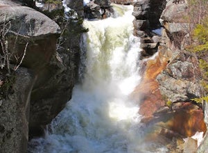
4.00.2 mi / 6 ft gainAfter parking in the allotted parking area at screw auger, make your way down to the falls to explore! There are several "smaller waterfalls" that the river flows over before making its way to the 27 foot main attraction. Going in April, the falls were at their most powerful. It made taking pictu...Read more -
Kennebunk, Maine
Hike the Bridle Path through the Madelyn Marx Preserve
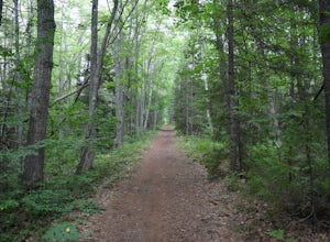
4.01.5 mi / 0 ft gainAfter crossing the Mousam River on Western Ave, see signs and gravel pull-off areas for parking at the Bridle Path trailhead. The Madelyn Marx Preserve is a greater part of the Kennebunk Land Trust home to many preserves in the area (So look for Kennebunk Land Trust signs as well).Hike through op...Read more -
Wells, Maine
Hike the Carson Trail in Rachel Carson National Wildlife Refuge
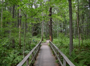
4.01 mi / 0 ft gainPull into the well marked Wildlife Refuge off Port Rd. There's several official building as well as an interpretive center and bathroom very close to the parking lot.The only trail, the Carson Trail, is feet from the parking area. It's an extremely well groomed gravel trail easily accessible for ...Read more -
Maine 26, Maine
Hike Eyebrow Trail to Old Speck Mountain Loop
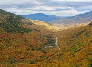
7.8 mi / 3000 ft gainThe first time I attempted this trail was in mid April, and the slush and mud I encountered was absolutely unbelievable. Snowshoes were useless. Crampons were useless. Boots alone meant dirty, wet, muddy feet. So, I had to bail. But I came back in October and I’m so glad I did because the views o...Read more -
Lincoln, New Hampshire
Osceola Mountain via Greeley Pond
4.06.8 mi / 2677 ft gainStart out at the Greeley Pond trailhead off of the Kancamagus Highway. After 1.3 miles the trail splits--bear right to get onto the Mt. Osceola Trail. Continue 1.5 miles to the summit. This summit hike offers a different kind of reward. Views are limited from the peak of Mt. Osceoloa, which allow...Read more -
Newry, Maine
Table Rock Trail
4.51.91 mi / 761 ft gainTable Rock Trail is a loop trail that takes you past a cave located near Newry, Maine.Read more -
Wells, Maine
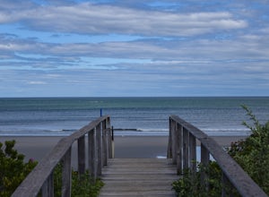
Hike to Laudholm Beach at Wells National Estuarine Reserve
1.5 mi / 0 ft gainFrom the main parking area take the Beach Barrier Trail which takes you through several different types of environment; fields, forests, and marshland before reaching Laudholm Beach to further explore or take a dip.Walk the length of Laudholm Beach if you have time where barrier beaches protect a...Read more


