Aurora, Illinois
Top Spots in and near Aurora
-
Chicago, Illinois
Grant Park
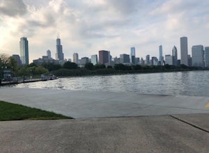
4.5Grant Park is located on the east side of Chicago. It is a great place to spend the day and explore. From the famous "Bean", which is actually named "the cloud", to Buckingham Fountain there is plenty to see in this park. It is also a great place to see the Chicago skyline, as well as have a picn...Read more -
Chicago, Illinois
Luire Garden
0.18 mi / 10 ft gainVisiting Chicago I was on a mission to find a great outdoors spot to be in. This definitely fulfilled my goal of finding a beautiful garden to hangout in! There are plenty of different paths and areas to explore just within the city! Location Located in Millennium Park it will be easy to find,...Read more -
Chicago, Illinois
Run Chicago’s Lakefront Trail
5.06.7 miChicago – the third largest city in the US and home to the deep dish pizza – doesn’t exactly scream “outdoorsy.” In reality, there is much more to Chicago than skyscrapers; there are dozens of parks, outdoor music venues, and the city is right on Lake Michigan, making it very easy on the eyes. Be...Read more -
Northfield, Illinois
Bike the Skokie Lagoons North Loop
3.04.5 miStarting at Tower Road, the path follows the bridge east to Forest Way Drive. The path mostly follows the road, and the shoreline of the lagoons up to Dundee Road, where you turn back West. Once across the bridge, you then head south on the paved trail back towards Tower Road. The Route is marked...Read more -
Chicago, Illinois
Lakeshore Path: North Ave Beach to Navy Pier
1.84 mi / 72 ft gainLakeshore Path: North Ave Beach to Navy Pier is a point-to-point trail that takes you past scenic surroundings located near Chicago, Illinois.Read more -
Vernon Hills, Illinois
Big Bear and Little Bear Lake Loop
1.74 mi / 43 ft gainBig Bear and Little Bear Lake Loop is a loop trail that takes you by a lake located near Vernon Hills, Illinois.Read more -
Deerfield, Illinois
Hike the Prairie Wolf Slough Loop
3.01.01 mi / 9 ft gainPark in the lot off of half day road (see map) to access the trail. Accessible year round, great for all skill levels, and dog-friendly.Read more -
Evanston, Illinois
Catch a Sunrise at The Lakefill
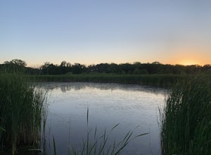
5.0From the Northwestern University campus, head to the Ryan Center for the Musical Arts to access the southern-most section of The Lakefill. If driving, parking is usually available nearby on Sheridan Road, to the southwest of The Lakefill. Once at the Ryan Center, take the pedestrian bridge on the...Read more -
Ringwood, Illinois
Hike the Glacial Park Loop Trail
2.3 mi / 216 ft gainGlacial Park is located in McHenry County Conservation District, near Richmond, Illinois. The park features prairies, a flowing river, and over 40 endangered plant and animal species. The park is open for hikers, horseback riders, fishers, and those wishing to canoe. Glacial Park is part of the H...Read more -
Oglesby, Illinois
Hike to Starved Rock's La Salle Canyon
4.34.4 mi / 370 ft gainThis out-and-back trail is one of the parks longest trails. Starting from the visitors center it is 2.2 mile hike one way and 4.4 miles if you go out and back. The trail is very much worth the long trek. You enjoy the views and fresh air of the Illinois river. You will also walk past the Illinois...Read more -
Oglesby, Illinois
Hike to Wildcat Canyon at Starved Rock SP
4.52 miIf you happen to find yourself in the Chicagoland area be sure to check out the Wildcat Canyon hike at Starved Rock State Park. This is a 2 mile out and back hike from the visitor's center that leads to the largest waterfall in the park. There are two viewpoints from the top of the canyon or yo...Read more -
Oglesby, Illinois
Hike Starved Rock's French Canyon
4.50.4 miStarting from the visitors center or the parks restaurant, depending on where you parked. If you were forced to park by the restaurant because of a busy day, you will start the trail head with a map of the park. You will follow the tallest stairs of the park down to the visitors center where the ...Read more -
Oglesby, Illinois
Hike Ottawa Canyon at Starved Rock State Park
5.03.9 miThis canyon is not as popular as some of the others in this park but it is my favorite by far. You can either hike the full 3.9 miles from the visitor center or you can jump in your car and head over to one of the parking lots on the east side for a shorter hike. Either way you will not be disap...Read more -
Oglesby, Illinois
Hike to St. Louis Canyon at Starved Rock State Park
5.03 miStarved Rock has some very interesting rock formations you can explore. The valley was formed by a series of floods as glacial melt waters broke through moraines, sending torrents of flood water surging across the land that eventually eroded the sandstone and sedimentary rock. If you arrive in ...Read more -
Lake Villa, Illinois
Hike Hastings Lake LCFP
5.02.37 mi / 88 ft gainPark in the lot off of Butler Lane (see map) to access the trail. This trail is open year round, is dog-friendly, and offers a variety of activities. In the winter, bring your snow gear!Read more -
Oglesby, Illinois
Hike the Matthiessen State Park Loop
4.85.8 miWith 5 miles of trails, which alternate between cliffs, canyons, and bluffs, Matthiessen State Park has plenty to offer. This particular trail also includes three waterfalls, along the way. From the Dells Area parking lot, head down the steps next to the log fort replica. At the 4-way junction tu...Read more

