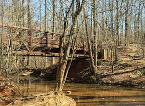
Gainesville, Georgia
Looking for the best hiking in Gainesville? We've got you covered with the top trails, trips, hiking, backpacking, camping and more around Gainesville. The detailed guides, photos, and reviews are all submitted by the Outbound community.
Top Hiking Spots in and near Gainesville
-
Atlanta, Georgia
Eastside Trail of the Atlanta Beltline
4.71.93 mi / 164 ft gainTo visit the Eastside Trail of the Atlanta Beltline, park in the paid public parking (different pricing Monday-Thursday & Friday-Sunday) at the far southeast corner of Piedmont Park, behind the Park Tavern restaurant and brewery. From there, walk to the intersection of Monroe Dr. and 10th St....Read more -
Blairsville, Georgia
Nottely Reservoir Trail
2.53 mi / 335 ft gainNottely Reservoir Trail is a loop trail that takes you by a river located near Blairsville, Georgia.Read more -
Clayton, Georgia
Hike the James E. Edmond trail to Lookoff Mountain Overlook
4.07.5 mi / 2378 ft gainBlack Rock Mountain State Park is Georgia's highest elevation State Park. It is adorned with several waterfalls, sweeping overlooks, blooming Rhododendron's, and plenty of miles of trail. The James E. Edmond trail is the longest and by far most challenging hike in the park. Its medium-long dis...Read more -
Marietta, Georgia
Hike the Battlefield and Mountain Loop
5.010.24 mi / 1355 ft gainFrom the visitor center, start on the Kenneshaw Mountain Trail, which takes you up a series of switchbacks to the summit of Kennesaw Mountain (600' elevation gain). Take in the views of Atlanta from the top, then continue on the trail as it descends, then starts up Little Kennesaw Mountain. At 2...Read more -
Clayton, Georgia
Hike to Martin Creek Falls
5.00.6 miThere are two different ways to get to this waterfall.The easiest way is through a trail in the Warwoman Wildlife Management Area. To get to this trail head, drive east on Warwoman Road from Clayton, GA. At approximately 3.5 miles, take a left onto Finney Creek Road (FS 152). You will see a sign ...Read more -
Marietta, Georgia
Hike to Noses Creek
3.52 miStarting at the Burnt Hickory Parking lot on Kennesaw National Battlefield, you head south on a pretty flat trail. After a mile and a half you will come across a bridge that goes over Noses Creek. If you're looking to cover more ground, the trails around the creek expand for miles in any directio...Read more


