Clayton, Georgia
Looking for the best photography in Clayton? We've got you covered with the top trails, trips, hiking, backpacking, camping and more around Clayton. The detailed guides, photos, and reviews are all submitted by the Outbound community.
Top Photography Spots in and near Clayton
-
Cedar Mountain, North Carolina
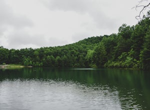
Hike to Fawn Lake
1 mi / 100 ft gainFawn Lake sits on the backside of DuPont State Forest, about a 15 minute drive from the High Falls Parking/ Visitor Center as well as Hooker Falls parking lots. With easy access and easy terrain, this is a must see to add to the list. While sometimes the main parking lots and trails of DuPont can...Read more -
Maggie Valley, United States
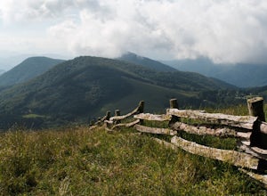
Hemphill Bald
Hemphill Bald is a quintessential Smoky Mountains vantage point and this moderate loop trail leading to it takes you through beautiful forest and rolling hills. This area is incredible in all seasons - wildflowers in the spring, colorful leaves in the fall, and with bare trees in the winter, the ...Read more -
Robbinsville, North Carolina
Hike the Big Fat Gap Trail
12 mi / 3000 ft gainThere are many trailheads leading into the wilderness on either the Tennessee or North Carolina side. My favorite is the Big Fat Gap trail on the North Carolina side at an elevation of 3,060'. To see the best of what this area has to offer take the Hangover Lead South Trail to the 5,180' Hangover...Read more -
Cleveland, South Carolina
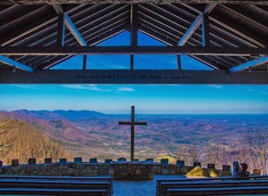
Photograph Fred W. Symmes Chapel (Pretty Place)
Getting there Fred W. Symmes (aka Pretty Place) Chapel is perched near the top of Standing Stone Mountain at 3000 feet above sea level. That being said, expect a long and winding drive up the mountain. It takes about 30 minutes starting from the bottom of the mountain to arrive to the chapel. Th...Read more -
Tellico Plains, Tennessee
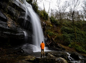
Hike to Falls Branch Falls
5.02.6 mi / 540 ft gainTo get to the trailhead, drive 22.5 miles on the Cherohala Skyway from Tellico Plains, Tennessee. If you are coming from the North Carolina side, drive 20.5 miles to the trailhead. The trailhead parking area is marked by a large green sign saying West Rattlesnake and is surrounded by a low stone ...Read more -
Little River, North Carolina
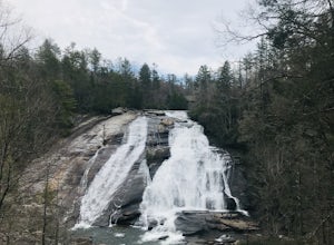
High Falls & Triple Falls
4.52.38 mi / 502 ft gainBoth falls provide ample open, flat rock right up next to the massive falls where you can picnic, take photos, or just lounge in the sun and mist. There are signs saying so, but be sure to be careful near the waters edge below the falls - swimming is not allowed as the current can be very strong....Read more -
Hendersonville, North Carolina
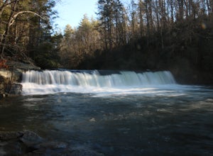
Hike to Hooker Falls
4.00.8 mi / 100 ft gainHooker Falls is located in Dupont State Forest in southern North Carolina. The hike is a great hike for kids to go on and to have a picnic. The waterfall is a beautiful waterfall that offers a great place to swim. Along the hike there are also other places you can see the river and you can swim a...Read more

