Alto, Georgia
Top Spots in and near Alto
-
Clayton, Georgia
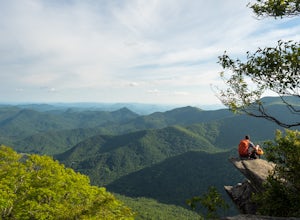
Hike the James E. Edmond trail to Lookoff Mountain Overlook
4.07.5 mi / 2378 ft gainBlack Rock Mountain State Park is Georgia's highest elevation State Park. It is adorned with several waterfalls, sweeping overlooks, blooming Rhododendron's, and plenty of miles of trail. The James E. Edmond trail is the longest and by far most challenging hike in the park. Its medium-long dis...Read more -
Clayton, Georgia
Camp at Tallulah River Campground
Tallulah River Campground is located in the Chattahoochee-Oconee national forest. It is just outside of Clayton, Georgia. The campground has about 15 spots that are big enough for a small to medium sized RV. Each camping spot also has a nice tent pad for a big tent. Most spots are also on the riv...Read more -
Clayton, Georgia
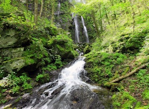
Hike to Martin Creek Falls
5.00.6 miThere are two different ways to get to this waterfall.The easiest way is through a trail in the Warwoman Wildlife Management Area. To get to this trail head, drive east on Warwoman Road from Clayton, GA. At approximately 3.5 miles, take a left onto Finney Creek Road (FS 152). You will see a sign ...Read more -
Arkaquah Trail, Georgia
Hike the Arkaquah Trail to Brasstown Bald
11 mi / 3756 ft gainThe Arkaquah Trail is unique as far as North Georgia trails go for any reasons. Its elevation gain and distance puts it near the top for most challenging day hikes in the Blue Ridge Mountains. If the 11 miles round-trip sounds a bit daunting, this hike can also be done as a 5.5 mile point-to-po...Read more -
Walhalla, South Carolina
Hike to Yellow Branch Falls
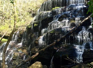
5.03 miOnce you have turned into the picnic area off of Highway SC 28, you will see the open and easy parking area. The trail begins at 2 points on the southern end of the parking area. These 2 points form a small loop about 0.2 miles long, with a spur in the middle of the loop onto the main yellow bran...Read more -
Walhalla, South Carolina
Hike to Issaqueena Falls and Stumphouse Tunnel
4.01.5 mi / 250 ft gainFrom Walhalla South Carolina, follow SC 28 westward 7 miles until you see Stumphouse Tunnel Park on the right-hand side of the road. Take this road halfway down, and park in the parking area on the right. From here, you can travel a short walk to the falls overlook, or, for the more adventurous ...Read more -
Cumming, Georgia
Hike the Indian Seats Trail
4.33.24 mi / 453 ft gainThe Sawnee Mountain Preserve is easy to get to with a GPS and offers plenty of parking. To get to the Indian Seats Trail you will start down a short (.17 mile) trail that will take you to the trailhead. The Indian Seats Trail is a loop so once you reach the marked trail you can go either left or ...Read more -
Cumming, Georgia
Mountainside Loop Trail
4.05.35 mi / 823 ft gainMountainside Loop Trail is a loop trail where you may see beautiful wildflowers located near Cumming, Georgia.Read more -
Young Harris, Georgia
Hike the Miller Trek
5.06.3 mi / 1325 ft gainThis is an awesome trek with views of both Young Harris and Hiawassee, GA! The trail starts from the parking area where there is the Miller Trek A-Frame (see photo for reference)! There are several different trails within the trail system on the mountain, but if you take 5 minutes to read the map...Read more -
Dillard, Georgia
Hike to Rabun Bald
5.03 mi / 4696 ft gainStarting at the trailhead you begin by following the yellow blazes. The trail isn't well marked so keep an eye out for the blazes you see. The trailhead starts at the dead end of Kelsey Mountain Trail. The path immediately starts to incline and doesn't stop. A few minutes in you will come to a fo...Read more -
Dawsonville, Georgia
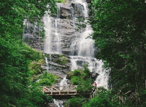
Amicalola Falls
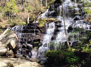
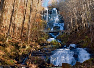
4.30.73 mi / 292 ft gainAdventurers access the falls through the state park entrance. From the parking lot, hikers follow the clearly marked signs to the base of the falls. The incline begins by the pond at the base of the falls. From the pond, follow the incline along the cascading portion of the falls to the stairs. A...Read more -
Dawsonville, Georgia
Hike to Springer Mountain
3.519 mi / 4346 ft gainBegin your journey from Amicalola Falls State Park. Despite the steep climb, you should park at the base of the falls and climb the steps for a great view of one of the grandest falls in the South. (For more on that hike, see: "Climb the Stairs to Amicalola Falls"). From the top of the falls, fol...Read more -
Dawsonville, Georgia
Amicalola Falls Loop via Upper Observation Platform
5.01.93 mi / 666 ft gainTo get there you can use Google Maps or Waze to “Upper Observation Platform” – W Ridge Staircase, Dawsonville, GA 30534. The other option is to start at the visitor center. If you start at the visitor center, it will add about a mile to your hike so parking in the upper parking lot like us will s...Read more -
Otto, North Carolina
Hike to and Climb Pickens Nose
4.81.5 mi / 200 ft gainFrom the parking area (fits about 6 cars) follow the trail on the same side of the road up the ridge through dense rhododendron. Several spur trails branch off of the main trail and lead to rock outcroppings with excellent views. Getting to the parking area is slow. The narrow gravel road winds...Read more -
Suwanee, Georgia
Sims Lake Park Trail
5.01.17 mi / 135 ft gainSims Lake Park Trail is a loop trail that takes you by a lake located near Suwanee, Georgia.Read more -
Tamassee, South Carolina
Hike to Lee Falls
4.01.6 miThe Hike: Head out through the middle of the first of three fields, crossing creeks two times as you come to them. At the end of the last field, the trail enters the woods. Hike through the woods for 0.3 mile and take the left fork, crossing a creek , and head toward the larger branch of Tamassee...Read more


