East Haven, Connecticut
Top Spots in and near East Haven
-
Litchfield, Connecticut
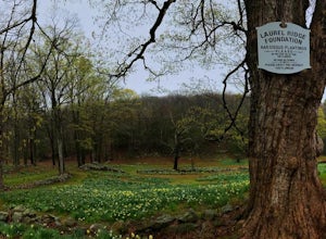
Photograph Daffodils at Laurel Ridge
Laurel Ridge is a private owned Farm , the owners are generous enough to let people visit these flowers so please be respectful of there rules. You may see the Daffodils from Sunrise-Sunset and usually fully bloomed Early April-May. Laurel Ridge is the perfect way to start Spring, the smell and ...Read more -
Shelter Island, New York
Hike through the Mashomack Nature Preserve
10 miJust a short ferry ride from the Hamptons, South Ferry Road is exactly where it sounds; very close to the South Ferry of Shelter Island. The parking lot of Mashomack Preserve is marked by a large sign. When you walk in, you'll see a large nature center. Sign in at a clipboard at the table out fro...Read more -
Kings Park, New York
Kayaking the Nissequogue River
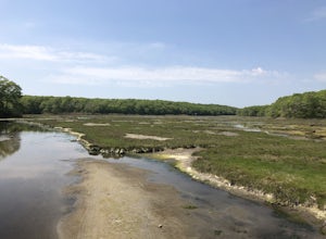
5.0Starting on the banks of Nissequogue River State Park, this 6 mile journey makes you feel like you’re cruising down river in the south, when you’re really on Long Island. I really suggest going as high tide is rolling in as there can be some shallow sections along this trip. Head out into the ope...Read more -
East Lyme, Connecticut
Hike Rocky Neck State Park Trail
5.02.5 mi / 141 ft gainRocky Neck State Park Trail is a 2.5 mile loop hike where you may see beautiful wild flowers located near East Lyme, Connecticut.Read more -
Southampton, New York
Paddle Peconic Bay
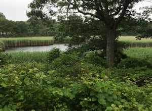
4.0While there are many ways to access the Peconic Bay, I have found the best direction to explore is north west after launching and during the sunset. If you head to the public beach on Towd Point Rd. you can launch from there and make your way out toward Robins Island. Like most places the water i...Read more -
Ridgefield, Connecticut
Hike the Hemlock Hills & Pine Mountain Loop
7.5 mi / 1174 ft gainThere are several trailheads for Hemlock Hills But the least crowded is at the intersection of Ned's Mountain road and Bogus Road. I took my 3 year old black lab. There are ton's of little ponds for your dog to jump in and do dog things. For the most part the hike is flat but at some parts it c...Read more -
New Fairfield, Connecticut
Hike Squantz Pond Trail
2.2 mi / 321 ft gainThe hike is rated as moderate and is accessible all year round. While it’s accessible during all seasons, the sights of the leaves changing colors in the autumn makes it an exceptionally beautiful time to do this hike. You’ll definitely want to snap some photos along the way of the foliage reflec...Read more -
Washington, Connecticut
Hike the Mount Tom Tower Trail
1.3 mi / 337 ft gainStarting from the parking lot of Mt. Tom State Park, hop onto the Tower Trail (yellow trail) which leads more into the woods. During winter time, the trail may be slippery, please use your best judgement and always know your limits. Gaining about 300 feet in total elevation in approximately 1 mil...Read more -
Glastonbury, Connecticut
Blackledge Falls
4.01.46 mi / 207 ft gainAlthough the park contains hiking trails, a pond and a streambelt, the primary draw of this parcel of land is the 25 foot waterfall. The falls flow varies depending on the volume of precipitation, from a trickle in the dry months to a three-pronged vertical drop after some consistent snow melt or...Read more -
Stamford, Connecticut
Hike Cove Island Park Loop Trail
5.01.1 mi / 3 ft gainThis trail is accessible year round and features water views of the Long Island Sound with beach access. The trail is a popular spot for walking, biking, fishing, and even bird watching. But if you’re not quite in the mood to get your steps in, you can use the small beach to sit and chat with a f...Read more -
Washington, Connecticut
Hike Meeker Trail
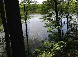
3.3 mi / 639 ft gainMeeker Trail is a 3.3 mile out and back hike that takes you by a lake located near New Preston, Connecticut.Read more -
Pound Ridge, New York
Leatherman's Loop
1.25 mi / 1183 ft gainThis loop trail is moderately rated and reaches a total elevation gain of approximately 1,183 feet. It’s located in the Ward Pound Ridge Reservation, which spans roughly 4,315 acres. It is Westchester County’s largest park and includes roughly 35 plus miles of hiking trails to explore. The Ward...Read more -
Manchester, Connecticut
Explore Wickham Park
5.0Wickham Park Is open the first weekend in April and closes the last weekend in October. Entrances fees are $5 Monday-Friday and $7 Saturday-Sunday. The park is known for its 250 acres of open fields, wildflowers, gardens, ponds and nature center. There is no where else can you go have a picnic w...Read more -
Brewster, New York
Fly Fish the East Branch of the Croton River
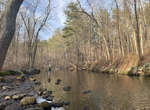
If you're craving some time away from the bustle of everyday life to enjoy some silence, broken only by the babbling sound of water flowing over small boulders and the occasional crunching of leaves-- you'll find many spots along the Croton River to satisfy your desire for stillness. The Croton...Read more -
Simsbury, Connecticut
Hike to the Heublein Tower on Talcott Mountain
4.32.54 mi / 404 ft gainThe Heublien Tower Trail, located just inside the Talcott Mountain State Park entrance off of Route 185 in Simsbury CT, is a short 1.25 miles. While the hike isn't long, the first 1/3 of a mile is a steep incline that will get your heart pumping. The trail itself it very well kept, and although ...Read more -
Patchogue, New York
Camp at Fire Island's Watch Hill
4.02 miIf departing from NYC, catch the early LIRR train from Penn Station (or Atlantic Terminal) towards Patchogue. You may have to transfer at both Jamaica & Babylon, but it's an easy hop across the platform. Trip will take approximately an hour and a half and cost around $15, Off Peak, each way. ...Read more

