Winter Park, Colorado
Top Spots in and near Winter Park
-
Bailey, Colorado
Payne Creek Trail via Brookside McCurdy Trailhead
4.517.98 mi / 3773 ft gainDay 1: Park at the Payne Creek/Brookside Trailhead (8,040 ft.) right outside Bailey. You'll go on the trail for about a mile before the trail parts to Craig Meadows or Craig Park. If you start this in the nighttime, it's best to camp before you part ways on the trail as it's a little more spaciou...Read more -
Estes Park, Colorado
Camp at Aspenglen Campground
5.0Aspenglen is one of the four main campgrounds within the park boundaries. The campground is for car camping and there are areas just for tents and then broader areas for tents and campers. There are 53 sites at this campground and it fills up quickly each year. Reservations are available six mont...Read more -
Estes Park, Colorado
Hike The Mummy Kill (a.k.a. Mummy Mania)
14.31 mi / 5600 ft gainWanna kill some mummies!? Of course you do! Who doesn't? Mount Chapin: 12,454 feet; Mount Chiquita: 13,069 feet; Ypsilon Mountain: 13,514 feet; Fairchild Mountain: 13,502 feet; Hagues Peak: 13,560 feet; Mummy Mountain: 13,425 feet The Mummy Kill is the perfect all-day hike for those seasoned h...Read more -
40.407117,-105.626146
Hike to Lawn Lake, Rocky Mountain NP
12.9 mi / 2558 ft gainThis 4 to 8 hour day hike leads to Lawn Lake, located inside a large basin at tree line, and surrounded by Fairchild Mountain, Hagues Peak, and Mummy Mountain. Lawn Lake is among the largest subapline lakes in Rocky Mountain National Park. As you ascend into the sub-alpine zone, you will be gree...Read more -
Estes Park, Colorado
Hike the Ypsilon Lake Trail
5.08.38 mi / 2000 ft gainTo get to the trailhead, enter Rocky Mountain National Park on the 36. Keep right at the fork with the 34 and then you'll take your next left and the parking for the trailhead is the first parking area on your right. There is an outhouse at the trailhead too, so if you need to take a pit stop b...Read more -
Estes Park, Colorado
Chasm Falls
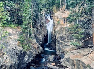
3.02.57 mi / 132 ft gainParking in Rocky Mountain National Park is tricky for Chasm Falls. Depending on where you are able to park, the hike will be a 0.1 mile, 2.8 mile, or 4.8 mile round-trip hike. It’s also important to know that Old Fall River Road is closed during the winter months from Nov 30th until the end of Ma...Read more -
Estes Park, Colorado
Mt. Ida via Milner Pass
5.09.28 mi / 2112 ft gainThe hike to Mt. Ida offers some of the most stunning views of Rocky Mountain National Park. How to get there: From the east, take Trail Ridge Road all the way to the west side of the park. You will pass Alpine Visitor Center and the road sharply turns south at Medicine Bow Curve. The trailhead...Read more -
Estes Park, Colorado
Backpack Alpine Terrain to Haynach Lakes
17 miBegin at the Milner Pass Trailhead off of Trail Ridge Road in Rocky Mountain National Park. Commonly used to summit Mount Ida, this trailhead is often popular with summer hikers. The trail climbs steeply through the trees before revealing open slopes of tundra and fantastic panoramic views. Altho...Read more -
Summit County, Colorado
Hike to Crystal Peak
5.08.6 mi / 2482 ft gainOnce you turn off of Colorado hwy 9 onto dirt, your GPS will lead you to a gravel lot. At the end of that lot there's a pretty steep gravel road that heads NNW (GPS coords: 39°25'43.01"N 106° 4'11.30"W | Map Link if you want to plug that into your GPS for parking). From this lot you'll walk up t...Read more -
Vail, Colorado
Ski the Minturn Mile
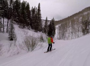
The Minturn Mile is best accessed after spending the day at Vail, but can be done so with skins and skis from the base. This description will assume you have access to the lifts at Vail by parking at one of the many resort/town parking areas. From either the top of Game Creek Express or Wildwoo...Read more -
Estes Park, Colorado
Climb at Lumpy Ridge
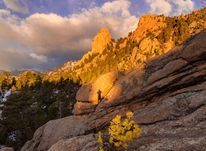
Lumpy Ridge is mostly a traditional climbing area with most climbs being two or more pitches after a mile to 3+ miles of mostly flat walking. From climbers left to right the larger areas consist of Sundance Buttress, The Bookend, The Bookmark, The Book, and Twin Owls. There are smaller formatio...Read more -
Estes Park, Colorado
Lumpy Ridge to Gem Lake
4.33.12 mi / 950 ft gainBegin by parking at the Lumpy Ridge trailhead, which is a couple miles outside of Estes Park on McGregor Avenue. At the trailhead, there are numerous signs indicating hiking trails, climbing routes, and other information about the area. After parking start hiking on the trail to the right of the ...Read more -
Vail, Colorado
Sunset Hike on the West Vail Trail
3.02 mi / 300 ft gainStarting in Lionshead, Vail, CO take the Gondola 19 up to the top of the mountain and head west straight out past Chair 26 and towards the Vail Mountain Wedding deck. Past the deck there will be a trail that you can follow out onto the edge of the mountain called the W Vail Trail. This trail will...Read more -
Breckenridge, Colorado
Hike the East Ridge of Pacific Peak
5.08 mi / 3500 ft gainStart from the McCullough gulch trailhead. If possible it would be worth having 2 cars and leaving one at the main McCullough trailhead so you don't have to walk the road on your way down. Bushwack through trees and willows up the ridge directly to the north of the trailhead. You might be lucky a...Read more -
Estes Park, Colorado
Chapin Pass Trail to Mount Chapin
3.95 mi / 1316 ft gainChapin Pass Trail to Mount Chapin is an out-and-back trail where you may see beautiful wildflowers located near Estes Park, Colorado.Read more -
Longmont, Colorado
Hike or Trail Run on Rabbit Mountain, CO
4.03.95 mi / 472 ft gainThis is a great hike/trail run in Boulder County. It is located between Longmont and Lyons and is part of Boulder County Open Space. Rabbit Mountain has over 5 miles of trails and 2,733 acres of beautiful open space. The views are incredible as most of your hike you are looking out at the entire ...Read more

