Snowmass, Colorado
Looking for the best chillin in Snowmass? We've got you covered with the top trails, trips, hiking, backpacking, camping and more around Snowmass. The detailed guides, photos, and reviews are all submitted by the Outbound community.
Top Chillin Spots in and near Snowmass
-
Glenwood Springs, Colorado
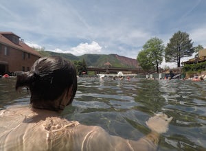
Relax at Glenwood Hot Springs
4.5Glenwood is best known for its large hot springs pool, kept between 90 and 93 degrees, while the minerals in the water are meant to provide a natural therapy to the body. There is also a smaller therapy pool, at 104 degrees, and a spa, as well. You'll find all the amenities you need here, and wi...Read more -
Leadville, Colorado
Savage Lakes Trail
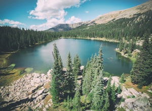
5.03.97 mi / 1299 ft gainThe majority of this hike traverses through the beautiful forest that is part of the Holy Cross Wilderness. No significant views are to be had until you've climbed 1,300 ft over 2. miles and reach lower Savage Lake. The trail is easy enough to follow with no junctions along the way, and is adjace...Read more -
Carbondale, Colorado
Camp at Paradise Divide
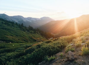
At a literally breathtaking 11,250 feet, Paradise Divide offers seclusion and scenery that can't be beat. Just fifteen miles outside of the world renowned ski resort Crested Butte, this area boasts wildflowers, wildlife, stunning peaks, and opportunities to watch amazing sunrises and sunsets pain...Read more -
Aspen, Colorado
Hike Lost Man Loop
5.08.8 mi / 1290 ft gainThis 8.8 mile "loop" is not a true loop and the trail ends 4 miles apart along Independence Pass, so a car shuttle is recommended. I would recommend starting at the west trailhead (closer to Aspen) but will describe both trailheads so you can set up another car or shuttle at the other one.1) West...Read more -
Crested Butte, Colorado
Hike to Judd Falls
3.02.5 mi / 220 ft gainStarting at 9600 feet, just outside the small town of Gothic is the trail head for Judd Falls. The parking lot is on the side of the road and getting to this area is completely possible with a passenger car. The trailhead includes bathrooms and is particularly uncrowded on weekdays and in the lat...Read more -
Independence, Ohio
Hike Mountain Boy Ridge from the Top of Independence Pass
5.06 miThe trailhead is to the Independence Pass viewing deck is located at the Summit parking area, which is about 20 miles from Aspen and 24 miles west of Highway 24 on the Leadville side. At the parking area you will notice a paved walkway that takes you to the viewdeck, which is a easy five minute w...Read more -
Independence, Ohio
Watch the Sunset from Independence Pass
1.0Start in the town of either Aspen or Twin Lakes and continue on Interstate 82 to the top of Independence Pass. Along the way, keep your eyes peeled for the Ghost Town of Independence, fields of wildflowers and the occasional moose, elk or deer. Continue on to the top of the pass where you will fi...Read more -
Independence, Ohio
Photograph Fall Colors Along Independence Pass and Twin Lakes, CO
5.0While this is a more of a photography adventure and a fall drive to take through Colorado, there are also many areas to hike along the way. The drive can start from really anywhere in the general area. From the front range area of Colorado, head up I70 and get off toward Twin Lakes around Copper....Read more -
Independence, Ohio
Drive Independence Pass
5.032 miWhether you are driving or biking, the elevation gain is significant, it's over 4,000 ft. The road is fairly narrow so being cautious is important. The highway itself is seasonal; it's closed for winter due to icy conditions. We stopped along the Grotto trailhead to hike around and get some views...Read more -
Minturn, Colorado
Backpack the High Alpine Seven Sisters Lake Chain
12 mi / 1000 ft gainThis lake chain is in a spectacular, undeveloped bowl of jagged and rugged mountain goodness located in the Holy Cross Wilderness Area. This hidden gem is easily accessible and, to my amazement, it is relatively unheard of even among many locals. More wonderful perks included in this backpacking ...Read more -
Crested Butte, Colorado
Camp at Oh Be Joyful Campground
5.0Oh Be Joyful Campground sits on the banks of the Slate River and consists of 15 camp sites dispersed over a decent amount of ground, split into two sides of the river. The river, when it's low is more of a stream and is only passable when it's low. It's a small thrill to drive through it to get t...Read more -
Crested Butte, Colorado
Explore the waterfalls of Oh Be Joyful Creek
If you're not already camping there, park at Oh Be Joyful Campground, about 5 miles up County Road 734 from downtown Crested Butte. There's parking on either side of the river crossing, but you're going to have to get your feet wet anyway, so might as well park in the first parking lot and walk a...Read more -
Crested Butte, Colorado
Hike to Meridian Lake
4.0The trail starts off with a small river crossing. You can find an easier place to cross nearby, or just march right through, if you have waterproof shoes or sandals.The beginning of the trail is the hardest. You will have a steep incline for about a quarter mile, following switchbacks up to the l...Read more -
Buena Vista, Colorado
Summit La Plata Peak
5.09.25 mi / 4500 ft gainThe Northwest Ridge is the most easily accessible and popular route, and for good reasons. The trailhead is on the side of Hwy 82, otherwise known as Independence Pass, about 14.5 miles from the Hwy 24 junction, or about 10 miles from Twin Lakes to the east. The trailhead is hard to miss, and you...Read more -
Minturn, Colorado
Hike to Tuhare Lakes
12 mi / 3000 ft gainOverview: About a 12 mile hike, with 3 alpine lakes, a significant climb and views worthwhile Photos: See all photos here. Getting There: The hike is accessed from the Half Moon pass parking lot - from the Fall Creek trailhead. The parking lot and trailhead are accessed at the end of Tigiwon Rd. ...Read more -
Crested Butte, Colorado
Drive Kebler Pass for Fall Colors
5.0Kebler Pass, or Gunnison County Road (GCR) 12, is an excellent place to see fall colors in Colorado. You won't get nearly as much congestion as on Independence Pass in Aspen, but you get just as many yellow and amber leaves. The road is dirt but passable by any vehicle–although because it's at ov...Read more

